



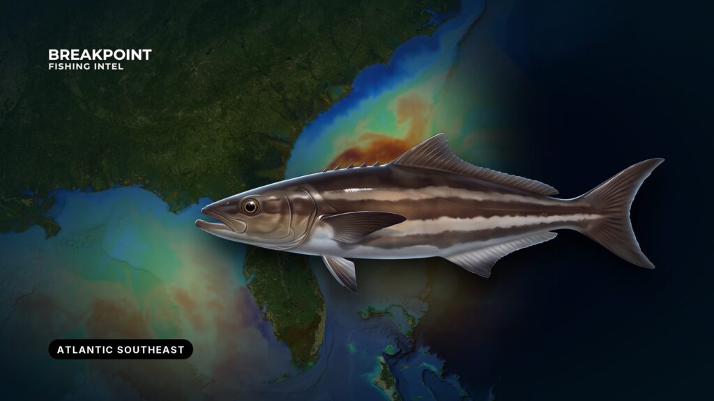
Cobia move through the Atlantic Southeast on a warming-water migration, and where they hold on a given day depends on water temperature and structure. The region runs from the Virginia/North Carolina line south through South Carolina and Georgia to Florida’s east coast, the same boundaries our Atlantic Southeast fishing coverage uses. Two management systems split this coast at the Florida/Georgia line, so the rules depend on where you fish and where you land. This guide covers run timing, the water and structure that stop moving fish, how anglers fish them here, and who regulates what.
Identification and Biology
Cobia are long, dark, torpedo-shaped fish that cruise near the surface and around structure, often riding with larger animals. The cobia species guide covers full identification, how to tell cobia from remoras and sharks, and growth detail.
Where and When Cobia Run in the Atlantic Southeast
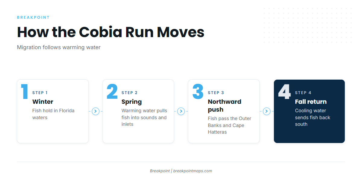
Cobia run south to north with the warming water. Fish winter in Florida waters. As spring water warms, the run moves north along the coast, reaching as far as Chesapeake Bay in summer. As the water cools, the fish return south.
The spring run fills the sounds and inlets first. Coastal estuaries such as Port Royal Sound fill with Atlantic group fish by May, and the cobia run into Port Royal then pushes past the Outer Banks and Cape Hatteras. Chesapeake Bay sits at the northern end of that run, outside this region.
Timing follows warming water, not the calendar. Arrival shifts from year to year, and peak spring timing differs from northeast Florida to the Outer Banks, so watch the water and match your dates to your stretch of coast. During the spring run, cobia gather inshore in sounds and inlets, which is where the rules matter most. The Regulations section below points to the agencies that set them.
The fall return runs the other way. Fish move south as the water cools, and nearshore and beach fish can show again in early fall. Temperature data is the best way to track it.
The same warming water brings other nearshore pelagics, such as king mackerel and mahi-mahi. You can find more in our guides to other coastal and offshore gamefish.
Key points on timing:
- Winter: fish hold in Florida waters.
- Spring: the run fills sounds and inlets, then moves north past Cape Hatteras.
- Summer: fish reach the northern end of the run at Chesapeake Bay.
- Early fall: fish begin the return south, and nearshore and beach fish can show again.
The Water and Structure That Hold Cobia
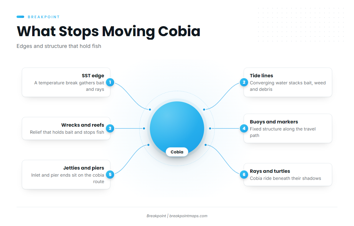
Start with the water. A temperature break concentrates bait, and rays and cobia travel with it. Tide lines and color changes work the same way: converging water gathers bait, weed and debris along a visible seam, and predators work that seam. Current edges do the same job, because moving fish pause and feed where current speed or direction changes.
Then look at structure. Each of these stops moving fish for a reason:
- Buoys: isolated vertical structure in open water that draws bait and the fish that follow it.
- Channel markers: the same effect along inlets and channels, where current also funnels fish past.
- Wrecks: relief that holds bait and gives cobia a place to ambush from.
- Artificial reefs: built relief that stacks bait over otherwise flat bottom.
- Nearshore live bottom: hard bottom that holds bait close to the beach.
- Pier ends and inlet jetties: fixed structure at the deepest, busiest water along the migration route, which puts shore anglers where cobia travel.
Rays and turtles are a cue in their own right. Cobia ride under cownose rays, manta rays and sea turtles, and scanning for those shadows is a primary way to find fish.
Breakpoint’s OBS SST layer shows where the warming edge sits along the coast. Chart Contours reveal relief and changes in bottom shape around wrecks, reefs and live bottom. Both have limits. Cloud blocks satellite SST passes, so a cloudy day leaves gaps. Some nearshore surveys are old, so contours show where to look, not what is there today. Chart layers are not for navigation.
How Anglers Fish Cobia Here
Sight Casting From a Tower
An elevated position lets the spotter see fish at a distance and call the cast. Polarized lenses are essential, since without them you see mostly surface glare. The usual presentation is a bucktail or a live eel placed in the fish’s path. Light, clarity and wind all affect how far you can see, so conditions decide whether this method works on a given day.
Live Bait
Live eels, menhaden and crabs are the standard baits. Reach for them when fish follow the boat, when you are working structure, or when a fish refuses an artificial.
Anchoring and Chumming on Wrecks and Reefs
Anchor up-current of a wreck or reef and run a menhaden chum slick. Stagger baits at different distances behind the boat so you cover the water column. This method suits slower days, beginners and charter clients.
Piers, Jetties, Charters and Kayaks
Pier ends and inlet jetties put shore anglers where cobia travel. Most piers follow a first-cast convention: the angler who spots the fish calls it and gets the first cast, then others take turns.
A cobia charter typically means sight fishing near rays and markers, with bottom fishing on slower days. Confirm with the captain what the trip includes, and check your license status with the state agency. The FAQ covers where to look.
For kayaks, check wind speed, wave height and period on the NWS marine forecast before launching, and account for the pull of a large fish near structure and inlets. Boat anglers should read the same three numbers.
Handling at the Boat
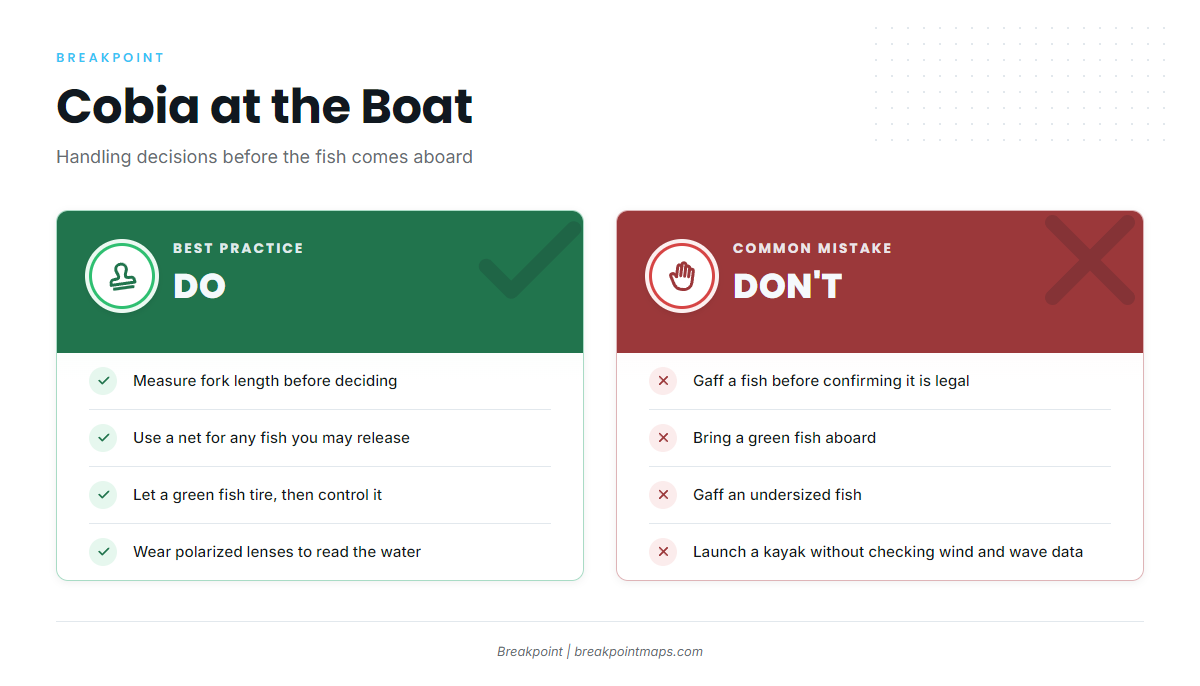
Use a net for any fish you may release, including undersized fish or a fish you choose not to keep. Use a gaff only on a fish confirmed legal and kept.
A green fish is one that still has energy at the boat, and bringing it aboard green is a common way to damage gear and people. Let it tire, then control it. Measure fork length before you decide. The FAQ covers the measuring method.
Before you run the inlets or the beach, check OBS SST and Chlorophyll for the edge and the clean water.
Guides to cobia fishing from specific ports: Boynton Beach, Darien, Hatteras Village, Charleston, Fernandina Beach, Golden Isles, Morehead City and Edisto Beach.
FAQ
When do cobia arrive in South Carolina?
In spring, as the water warms. The Atlantic group fills estuaries such as Port Royal Sound by May. Timing shifts with each year’s warming, so watch water temperature rather than the calendar.
Do I need a fishing license on a pier or a charter?
Licensing is set by each state. Check NCDMF, SCDNR, Georgia DNR Coastal Resources Division or FWC for your spot. Ask a charter whether passengers are covered.
Which rules apply if I fish federal waters and land in North Carolina?
Federal rules apply: 36 inches fork length and 1 per person per day, not to exceed 6 per vessel per day. Where North Carolina’s limit is more restrictive, it applies, so check NCDMF before you go.
Why are Florida east coast cobia rules different?
Below 30°42′45.6″ N the fish belong to the Gulf migratory group. Federal waters there allow 1 per person per day and 2 per vessel per trip, with no closed recreational season. FWC governs state waters.
How do I measure fork length?
Measure from the tip of the closed mouth to the fork of the tail, on a flat surface. The minimum in the federal zones above is 36 inches fork length.
Can I fish for cobia from a kayak?
Yes, with preparation. Check wind, wave height and period on the NWS marine forecast, and plan for a large fish near structure and inlets.
What is the cobia vessel limit?
In Atlantic-group federal waters off North Carolina, the limit is 6 per vessel per day, or North Carolina’s stricter limit. Off Florida’s east coast in federal waters, the limit is 2 per vessel per trip. In state waters, and for South Carolina and Georgia, check the state agency, because ASMFC lets states set vessel limits up to 6.