



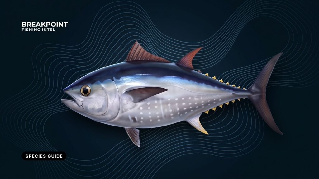
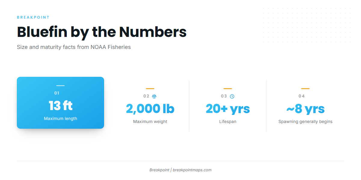
Atlantic bluefin tuna (Thunnus thynnus) grow to 13 feet and 2,000 pounds, according to NOAA Fisheries. This guide covers how to identify them, their size classes, where they are found by region, how they feed and move, the methods used to catch them, the regulations, and a short FAQ. It can’t promise fish, only help you decide where to look.
How to Identify Atlantic Bluefin Tuna
Bluefin are the largest tuna in the Atlantic. Pectoral fin length and finlet color separate them from yellowfin, bigeye and blackfin.
Bluefin school by body size rather than by species, sometimes alongside albacore, yellowfin, bigeye and skipjack. In a mixed school, check every fish.
| Species | Pectoral fin | Second dorsal and anal fins | Finlets and color | Body shape | Where US anglers meet it |
|---|---|---|---|---|---|
| Atlantic bluefin tuna | Short, does not reach the second dorsal | Short | Yellow finlets edged in dark | Deep, heavy body | Gulf of Maine to North Carolina, with spawning fish in the Gulf of America |
| Yellowfin tuna | Moderate | Long and sickle-shaped on adults | Yellow finlets, yellow lateral band | Streamlined | Offshore Atlantic and Gulf |
| Bigeye tuna | Long | Moderate | Finlets yellow with dark edges | Plump, with a large eye | Offshore canyons and the Gulf Stream edge |
| Blackfin tuna | Short to moderate | Short | Dark finlets with little or no yellow | Small, compact fish | Southeast Atlantic and Gulf |
Swipe the table sideways to see every column.
Check before you keep. Bluefin carry their own size classes, limits and reporting duty, separate from the other tunas. Identify the fish before it comes aboard to be kept. If in doubt, treat it as bluefin and follow the bluefin rules.
For the rest of the family, see our guides to the other Atlantic tunas.
Bluefin Size Classes and Curved Fork Length
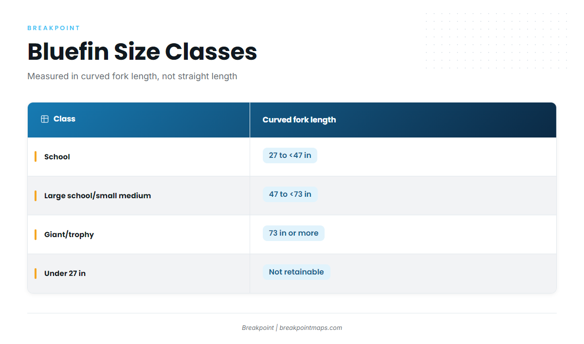
Bluefin are managed by size class, measured in curved fork length: the distance from the tip of the upper jaw to the fork of the tail, following the curve of the body. This differs from the straight total length used for many other species.
| Class | Curved fork length | Retention notes |
|---|---|---|
| School | 27 to less than 47 inches | Retainable under Angling category limits |
| Large school/small medium | 47 to less than 73 inches | Retainable under Angling category limits, with a tighter per-vessel cap |
| Giant/trophy | 73 inches or more | Falls under area trophy subquotas |
Fish under 27 inches fall outside the retainable classes. Class determines tackle weight and which limit applies, so measure before deciding what to do with the fish.
Where and When to Find Bluefin, by Region
Bluefin follow temperature and bait along the coast. Northern waters hold them in summer and autumn, and the Carolinas hold them in winter and spring.
NOAA puts spawning at mid-April to June, mainly in the Gulf of America. It starts in April in the southernmost areas and runs into early August in the Slope Sea, the water between the shelf break and the Gulf Stream. In the Gulf of Maine, the largest fish are western-origin (over 250 cm, about 98 inches), while the small and intermediate classes are mostly eastern-origin. Bluefin are epipelagic and come near shore seasonally, and per the Florida Museum species profile, they can cross the Atlantic in less than 60 days.
| Region | When fish are present | What the sources show | Notes |
|---|---|---|---|
| Gulf of Maine and Cape Cod | Summer and autumn | Schools arrive in summer and autumn and leave in winter and spring | Atlantic herring is the principal prey |
| Southern New England, New York Bight and Mid-Atlantic | On the seasonal movement | Fish pass through between northern and southern waters | See the Northeast guide for timing |
| Slope Sea | Spawning into early August | The western Slope Sea produces the most larvae in early summer | Offshore, between the shelf break and the Gulf Stream |
| North Carolina and the Outer Banks | Mid-October to mid-May for tagged fish | Tagged fish released off Morehead City aggregated over that span, mostly in 68 to 73 °F water (20 to 23 °C) | Winter fishery |
| Southeast (Blake Plateau and Florida Atlantic coast) | Spawning off the Carolinas | Spawning occurs shoreward of the Florida Current, on the Blake Plateau and north of the Bahamas | See the Southeast guide |
| Gulf of America | Spawning April to June | Designated spawning grounds | Closed to targeting |
Atlantic Northeast
The Northeast runs from the Gulf of Maine and Cape Cod through Southern New England and the New York Bight, then south through the Mid-Atlantic to North Carolina. Herring, mackerel, menhaden and sand lance hold fish in these waters. Bait sets the map and temperature breaks set the edges. Our Atlantic Northeast bluefin guide has the place-level detail.
Atlantic Southeast
The Southeast covers North Carolina’s winter fish, the Outer Banks, the Blake Plateau and the Florida Atlantic coast. Cold-season bluefin move through the Carolinas, and spawning activity sits offshore on the Blake Plateau and north of the Bahamas. Our Atlantic Southeast bluefin guide covers ports and structure.
Gulf of America
The Gulf holds the western stock’s spawning grounds and is closed to targeting. See the Regulations section.
How Bluefin Feed and Move
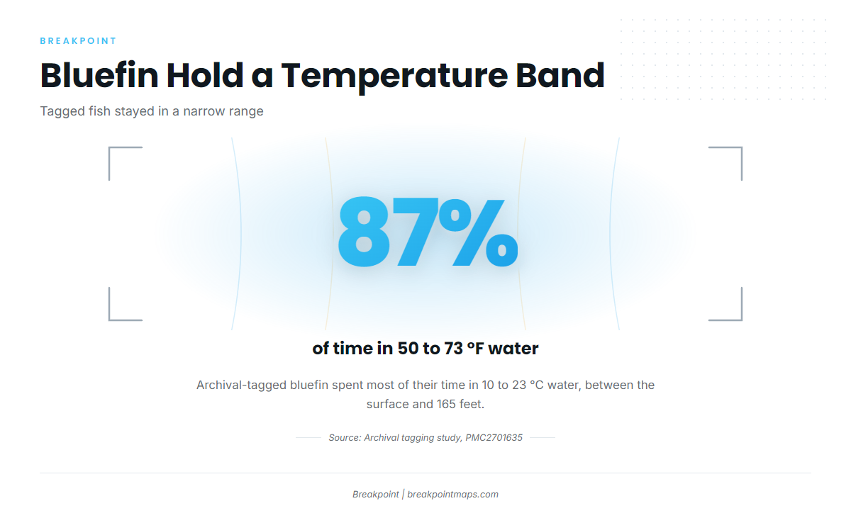
Bluefin go where the bait is, within a temperature band, usually in the top 165 feet of water.
According to NOAA, adults feed mainly on herring, bluefish and mackerel, and juveniles eat fish, squid and crustaceans. FishBase adds anchovies, sauries, hakes and squid. In regional waters, menhaden and sand lance fill the same role.
Data from archival tagging across the Atlantic shows how they use the water:
- Tagged fish spent most of their time between the surface and 50 meters (about 165 feet).
- Mean dive depth was about 113 feet (34.5 m).
- 87% of occupancy was in 50 to 73 °F water (10 to 23 °C).
- Fish frequently dive to about 1,640 to 3,280 feet (500 to 1,000 m), according to NOAA.
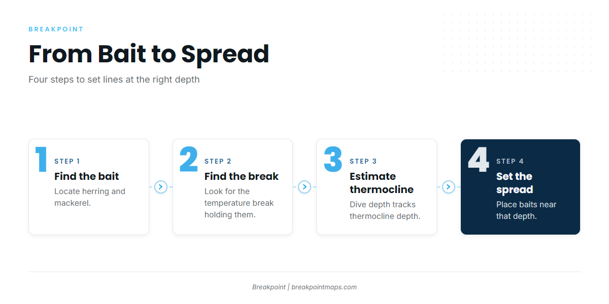
Mean dive depth tracks thermocline depth, so read the thermocline as well as the surface temperature. The chain from bait to spread runs like this:
- Find herring and mackerel.
- Find the temperature break holding them.
- Estimate the thermocline depth there.
- Set the spread or drop baits near that depth.
The data has limits. Cloud blocks SST passes, surface temperature does not show the thermocline, and chlorophyll shows where bait may gather but not where the fish are.
You can read temperature breaks and bait edges with the OBS SST, Chlorophyll and Chart Contours layers in Breakpoint. Chart layers are not for navigation.
How Bluefin Are Caught
Recreational bluefin are caught on rod and reel by trolling, chunking, live bait and kites, and casting or jigging into schools. NOAA notes that fishermen generally target schools.
| Method | What it is | Where it fits |
|---|---|---|
| Trolling | Spreader bars and skirted lures run near temperature breaks | Covering ground to find school and medium fish |
| Chunking | Cut bait fed into a slick | Larger fish on Northeast structure |
| Live bait and kites | Live herring, mackerel or menhaden held at the surface | Fish that ignore the spread |
| Topwater and jigging | Stickbaits cast to breaking fish, jigs sent to marked fish | Surface feeds and fish at thermocline depth |
| Harpoon | A separate permit category from Angling | Listed for completeness |
Trolling
Trolling covers ground while you search for school and medium fish. Run spreader bars and skirted lures along temperature breaks and bait edges.
Chunking
Chunking means drifting cut bait in a slick, at anchor or on the drift. It is the classic method on Northeast structure for larger fish.
Live bait and kite fishing
Live herring, mackerel or menhaden work when fish turn away from the spread. A kite holds the bait at the surface and keeps it away from the boat.
Topwater and jigging
Cast stickbaits into breaking fish, or jig marked fish at thermocline depth, as in the depth chain above.
Harpoon
Harpoon fishing is a separate category from Angling and falls under different permit rules.
Every retained or dead-discarded bluefin must be reported, so read the Regulations section before you leave the dock. For ports and place-level detail, use our regional and local fishing guides, and plan the run with the layers before you go.
Frequently Asked Questions
Do I need a permit to fish for bluefin tuna?
Yes. Private vessels need an HMS Angling permit, and for-hire vessels need an HMS Charter/Headboat permit from NOAA Fisheries. The permit is tied to the vessel. Federal rules follow the permit into state waters unless a state rule is stricter.
How fast do I report a bluefin?
Report each retained or dead-discarded bluefin to NOAA HMS within 24 hours. You can reach the HMS line at 1-888-USA-TUNA. Check the NOAA HMS permits site for the current reporting steps before your trip.
How many bluefin can I keep?
Limits apply per vessel, differ by vessel type and change by NOAA in-season action. Only 1 fish may be 47 to less than 73 inches. Check NOAA HMS for the figure that applies on your day.
Can I keep a giant bluefin?
Fish 73 inches or more fall under area trophy subquotas, and each area closes when its quota is met. Check NOAA HMS for area status before you fish. When an area is closed, trophy fish cannot be retained there.
Can charter clients keep bluefin, and who handles the permit?
The vessel’s HMS Charter/Headboat permit covers the trip, and charter limits apply per vessel. Ask the captain how reporting is handled before you book. The permit belongs to the vessel, and clients do not need their own.
Where can I find local ports and reports?
The regional guides carry the place-level detail: ports, structure and seasonal timing for each stretch of coast. Start with the region you plan to fish, then work down to the port nearest your launch.
Can I fish for bluefin in the Gulf of America?
No. NOAA designates the Gulf of America as bluefin spawning grounds and does not allow targeted fishing there. Spawning runs from mid-April to June.
Where to Go From Here
A bluefin trip comes down to three decisions: where the bait sits, where the temperature break holds it, and which rules govern the fish you meet. Breakpoint reads the ocean data behind the first two so you can plan the run the night before. Download Breakpoint from the App Store or Google Play and see which pins the layers rank for your region.