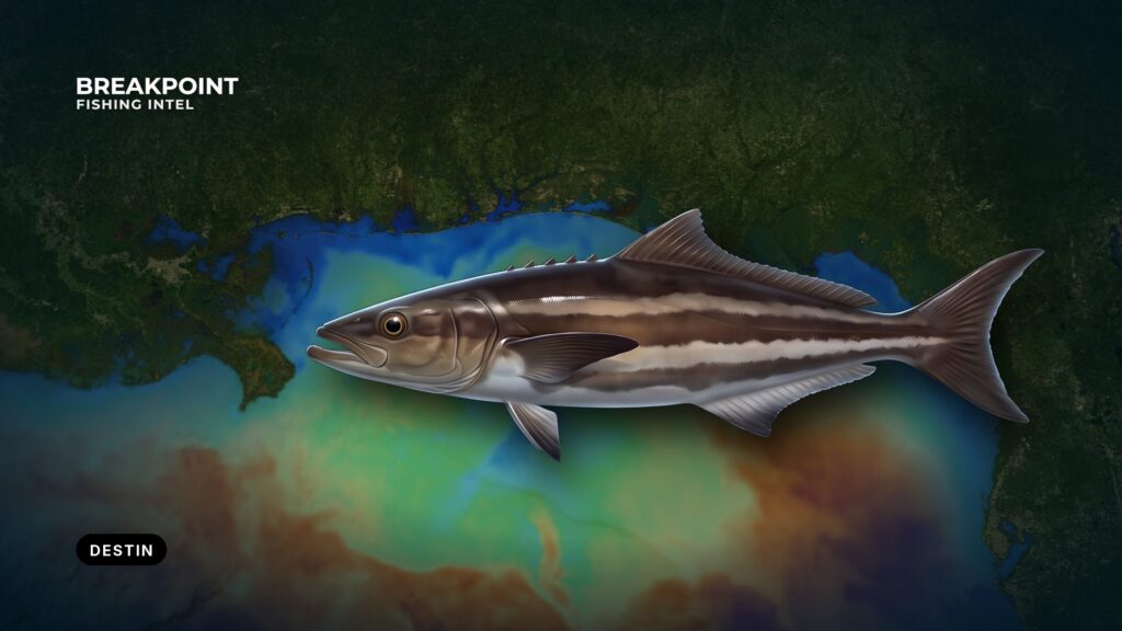
Cobia fishing off Destin starts with one inlet, a short run to shallow beachfront water, and a state line 9 nautical miles out. For anyone running their own boat, the useful details are which ramp puts you closest to East Pass, how the channel behaves, where the fish hold once they’re past the beach, and which rules apply on each side of the line.
Biology and general tactics are in our cobia fishing guide. This page covers Destin only: where to launch, what to check before the run, where fish hold, and what you can legally keep.
Getting out of Destin
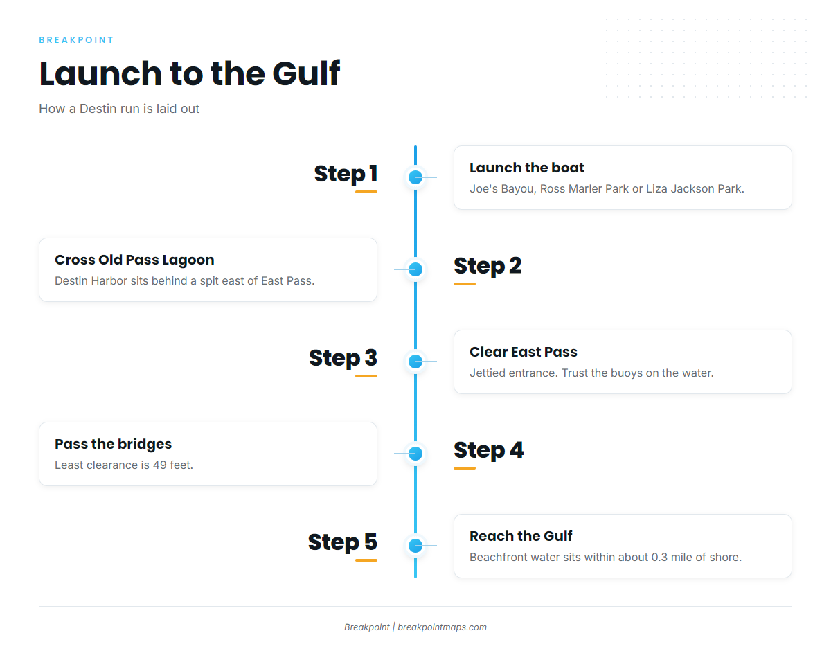
Destin Harbor sits in Old Pass Lagoon, behind a spit on the east side of East Pass, the jettied entrance between Choctawhatchee Bay and the Gulf. Charter boats moor along the lagoon’s north side.
Ramps and fuel
Three public ramps serve trailer boats around the Pass:
- Joe’s Bayou Boat Launch is run by the City of Destin. The Coast Pilot places Joes Bayou about 2 miles northeast of the bay entrance.
- Ross Marler Park boat ramp is on Okaloosa Island.
- Liza Jackson Park boat ramp is in Fort Walton Beach on Santa Rosa Sound.
Details for the last two are in the county’s ramp listings. HarborWalk Marina in Destin Harbor lists fuel.
Running East Pass
The channel south of the U.S. 98 bridges changes often and shoals between dredgings. U.S. Coast Pilot 5 notes that buoys are moved to mark the better water, so follow the buoys on the water rather than a saved track or last year’s line.
The jetties carry lights at their seaward ends. The bridges, with a least clearance of 49 feet, are visible from close offshore.
Three areas to know about:
- A restricted area surrounds the Destin Coast Guard Station west-southwest of the bridge (33 CFR 334.746).
- A guided-missile test danger zone lies in the Gulf south of Choctawhatchee Bay (33 CFR 334.720).
- Unexploded ordnance lies on the bottom about a mile off Santa Rosa Island, roughly 8 miles west of the entrance. Treat it as a bottom-contact concern when anchoring or chumming there.
Reading conditions
The NWS Mobile coastal waters forecast covers the Okaloosa-Walton County line to Pensacola, out 20 nm. Read the GMZ655 coastal forecast before every run, and take three numbers from it:
- Wind speed and direction
- Wave height
- Wave period
Depths under 30 feet are rarely more than 0.3 mile off the beach on this coast, and the sea breaks heavily on shore under south winds. That puts breaking water right where the beach fish travel.
Compare the forecast with what you see at the jetty ends before committing. On OBS SST, cloud blocks the satellite pass, so a gap on the layer means no reading, not cold water.
Where cobia hold off Destin
The beachfront lane
Migrating fish travel the shallow water within about 0.3 mile of shore. According to the Florida Museum cobia profile, cobia follow rays, turtles and sharks, and they hold on objects that break up open water, such as buoys, pilings and anchored boats.
Treat the East Pass buoys and channel markers as structure as well as navigation aids. Keep clear of the channel and of traffic.
Named public structure
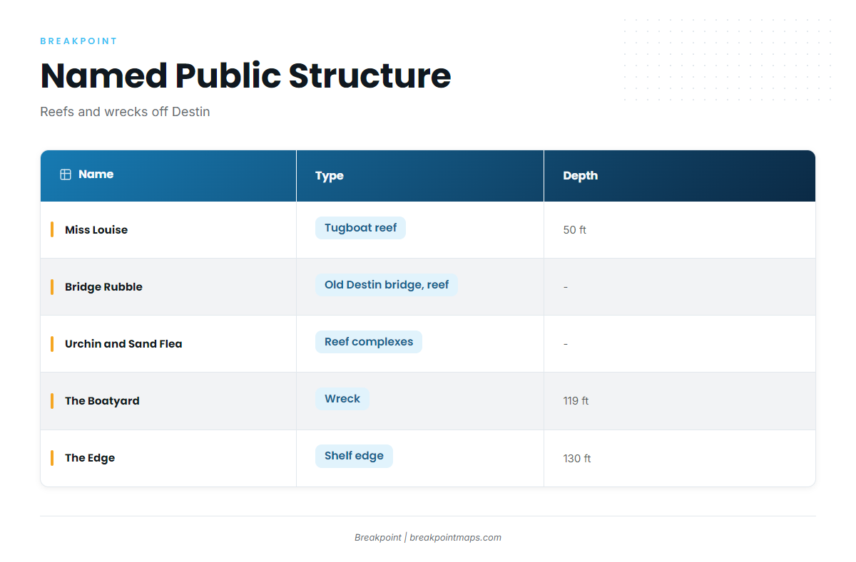
| Name | Type | Depth |
|---|---|---|
| Miss Louise | Tugboat reef | 50 ft |
| Bridge Rubble | Old Destin bridge, reef | |
| Urchin and Sand Flea complexes | Reef complexes | |
| The Boatyard | Wreck | 119 ft |
| The Edge | Shelf edge | 130 ft |
The deeper sites hold fish after the beach run. Reef work also suits days when the beachfront water is breaking.
In the Breakpoint app, Chart Contours shows the bottom around these reefs, so you can see how each site sits on the slope before you run. OBS SST shows where the warm water sits as the spring run approaches. Chart layers are not for navigation.
When the fish are here
Cobia off Destin follow three phases:
- A spring run along the beach
- Fish on structure afterward
- A fall presence
The species’ temperature range is 68 to 86°F. That is the range cobia live in, and it doesn’t trigger the run. Watch the warm water build on OBS SST instead of going by a calendar date.
Tactics
Sight-casting the beach
Tower sight-casting is the signature method. One person sits high scanning for dark shapes while the boat idles along the beachfront. Look for rays, turtles and sharks, and for fish holding on buoys and markers.
Approach slowly and off-axis, and keep the engine pitch steady when you commit to the cast. Cast ahead of the fish or the ray so the bait sits in its path.
A bucktail jig is the primary lure. Keep a second rod rigged with a live eel or a pinfish.
Structure
On the named reefs and wrecks, anchor up-current, chum, and free-line a live or dead bait back into the slick. When the beach is slow, run and gun a line of buoys and markers. Fish can hold anywhere from the surface shade down the chain.
The deeper sites sit near or past the state line, and that line decides which rules apply.
FAQ
When do cobia run off Destin?
The main run is a spring run along the beach. Fish stay on reefs and wrecks afterward, and a fall presence follows. We print no dates because the timing moves with the water. Watch the warm water build on OBS SST instead of going by a calendar date.
Which ramp is closest to East Pass?
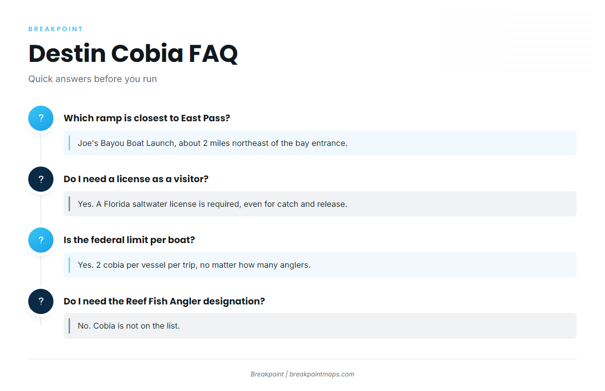
Joe’s Bayou Boat Launch, run by the City of Destin, about 2 miles northeast of the bay entrance. Ross Marler Park and Liza Jackson Park are alternatives. HarborWalk Marina lists fuel.
Do I need a license as a visitor?
Yes. A Florida saltwater fishing license is required, including for catch and release and for landing fish caught in federal waters. Non-residents can buy annual, 7-day or 3-day licenses through FWC’s licensing channels.
What are the federal cobia limits past 9 nautical miles?
36 inches fork length minimum, 1 per person per day, not to exceed 2 per vessel per trip, and no closed recreational season. Check the federal and Gulf Council pages before fishing, since rules change.
Is the vessel limit per boat?
Yes. In federal waters, 2 cobia per vessel per trip is the ceiling no matter how many licensed anglers are aboard. For state waters inside 9 nm, check FWC’s cobia regulations.
Do I need the State Reef Fish Angler designation for cobia?
No. Cobia is not on the list. The designation is required, free, for private-vessel anglers 16 and older who keep listed reef species such as greater amberjack or gray triggerfish on the same trip.