



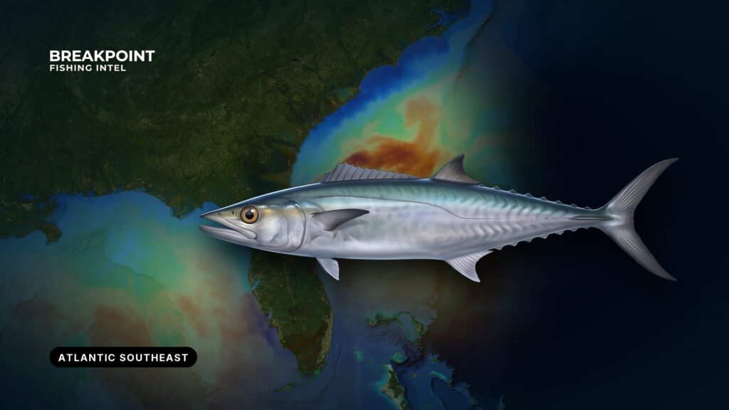
King mackerel fishing in the Atlantic Southeast runs the coast from North Carolina to Florida’s east coast. Kings move north in spring, south in fall, and winter off Florida. Rules change at 3 nautical miles, so the same king can carry a different bag limit depending on which side of that line it was caught.
This guide covers where kings are, what water and structure hold them, and which rules apply at that spot. It treats coastal migratory pelagics like king and Spanish mackerel as a matter of both location and law. For the wider region, from Cape Hatteras to Jupiter, see fishing the Atlantic Southeast. No guide can promise fish, but this one should help you decide where to look and which limit applies.
King Mackerel Identification and Biology
King mackerel are fast, toothy coastal migratory pelagics that travel in schools and follow warm water and bait along the coast. Their teeth are sharp, which is why wire leaders are standard.
Anglers often confuse kings with Spanish mackerel and cero. Kings are generally larger and favor deeper structure and faster bait schools. Identification matters legally because Spanish and king mackerel carry different size and bag rules, so a misidentified fish can be an illegal fish.
Scomberomorus cavalla belongs to the Atlantic migratory group along this coast. According to NOAA Fisheries, that group spends summers in the northern part of its range and winters in the southern part. Atlantic and Gulf group fish co-occur off Florida in winter. "Smoker" is local slang for a big king.
Full identification marks and life history are in the king mackerel species guide.
Where and When to Find King Mackerel in the Atlantic Southeast
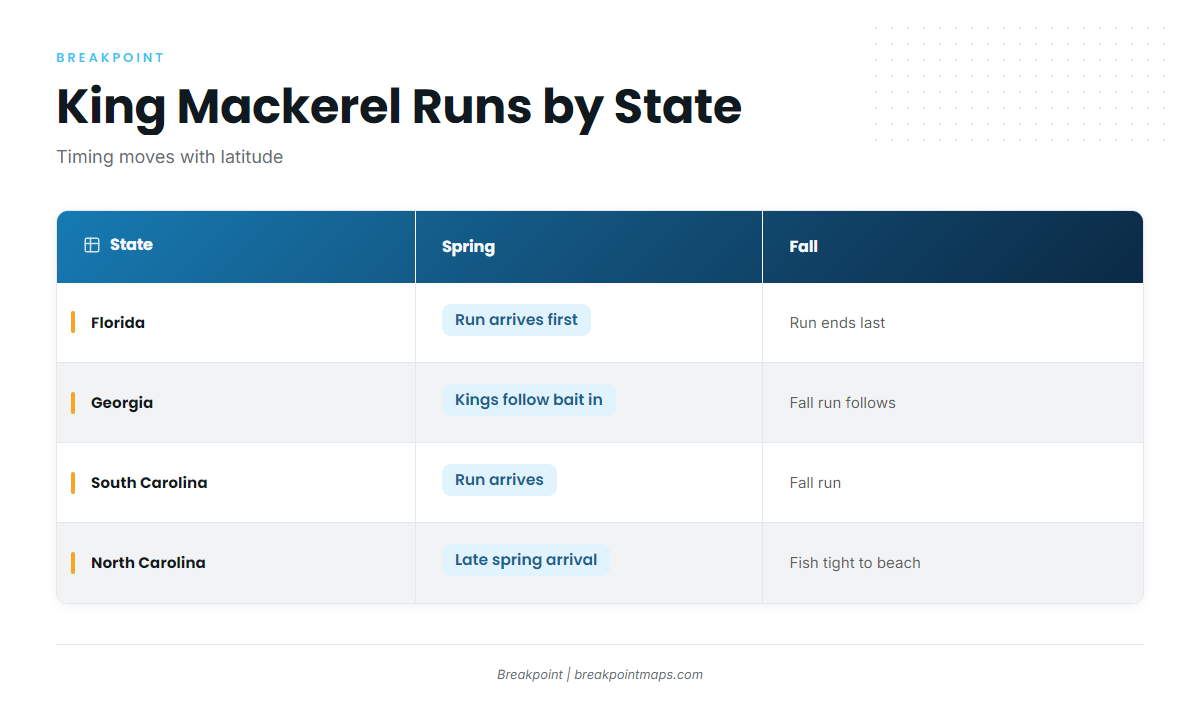
Kings follow warm water and bait north in spring, spread through the Carolinas in summer, and slide south in fall and winter off Florida’s east coast.
Timing moves with latitude. Florida sees fish first in spring and last in fall. Spring and fall runs push kings close along beaches, inlet mouths and nearshore structure, while in summer they spread across nearshore and offshore water.
| State | Spring | Summer | Fall | Winter |
|---|---|---|---|---|
| Florida east coast | Run passes through | Fish thin out toward the north | Fall run arrives from the north | Main wintering ground |
| Georgia | Run arrives from the south | Nearshore reefs and live bottom | Fall run | Fish offshore or gone south |
| South Carolina | Run arrives behind Georgia’s | Nearshore reefs and ledges | Fall run | Fish offshore or gone south |
| North Carolina | Late arrival | Fish hold through summer | Fall run, tight to beach and inlets | Gone south |
Swipe the table sideways to see every column.
Florida’s East Coast
Florida’s east coast holds the winter fish. The Atlantic group winters in the south, and off Florida it mixes with the Gulf group. The coast from Jupiter to Jacksonville sees both runs pass through.
Named ground includes:
- Cape Canaveral’s 8A Reef, Pelican Flats and Southeast Shoal
- The Gulf Stream edge, which runs close to shore in the south
- Jacksonville Beach Pier and Lake Worth Pier
Kings push close to the beach when bait is there.
Georgia
In spring, kings move in from the shelf toward the coast, following bait. Georgia’s shelf is wide, so much of the structure lies well offshore. Nearshore artificial reefs and live bottom hold fish during the runs.
South Carolina
The spring run arrives behind Georgia’s. Summer holds fish on nearshore reefs and ledges, and the fall run follows. Ports like Murrells Inlet, Charleston and Hilton Head put you within reach of nearshore artificial reefs, live bottom and ledges.
North Carolina
North Carolina is the northern end of the Southeast run. Fish arrive late in spring and hold through summer, and the fall run brings them tight to the beach and inlets.
Named ground includes:
- Cape Lookout Shoals and Frying Pan Shoals
- Bogue Inlet, Seaview, Jolly Roger and Oak Island piers
Oak Island is known for big pier kings. If you are traveling, time the trip to the runs, but water and bait decide the day more than the calendar does.
Water and Structure That Hold Kings
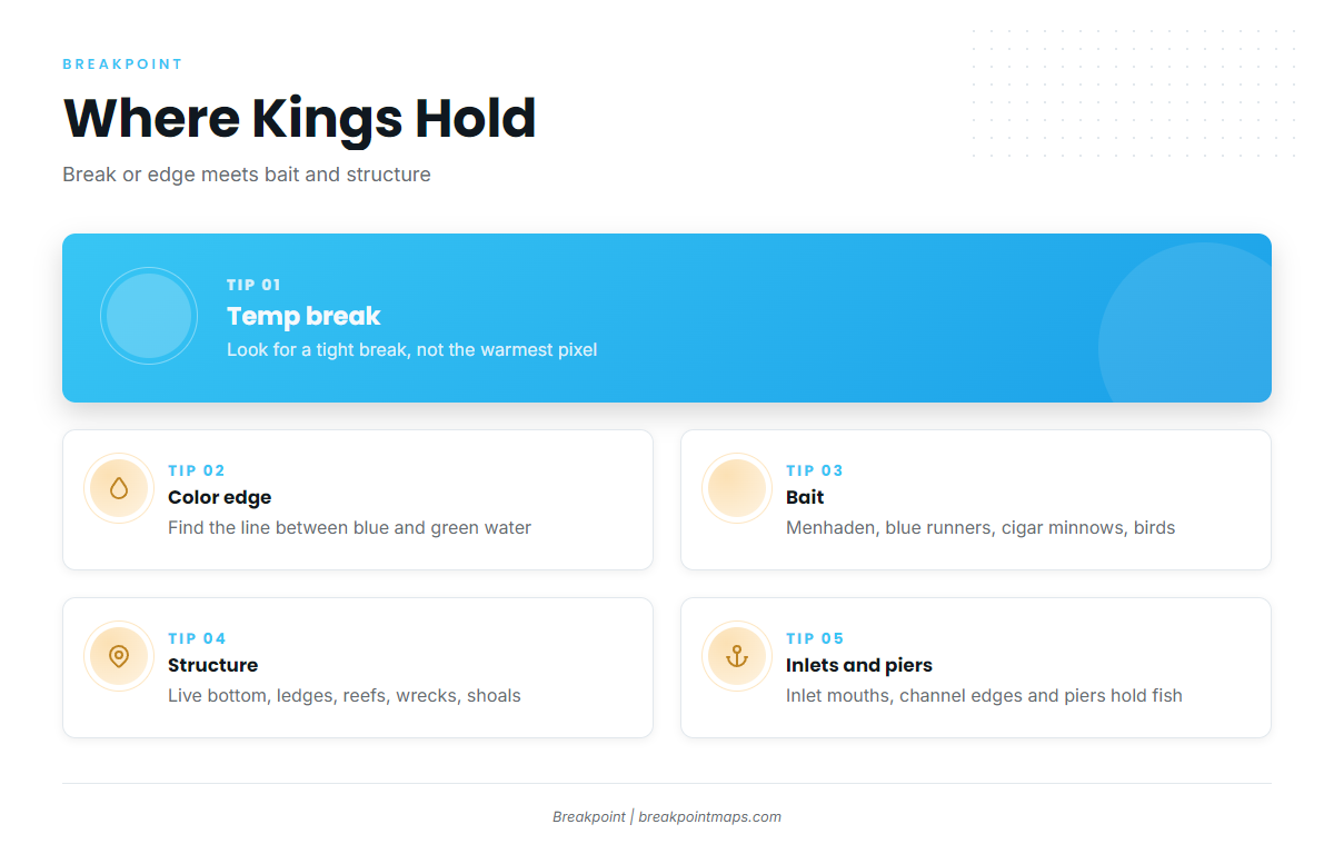
Kings hold where a temperature break or color change meets bait and hard structure.
They are temperature-driven, holding along temperature breaks and clean-to-green color changes where current and clarity shift. Bait is the main sign: menhaden (pogies), blue runners, cigar minnows, diving birds, and bait marks on the sounder.
The Gulf Stream edge is the offshore travel lane and holding water. It runs closest to shore off south Florida.
Structure that holds kings:
- Live bottom (hard bottom)
- Rock ledges and depth changes that funnel bait
- Artificial reefs
- Wrecks
- Shoals such as Cape Lookout and Frying Pan
- Inlet mouths and channel edges
- Piers
On OBS SST, look for a tight temperature break rather than the warmest pixel. On Chlorophyll, find the edge between bluer and greener water. On Chart Contours, find the ledges, live bottom and reef sites near where those edges cross. Start where the break, edge and ledge overlap.
An SST chart shows surface temperature, not fish. Cloud cover blocks satellite passes, so a cloudy pass leaves the chart stale. Check when the image was taken. Chart layers are not for navigation.
How Anglers Fish for King Mackerel Here
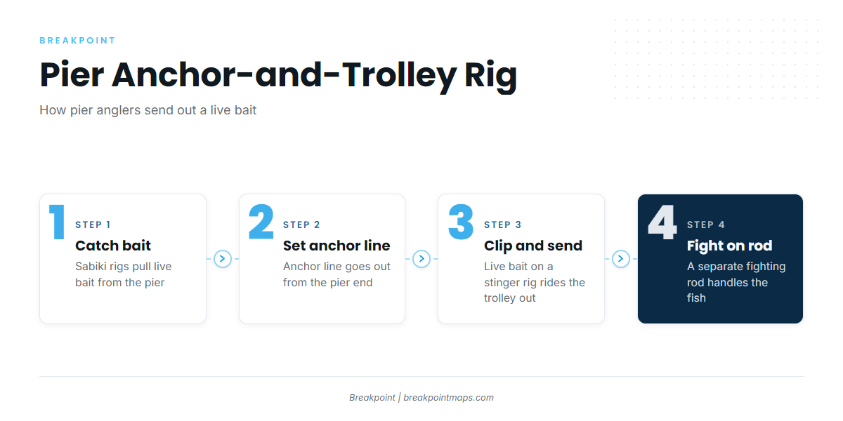
Slow-trolling live bait over structure is the Southeast standard. Spoons and planers cover water, and piers fish anchor-and-trolley rigs.
Slow-Trolling Live Bait and Stinger Rigs
The standard baits are menhaden (pogies), blue runners and cigar minnows. Bump or slow troll at a dead-slow pace so baits swim naturally over ledges, reefs and wrecks. Drifting and anchoring are the alternatives.
A stinger rig works like this:
- The lead hook goes through the bait’s nose.
- A trailing stinger treble rides free toward the tail on a short wire section.
- When a king slashes behind the head and cuts the bait short, the stinger catches the fish.
Use wire leader because of the teeth.
Trolling Spoons and Planers
Spoons and diving plugs at standard trolling speed cover water fast. They help when fish are scattered or live bait is hard to get. Planers pull baits down along ledges and structure. Think of them as search tools that complement live bait.
Pier and Nearshore Small-Boat Fishing
Pier and small-boat anglers depend on the runs bringing kings within reach. The anchor-and-trolley rig keeps a live bait working without tangles:
- An anchor line is set at the end of the pier.
- A live bait on a separate fighting rod is clipped to it and slides out on a trolley.
- The bait stays in place, and the fight starts from the fighting rod when a king hits.
Kites hold a live bait at the surface away from the pier or boat. Live baits come from the pier itself on sabiki rigs. Bluefish and whiting are used at Jacksonville Beach Pier, and goggle-eyes, ballyhoo and greenies at Lake Worth Pier. Bait species must meet their own size rules. Named kingfish piers include Oak Island, Seaview, Jolly Roger, Bogue Inlet, Jacksonville Beach and Lake Worth.
Tidal changes are often the active windows. Small boats and kayaks can reach nearshore reefs, inlet mouths and shoals during the runs. Conditions decide the trip, so read wind, wave height and period on the NWS marine forecast.
A pier sits inside state waters, so state rules apply (see Regulations below).
The same structure holds cobia, Spanish mackerel and mahi. See other coastal and offshore gamefish.
Before you leave the dock, check OBS SST, Chlorophyll and Chart Contours to decide where to start looking. Chart layers are not for navigation.
Guides to king mackerel fishing from specific ports: Boynton Beach, Darien, Carolina Beach, Edisto Beach, Fernandina Beach, Golden Isles, Hatteras Village and Folly Beach.
FAQ
When is the best time to fish for kings in each Southeast state?
Florida’s east coast has winter fish and both runs. Georgia and South Carolina peak during the spring and fall runs and hold fish through summer. North Carolina peaks from late spring through fall. Water and bait matter more than the calendar.
Which king mackerel rules apply where I am fishing?
Inside 3 nautical miles, state rules apply. From 3 to 200, federal Atlantic group rules apply: 24 inches fork length, 3 per person. Off Florida’s Atlantic coast, state waters allow 2 per person. Monroe County follows Gulf rules. Check the agency before fishing.
What rig do pier anglers use for king mackerel?
The anchor-and-trolley rig. An anchor line is set from the pier end, and a live bait on a stinger rig is clipped to it and sent out on a trolley. You fight the fish on a separate rod. Live bait is caught from the pier with sabikis.
How do I tell a king mackerel from a Spanish mackerel or cero?
Kings are generally larger and use deeper structure and faster bait schools. Correct identification matters because size and bag rules differ by species. The king mackerel species guide has the full identification marks.
Do charter passengers need a federal permit for king mackerel?
No. The for-hire vessel needs the federal charter vessel/headboat permit for Atlantic coastal migratory pelagic fish. Private recreational anglers need no federal permit. State saltwater licenses are separate, so check the state agency.
Are big king mackerel safe to eat?
Large kings are subject to consumption advisories. Check the health advisories from the state where you fish before keeping large fish, and follow the official guidance.
How do I find kings on an SST or chlorophyll chart?
Look for a sharp temperature break and a color edge that cross ledges, live bottom or reefs. SST shows surface water, not fish, and cloud blocks satellite passes.
To see those layers in one place the night before a trip, download Breakpoint from the App Store or Google Play and check what the map shows for your port.