



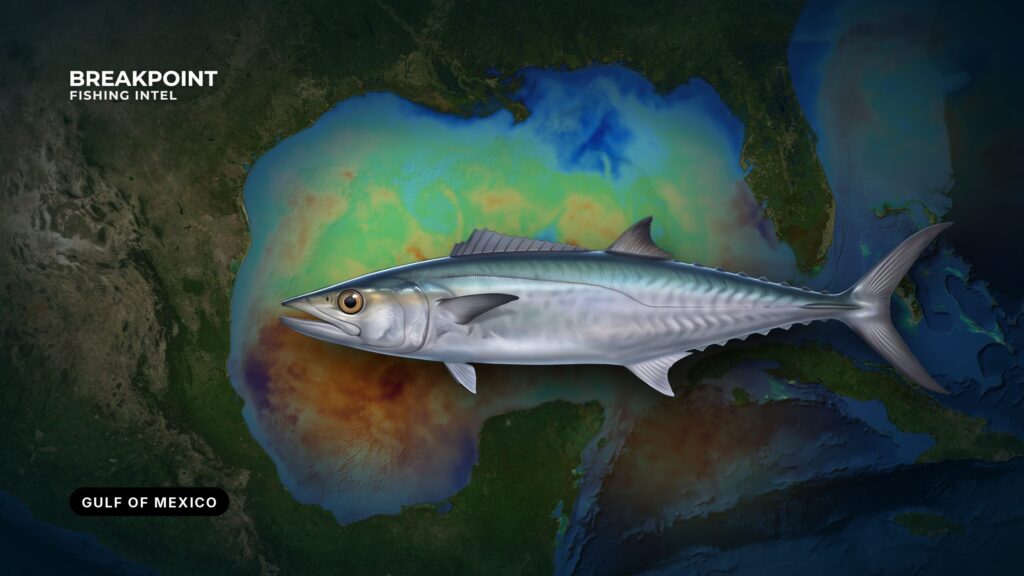
King mackerel in the Gulf belong to the Gulf migratory group, a stock managed separately from the Atlantic fish. NOAA Fisheries recognizes 3 king mackerel stocks, and the Gulf stock is one of them. NOAA Fisheries manages the fishery jointly with the Gulf and South Atlantic councils under the Coastal Migratory Pelagics fishery management plan. Federal documents use a different name for the Gulf, and the Regulations section shows both.
Fishing for kings in the Gulf depends on where the fish are, why they hold there, and how the water and structure show it. This page covers where and when by region, the water and structure, how anglers fish, and how federal and state rules divide. The FAQ closes the page.
Identification and biology
The king mackerel is a long, toothy, fast pelagic that anglers also call kingfish. Its lateral line dips sharply under the second dorsal fin, which separates a king from a spanish mackerel or cero. A "smoker" is the trophy-class king that tournament anglers chase.
The king mackerel species guide covers identification and general biology in full.
Where and when kings run in the Gulf
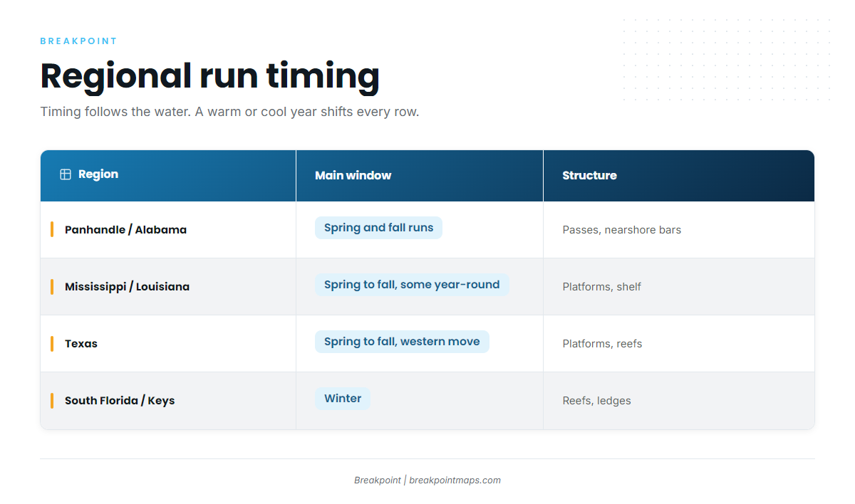
Kings move north as the water warms in spring and slide south as it cools in fall. Bait moves with the same water, and kings follow the bait. The run is a moving edge of water and bait rather than a calendar date, so timing shifts with each year’s water.
The Gulf has a long coastline, a broad shelf and plenty of structure, and the Gulf of Mexico fishing guide covers the wider picture. The migration pattern itself is documented in the LSU Sea Grant migration notes:
- Eastern Gulf fish winter off Florida and move up the coast to the northern Gulf in summer.
- Western Gulf fish move between Louisiana, Texas and Mexico, wintering south and summering north.
- Some large fish stay in the northern Gulf off Louisiana year-round.
Florida Panhandle and Alabama
The spring run arrives as the water warms. The fall run pushes fish back south, and fall is the stretch anglers here tend to watch closest. Around Destin and Orange Beach, kings work the passes, the nearshore bars and the reefs and wrecks beyond them.
Mississippi and Louisiana
The oil and gas platforms off Venice and across the Louisiana shelf hold bait and kings through the warm months. Because some large fish stay off Louisiana year-round, the area is never fully empty.
Texas and Mexico
Off Port Aransas, the Texas platforms and reefs are where the run shows up as western Gulf fish move north for summer and south for winter.
South Florida and the Keys
South Florida and the Keys are the winter grounds. Fish from the Gulf and Atlantic migratory groups mix off the Keys and southeast Florida. For the Atlantic side of that mix, see king mackerel fishing on the Atlantic coast.
Regional run timing
| Region | Main window | What drives it | Typical structure |
|---|---|---|---|
| Panhandle and Alabama | Spring and fall runs | Warming water in spring, cooling water and bait moving south in fall | Passes, nearshore bars, reefs, wrecks |
| Mississippi and Louisiana | Spring through fall, plus some year-round fish | Bait stacked on the shelf, a resident population of large fish | Oil and gas platforms |
| Texas | Spring through fall, western movement | Seasonal movement between Texas, Louisiana and Mexico | Platforms, reefs |
| South Florida and Keys | Winter | Fish from both migratory groups concentrate in warm water | Reefs, wrecks, hard bottom |
Timing follows the water, so a warm or cool year shifts every row.
The water and structure that hold them
Kings relate to structure because it concentrates bait. They don’t use it for cover, so finding the bait puts you close to the fish.
Structure that holds kings in the Gulf:
- Oil and gas platforms. Vertical structure through the water column holds bait at every level.
- Artificial reefs and wrecks. Both stack bait and give kings a place to patrol.
- Ledges and hard bottom. Edges create current breaks that attract bait.
- Passes and nearshore bars. Moving water funnels bait through a narrow lane.
- Current over structure. Water pushing across a rig, wreck or ledge activates feeding.
Water features that point to fish:
- Temperature breaks. Kings cruise the edge where warm and cool water meet.
- Color edges. Clean green-to-blue water edges hold bait and kings.
- Debris and weed lines. Floating lines gather bait.
- Visible bait schools. Pogies (menhaden), cigar minnows, blue runners and threadfin herring mark where kings feed.
Reading it on the map
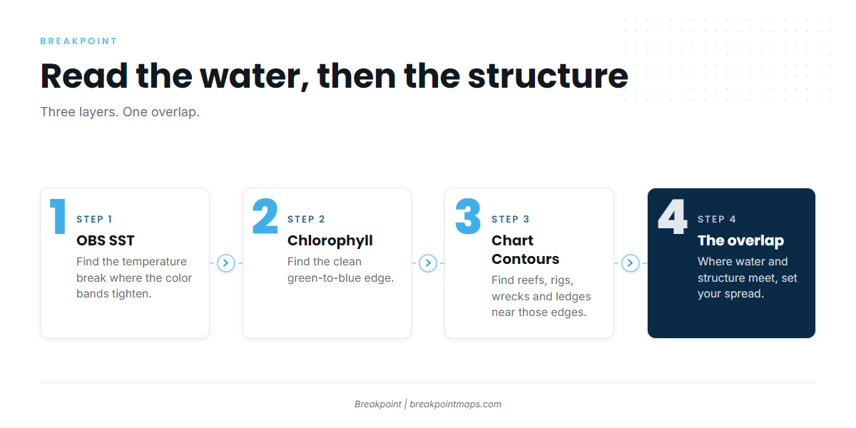
Start with the water, then the structure, then the overlap. In Breakpoint, OBS SST shows the temperature break where the color bands tighten. Chlorophyll shows the clean green-to-blue edge. Chart Contours show the reefs, rigs, wrecks and ledges near those edges. Where a break or color edge sits over structure, you have a place worth fishing.
Chart layers are not for navigation. Cloud can block a satellite pass, so a gap in SST is missing data, not missing fish. A forecast is a forecast. Check the official marine forecast for wind, wave height and period before you leave the dock.
How anglers fish for kings here
Slow-trolling live bait
Anglers slow-troll pogies (menhaden), cigar minnows and blue runners around structure and along bait edges. A live bait swimming naturally near the bait kings are already feeding on looks like part of the school.
Stinger rigs and wire
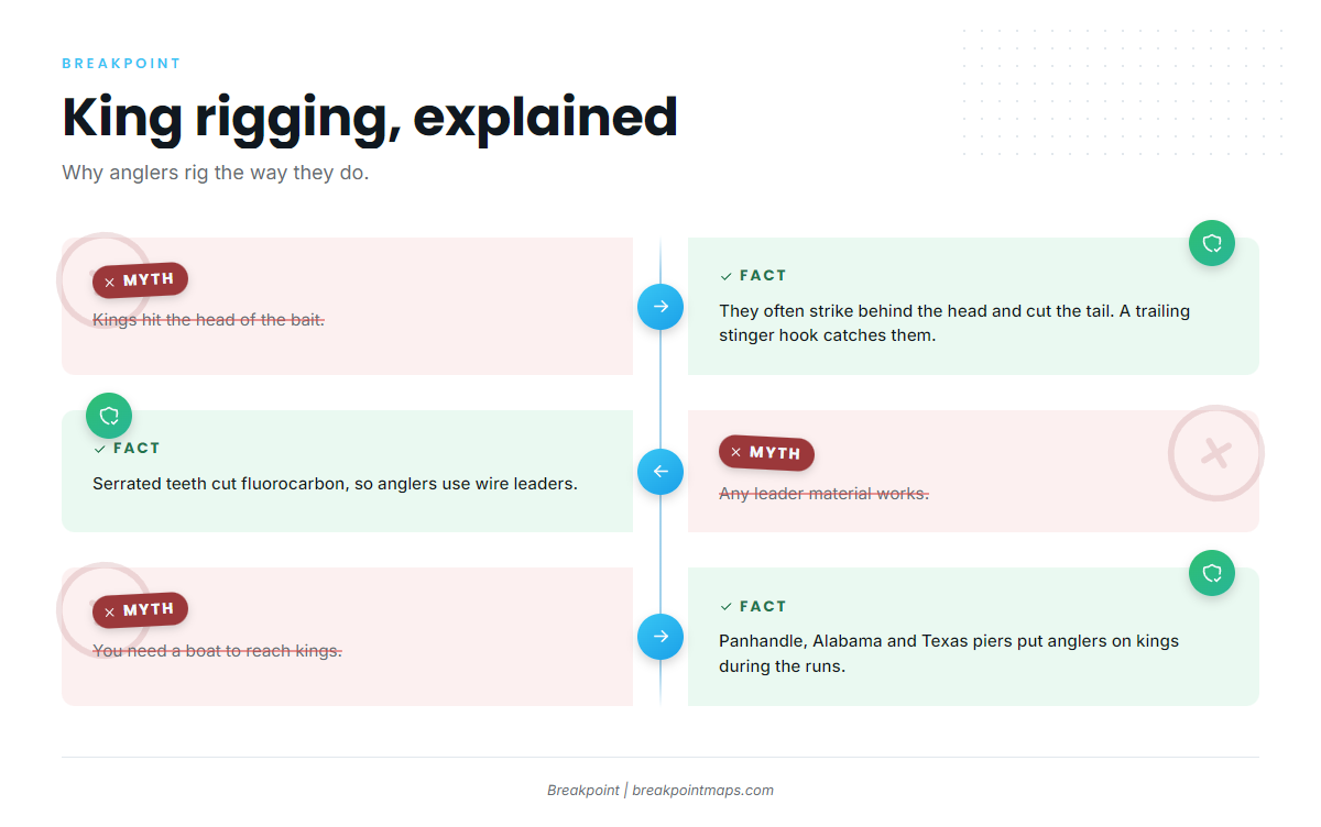
Kings often strike short, hitting behind the head of a bait and cutting off the tail. A trailing treble hook on a short wire trace, called the stinger, hooks those fish. Serrated teeth cut fluorocarbon, so anglers use wire leaders. A single hook in the nose of a bait lets a short-striking king swim off with the back half.
Spoons and planers
Spoons, diving plugs and planers cover more water faster. Use them to find fish, then switch to bait once you know where kings are holding.
Kites
A kite holds a bait at the surface, away from the boat, so it splashes where kings can see it and where the boat’s noise does not reach it.
Piers
Panhandle, Alabama and Texas piers let anglers without a boat reach kings during the runs. Pier anglers fish live bait under a float or on a trolley rig with wire. The timing in the table above applies. A Florida pier license can cover anglers on the pier, and the Regulations section has the detail.
Kingfish tournaments, including SKA events, chase smokers. Cobia and spanish mackerel share the same rigs and structure, and the coastal and offshore gamefish guides cover them.
Locate the break, then the bait, then the structure under them, and you can decide where to set the spread.
Guides to king mackerel fishing from specific ports: Dauphin Island, Apalachicola, Cocodrie, Biloxi, Corpus Christi, Orange Beach, Boca Grande and Venice.
FAQ
What is the best time for king mackerel fishing in the Gulf of Mexico?
Spring and fall runs bring kings through the northern Gulf, and winter is the window in South Florida and the Keys. Timing follows the water and the bait, so a warm or cool year moves the run.
What is the king mackerel limit in Florida?
The limit is 24 inches fork length and 3 per person per day. The season is open year-round in Gulf state waters and all Monroe County state waters. The same figures apply in federal Gulf waters.
Do I need a federal permit for king mackerel?
Private anglers do not. For-hire vessels need the federal Gulf coastal migratory pelagic charter/headboat permit. State licenses still apply, so check the agency page for the state where you fish and land.
What is fork length, and how is it different from total length?
Fork length runs from the tip of the snout to the fork of the tail. Total length runs to the tip of the tail. Federal and Florida king mackerel minimums use fork length. For other states, check the state agency page.
Why do federal documents say Gulf of America?
NOAA Fisheries and the Gulf Council use "Gulf of America" for the same waters anglers call the Gulf of Mexico. The rules cover the same body of water.
How do I tell a king from a spanish mackerel?
The king’s lateral line dips sharply under the second dorsal fin. The spanish mackerel’s runs straight, and it has gold spots. The king mackerel species guide has the full identification breakdown.