



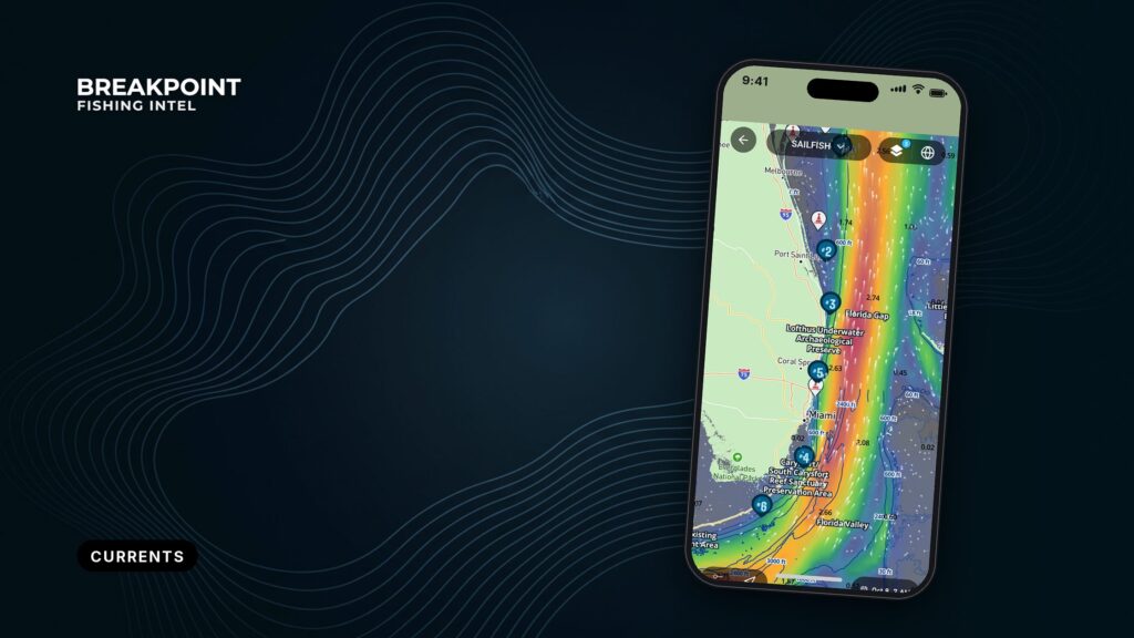
Not for navigation. Breakpoint charts are for trip planning. Navigate with official charts and your vessel’s instruments.
An eddy is a spinning loop of water that breaks off a main current and travels on its own. Eddies can be tens to hundreds of miles across, spin in either direction, and last for months. Bait and pelagic fish stack up along their edges.
Those edges move from day to day, so the day’s data is more reliable than a saved line. The three current systems in our waters, the Loop Current, the Gulf Stream and the California Current, all shed edges that drift.
This guide covers how to read the currents layer, OBS SST and Chlorophyll together. The goal is a better decision about where to look before you commit the fuel. It does not promise fish.
Currents and eddies are moving features, not fixed lines
A current is a coherent stream of water driven by wind and by differences in temperature, density and pressure, then steered by Earth’s rotation. WHOI explains how ocean currents form in more depth.
Eddies start as bends in a current. A bend, called a meander, lengthens into a loop and pinches off, and the loop then travels on its own. Gyres are basin-wide, permanent circulations; eddies are smaller and temporary.
Eddies work like the ocean’s weather systems. According to the NASA JPL eddy overview, they move at about 0.5 knots, can be over 300 km (about 200 mi) across, and can persist for many months. NOAA research on spinning eddies puts their size at tens to hundreds of miles and notes they can rotate clockwise or counterclockwise.
In the Northern Hemisphere, warm-core eddies spin clockwise (anticyclonic) and cold-core eddies spin counterclockwise (cyclonic).
Warm-core and cold-core eddies work in different ways
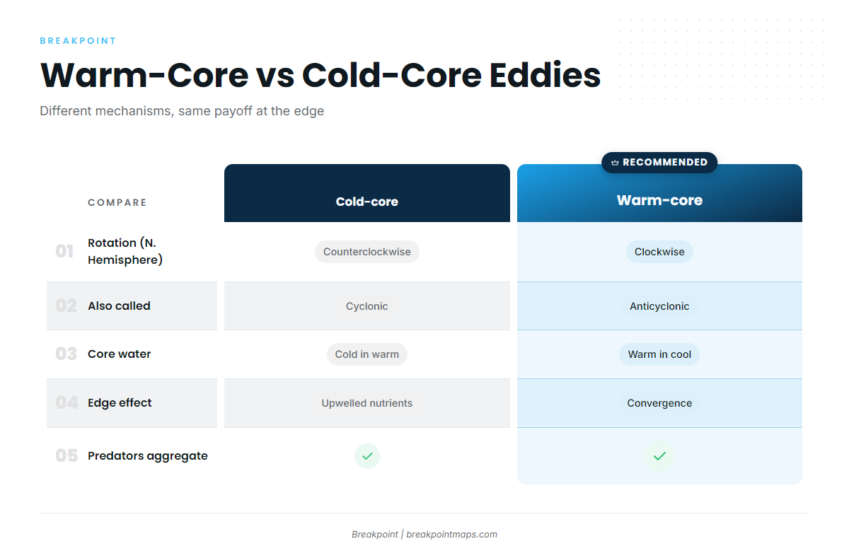
| Type | Rotation (N. Hemisphere) | Core water | At the edge | Source |
|---|---|---|---|---|
| Warm-core | Clockwise, anticyclonic | Warm water inside cooler water | Convergence gathers bait. Predators aggregate. | NOAA Fisheries |
| Cold-core | Counterclockwise, cyclonic | Cold water inside warmer water | Upwelled nutrients feed plankton. Large fish feed near the edges. | NASA JPL |
Swipe the table sideways to see every column.
Both types matter, through different mechanisms. NOAA’s finding is that predators such as striped marlin aggregate in anticyclonic eddies to feed. JPL’s point is that cold-core eddies trap nutrients and plankton, and large fish feed near their edges. Neither type is better on paper, and the day’s edge decides.
The three current systems behind our offshore fishing
Each system builds edges in its own way. The table below shows where they run and what they hold.
| System | Region | What forms the edge | Target species |
|---|---|---|---|
| Loop Current | Eastern Gulf, Florida Straits | Northward intrusion, shed warm eddies, eddy edges | yellowfin tuna, blue marlin, mahi, wahoo |
| Gulf Stream | Florida east coast to the Outer Banks and Hatteras | Western wall, meanders, filaments | mahi, wahoo, yellowfin tuna, blue marlin |
| California Current | Southern California Bight, Point Conception, Pacific Northwest | Upwelling, fronts, eddies | albacore, bluefin tuna |
The Loop Current sheds eddies that drift west across the Gulf
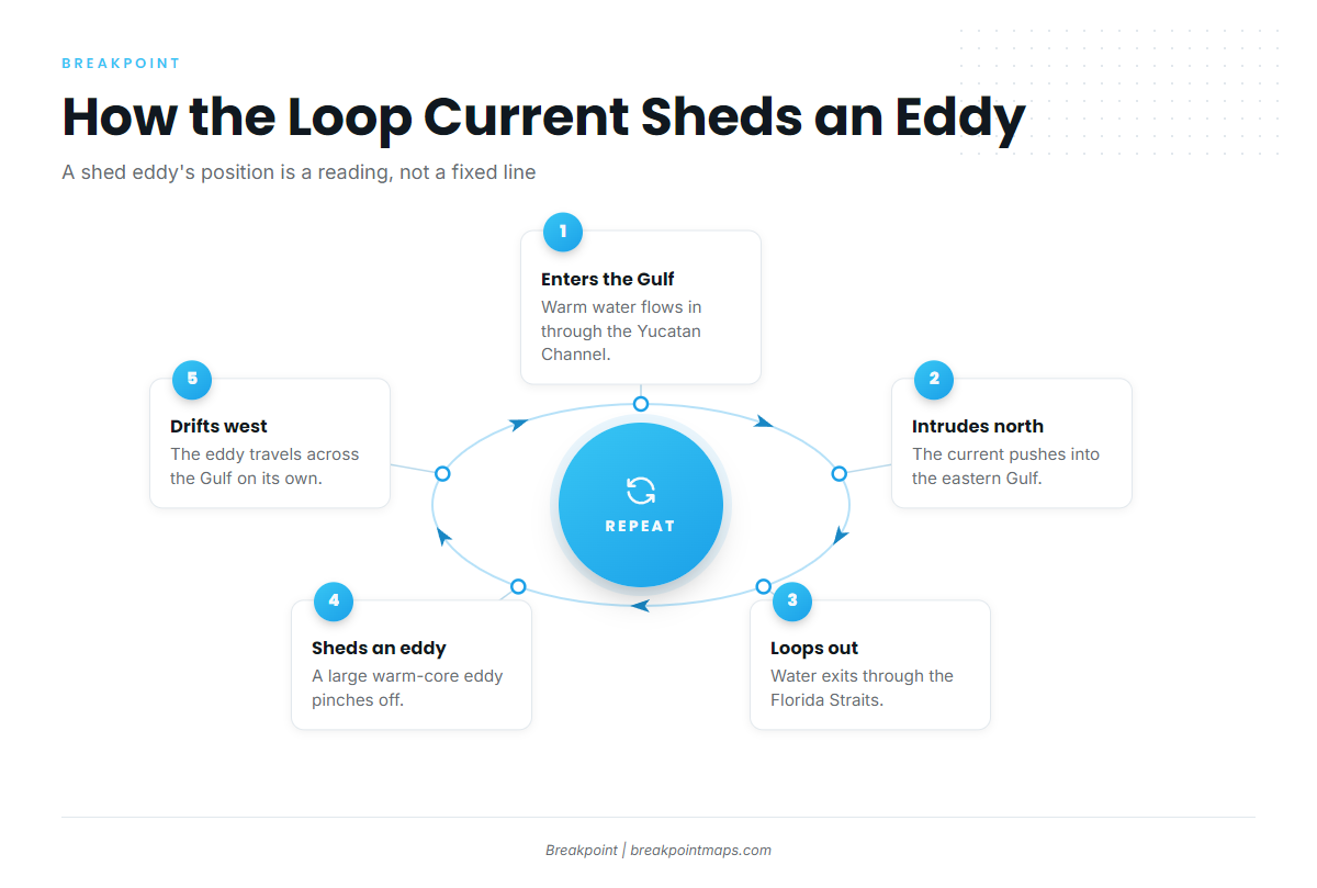
The Loop Current works in a sequence:
- Warm water enters the Gulf through the Yucatan Channel.
- It intrudes north into the eastern Gulf.
- It loops back out through the Florida Straits.
- It periodically sheds a large warm-core eddy.
- The shed eddy drifts west.
Research on Loop Current eddies shows they carry significant energy and strong currents, with implications for fisheries. Eddy separation is still actively studied. A shed eddy’s position is a reading from the latest satellite pass, not a fixed line.
Start with the eddy edges and the places where an eddy touches the Loop Current. Those are the spots to check for yellowfin tuna and blue marlin.
The Gulf Stream’s western wall and meanders build edges close to shore
The western wall is the sharp inshore edge where Gulf Stream water meets cooler shelf water. Meanders are bends in the stream that push warm water inshore or pull it offshore. Filaments are thin streamers of stream water peeling off the main flow.
The Florida Straits and the run up to the Outer Banks and Hatteras are where the stream sits closest to the shelf break. For a regional example of fishing the edge, see our guide to wahoo off Cape Hatteras.
Experienced Gulf Stream anglers watch the stream’s eddies and backflows. Meanders shift the wall’s position, so a waypoint saved last week can be miles off.
The California Current runs on upwelling, fronts and eddies
Upwelling is cold, nutrient-rich water rising from depth to the surface. The California Current is a cool, southward-flowing current. Wind-driven upwelling along the coast builds fronts and eddies, and the pattern runs from Point Conception through the Southern California Bight.
Per NOAA Fisheries, juvenile Pacific albacore are often found near oceanic fronts or temperate discontinuities. Albacore schools also associate with floating objects, including sargassum, according to the FishBase albacore species profile.
On the Atlantic and Gulf side, you often fish warm water pushing into cool water. On the West Coast, cool upwelled water and the fronts it builds do much of the work.
Edges concentrate bait, and bait draws pelagics
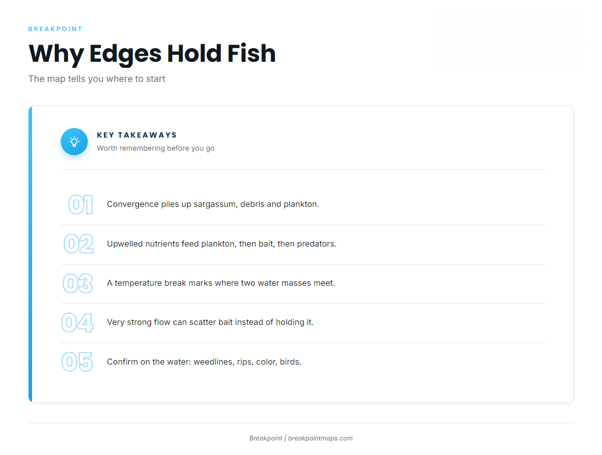
A convergence zone is where two water masses meet and push surface water, debris and plankton together. Three mechanisms stack up along an edge:
- Convergence. Surface flow piles up sargassum, debris and plankton along the line.
- Upwelling and nutrients. Nutrients feed plankton, plankton feeds bait, and bait draws predators.
- Temperature break. A temperature break is a sharp change in water temperature over a short distance. It marks where two water masses meet.
The food chain runs from plankton to bait to mahi, wahoo, yellowfin tuna and blue marlin. NOAA ties knowing where species congregate to saving time and fuel.
Strong flow can work against you. Water moving too fast can scatter bait instead of holding it, so a ripping edge is not automatically a good one.
Confirm the edge on the water by looking for:
- Weedlines, which are floating sargassum gathered by converging water
- Rips
- Color changes from blue to green
- Birds working
The map tells you where to start, and the water tells you whether you are on the edge.
Reading the currents layer alongside OBS SST and Chlorophyll
Fishing chart layers are planning tools. They are not for navigation. Use official nautical charts and your electronics to run the boat.
OBS SST shows the temperature break
Infrared satellite SST shows surface temperature. A break appears as tightly packed color bands. Look for a warm finger pushing into cooler water.
We cover how to read a temperature break on an SST map in detail.
Chlorophyll shows the blue-green edge
Ocean color satellites read chlorophyll, a proxy for plankton. Green water is plankton-rich, and blue water is clean and low in plankton. The line between them is often a bait edge.
The currents layer shows flow direction and speed
Arrows, called current vectors, point the way the water is moving. Longer and denser arrows mean faster flow. Look for fast flow meeting slow water, and for rings of arrows that mark an eddy.
Altimetry is the measurement of sea surface height from satellites, and many currents layers are built from it. The next section covers what it can and cannot see.
Where the layers agree, look first
The strongest target is where a temperature break, a blue-green edge and a current edge line up, ideally over bottom structure. When the layers disagree, the next section shows how to weigh them.
In Breakpoint, the currents layer, OBS SST and Chlorophyll sit on one map, so you can check the day’s edge positions before you commit fuel.
What the data can’t see
Every layer has a blind spot, and it helps to know each one before you trust the picture.
What each layer can’t see:
- Altimetry (currents and eddies). It reads sea surface height, and eddies show up as sea level anomalies. AVISO explains how satellites track eddies, and some are tracked for longer than 3 months. It sees through cloud. Its resolution is coarser and it carries noise, as research on satellite altimetry and eddy detection describes. Small filaments can be missed.
- OBS SST (infrared). Clouds block it. A cloudy pass leaves a gap, not a reading.
- Chlorophyll (ocean color). Clouds block it too. River runoff can turn water green without making it a good edge.
- Composites. A composite blends several passes to fill cloud gaps. It trades freshness for coverage, so an edge on a multi-day composite may have moved since.
- Latency and forecasts. Every layer is a reading from its pass time. A forecast is a forecast.
When SST is clouded out, lean on altimetry for eddy position and use the last clear SST pass for the break. Agreement between layers raises confidence. Conflict is a reason to check on the water.
A night-before and morning-of workflow
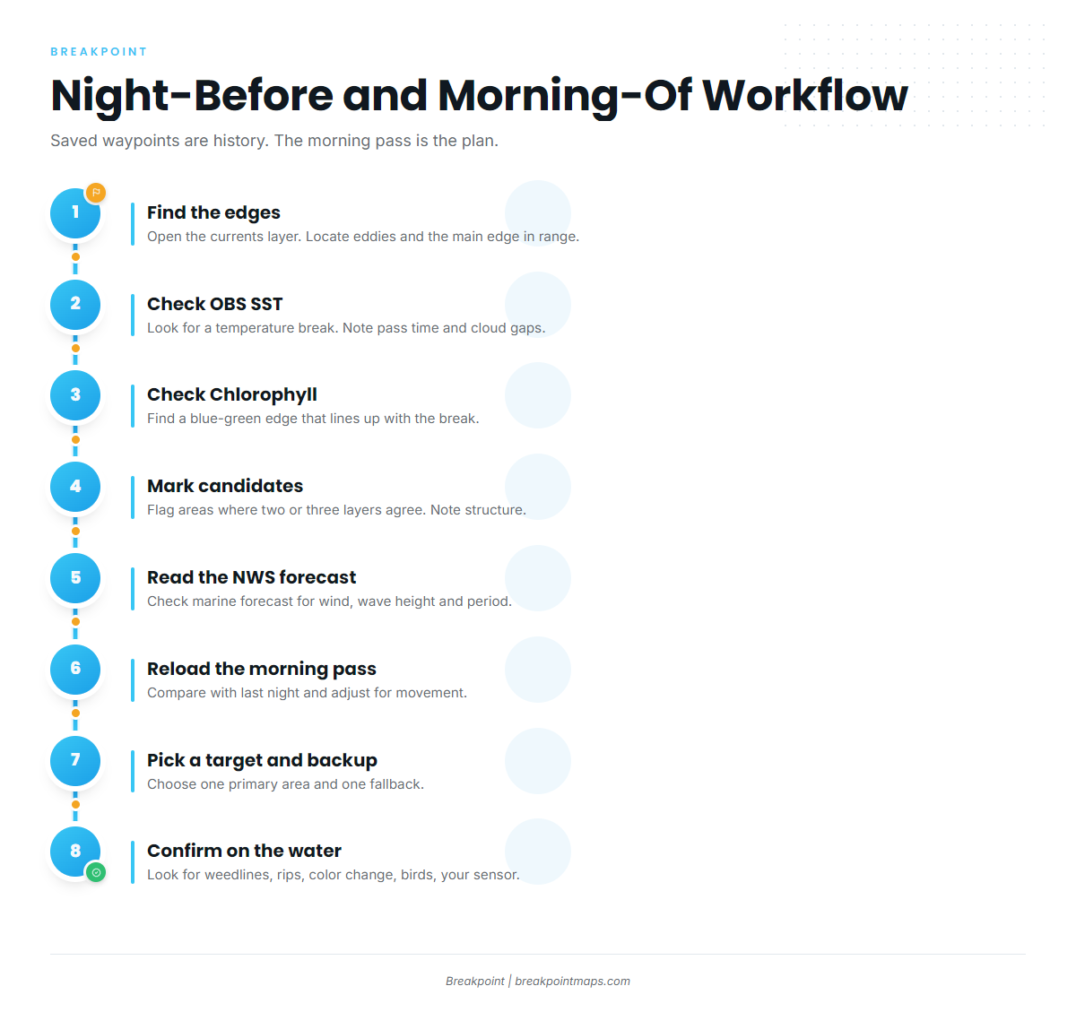
Fishing chart layers are not for navigation. Use official nautical charts and your electronics to run the boat.
Night before
- Open the latest currents layer. Find eddies and the main current edge within your fuel range.
- Check OBS SST for a temperature break on that edge. Note the pass time and any cloud gaps.
- Check Chlorophyll for a blue-green edge that lines up with it.
- Mark your candidate areas where two or three layers agree. Note bottom structure.
- Read the National Weather Service marine forecast for wind, wave height and period. Make the go or no-go call on those numbers.
- Cache the map while you have signal.
Morning of
- Reload the latest pass. Compare it with last night’s view and adjust for movement.
- Pick a primary target and a backup.
- Confirm on the water with weedlines, rips, color change, birds and the surface temperature on your own sensor.
Saved waypoints are history, and the morning pass is the plan.
Frequently Asked Questions
What is an eddy in the ocean?
An eddy is a spinning loop of water shed from a main current. Per NASA JPL, eddies move about 0.5 knots, can be over 300 km (about 200 mi) across, and can last for many months. They drift, so their position changes from day to day.
What is the difference between a warm-core and a cold-core eddy?
Warm-core eddies spin clockwise in the Northern Hemisphere and hold warm water inside cooler water. Cold-core eddies spin counterclockwise. NOAA reports predators aggregating in anticyclonic eddies. JPL notes cold-core eddies trap nutrients and plankton, and large fish feed near their edges.
Why do current edges hold fish?
Edges are where water masses converge. Surface flow pushes plankton, sargassum and debris together, and upwelled nutrients feed plankton. Bait follows the plankton, and predators such as mahi, wahoo, yellowfin tuna and blue marlin follow the bait.
Can I save eddy and edge waypoints for next trip?
Treat them as history only. Eddies move and meanders shift the edge, so a saved line can sit miles from the water you want. Check the latest pass on the day, including the Loop Current eddy position if you fish the Gulf.
What do clouds do to SST and chlorophyll data?
Clouds block both layers and leave gaps in the image. Composites fill those gaps with older passes, so they cost you freshness. Altimetry still sees eddies under cloud, which is why it helps when the other layers go blank.
Are fishing chart layers safe to use for navigation?
No. Chart layers are planning tools and are not for navigation. Use official nautical charts and your electronics to run the boat. For wind, wave height and period, read the National Weather Service marine forecast and decide on those numbers.
Conclusion
Edges hold bait, but warm-core and cold-core eddies work in different ways, and all three current systems move. Read the currents layer, OBS SST and Chlorophyll together the night before. Reload the morning pass, then confirm on the water. NOAA’s point holds: knowing where fish congregate saves time and fuel.
Open the map, check the day’s edges, and make a better decision about where to look. Download Breakpoint from the App Store or Google Play and see the layers side by side.