



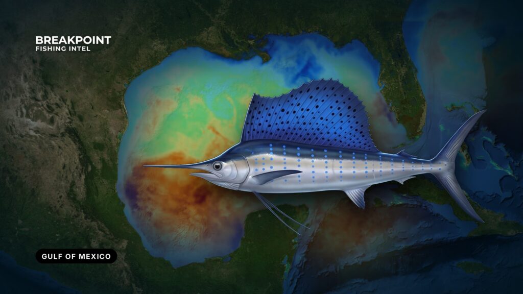
Sailfish fishing in the Gulf of Mexico comes down to finding the edge: where warm blue water meets bait, current and the shelf break. A temperature edge, a color change, a weedline, an eddy edge and a contour at the shelf break each mark a spot where bait concentrates and sailfish feed. Sailfish are a highly migratory billfish managed by NOAA Fisheries, so the rules follow the fish across jurisdictions. This page covers where and when sailfish move through each part of the Gulf, which water to look for, how anglers fish for them, and how federal and state rules divide. Most sailfish are released, and the Regulations section explains what applies whether you release one or keep one. Sailfish are one part of the wider offshore fishery covered in our Gulf of Mexico fishing guide.
Where and When: Sailfish Fishing in the Gulf of Mexico by Region
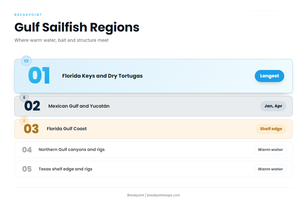
Sailfish follow warm water. The Florida Museum publishes a sailfish temperature range of 70-83°F, the widest band available, and NC DMF narrows it to 77-82°F. Seasons in each part of the Gulf follow where that water sits: warm water first, then bait, then fish.
According to the Florida Museum, spawning in the western Atlantic may begin as early as April and occurs mostly in summer, which keeps fish in motion through the warm months.
Sailfish also appear in warm seasons at the northern extremes of their range, as far north as the Gulf of Maine according to the NC DMF sailfish species profile. If you fish up that way, see our notes on sailfish off the Northeast.
| Region | What sets the timing | Structure to look for |
|---|---|---|
| Florida Keys and Dry Tortugas | Warm water lingers longest, close to the Loop Current’s exit path | Edges along the Gulf side of the Keys, the Dry Tortugas |
| Florida Gulf Coast | Warm water and bait pushing toward the shelf edge | Shelf edge, color changes |
| Northern Gulf (Panhandle to Louisiana) | How far warm water and Loop Current eddies push north | De Soto Canyon, Mississippi Canyon, platforms |
| Texas | Warm-season blue water reaching the shelf edge | Shelf edge, rigs |
| Yucatán and Mexican Gulf | Southern end of the movement, upstream of the Loop Current | Yucatán shelf and current edges |
Florida Keys and Dry Tortugas
These are the southern gateway waters, closest to the Loop Current’s path out of the Gulf. Warm water lingers here, which gives this region the longest window of any part of the Gulf.
The Atlantic side runs differently. Off southeast Florida, FWC notes that sailfish move inshore to shallow water and spawn near the surface in summer, which is why that coast has a kite fishery. For that side, see our notes on sailfish in the Atlantic Southeast.
Florida Gulf Coast
The shelf is wide here, so blue water sits far from much of the coast. Sailfish show up where warm water and bait push toward the shelf edge. Florida state waters on the Gulf side run from shore to 9 nautical miles, a boundary that matters for the rules covered below.
Northern Gulf: Panhandle, Alabama, Mississippi and Louisiana
De Soto Canyon sits off the Panhandle and Alabama, and Mississippi Canyon sits off Louisiana. Both bring the shelf drop close to port, and oil and gas platforms off Louisiana add standing structure.
This warm-season fishery depends on how far warm water and Loop Current eddies push north. A study of Gulf sailfish larvae found that larval abundance rose with Sargassum biomass at eddy features in the northern Gulf, so eddy edges with weed on them are worth your time.
Texas
The shelf edge and the rigs are the structure in this warm-season, blue-water fishery. Look for the same stack of features as farther east: a warm-water edge, a color change and weed, close to the shelf break or a platform.
Mexican Gulf and the Yucatán
According to Lam et al., January and April are peak months for sailfish fishing off the Yucatán Peninsula. This is the southern end of the Gulf’s sailfish movement, upstream of the Loop Current. The U.S. rules in this guide apply in U.S. waters only.
The Water and Structure That Hold Sailfish
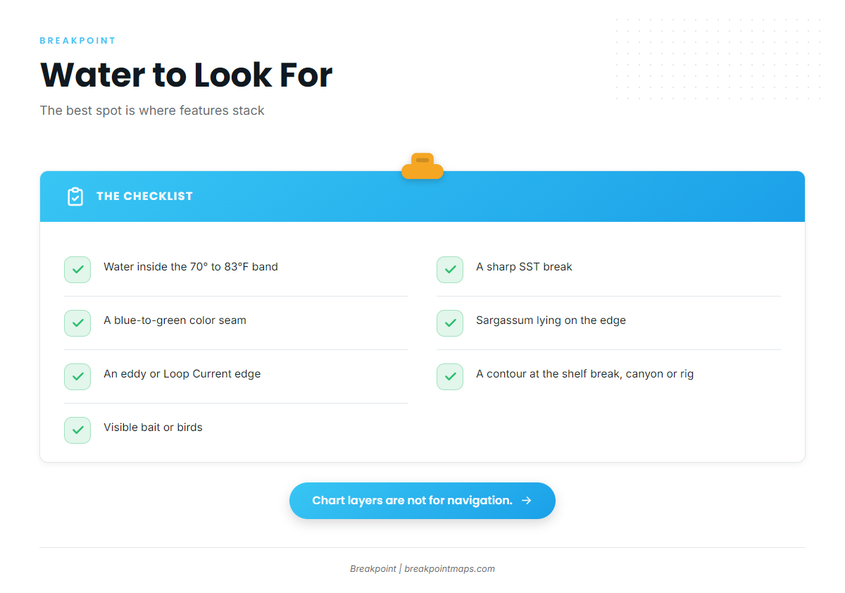
Sailfish sit where several features overlap. Build the picture in this order: temperature, color, sargassum, current, bottom, then the overlap.
Temperature: the SST break
An SST break is a line where surface temperature changes quickly over a short distance, marking two water masses meeting. Bait stacks along the boundary, and predators work it.
Use the temperature band above as your target: 70-83°F from the Florida Museum, 77-82°F from NC DMF. In Breakpoint, OBS SST shows the break.
Cloud blocks an SST pass. A gap on the map is missing data, not cold water.
Color: blue water and the chlorophyll edge
A color change, or chlorophyll edge, is where green, plankton-rich water meets clear blue water. The green side feeds bait, and the clean side gives predators visibility, so the seam between the two is the target. Chlorophyll shows color, not fish.
A nearshore color change is river and shelf water against offshore water. A Loop Current eddy edge is a deep, moving wall of warm water. They behave differently, as the current section below explains.
Floating structure: sargassum weedlines
Weedlines form where currents converge, and they hold small bait in open water. The larval research above ties sailfish to Sargassum at eddy features, which is the same logic at work.
- Troll along the line, not through it.
- Look for scattered patches as well as solid lines.
- Look for weed lying along a temperature or color edge, where two features stack.
Current: the Loop Current and its eddies
The Loop Current carries warm, clear water into the Gulf from the Yucatán Channel and out past the Dry Tortugas. Eddies break off and drift, carrying warm blue water and edges into the northern and western Gulf.
An eddy edge is a moving boundary that can sit far offshore and shift day to day. A nearshore color change is shallower and tied to runoff and the shelf, so it usually changes with wind and river output. The first can justify a long run to a line that is there today; the second is closer to port.
An edge seen on yesterday’s pass may have moved. Read the newest clear image.
The bottom: shelf edge, canyons and rigs
Where the bottom drops, current pushing against the slope lifts nutrients and concentrates bait. De Soto Canyon and Mississippi Canyon bring deep water close to the coast, and platforms are fixed structure that holds bait in otherwise open water.
NC DMF places sailfish habitat at 120 to 300 feet of water. Chart Contours in Breakpoint show where the bottom steps down. Contours come from surveys of varying age, and chart layers are not for navigation.
Where it all overlaps
The best place to look is where two or more of these features stack. A temperature edge crossing the shelf break near a color change, with weed on it, beats any single feature alone.
Water to look for:
- Water within the sourced temperature band
- A sharp SST break
- A blue-to-green seam
- Sargassum lying on the edge
- An eddy or Loop Current edge
- A contour at the shelf break, a canyon or a rig
- Visible bait or birds
To stack these in Breakpoint, turn on OBS SST to find the break, add Chlorophyll to see the color edge, then add Chart Contours to see where both cross the shelf break. Chart layers are not for navigation.
Before you commit to a run, check wind, wave height and wave period in the NWS marine forecast.
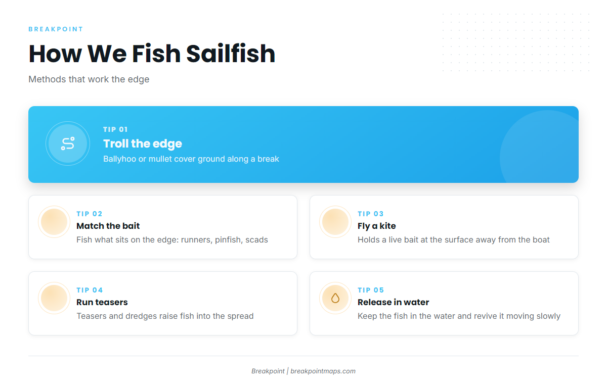
How Anglers Fish for Sailfish in the Gulf
White marlin and blue marlin can share the same spread and the same water, so the billfish guides are worth a read before you rig.
Trolling ballyhoo and mullet
Trolling covers ground, and covering ground finds fish along an edge. The Florida Museum names whole mullet and ballyhoo as trolling baits. NC DMF lists artificial and natural baits such as mullet, Spanish mackerel, bonito and ballyhoo.
Live bait and the kite
FWC names blue runners, pinfish, mullet, scads, ballyhoo and squid as baits that attract cruising sailfish. A kite holds a live bait at the surface away from the boat. It is a southeast Florida staple and works where fish are working an edge.
Match the bait to what sits on the edge. According to the Florida Museum, sailfish prey includes cephalopods, mackerels, jacks, halfbeaks and needlefish.
Teasers
Teasers and dredges raise fish into the spread, bringing them up behind the boat where they can find a bait.
Handling the release
A sailfish you plan to release stays in the water in federal waters, and in state waters if the vessel holds an HMS permit. The Regulations section has the details.
- Keep the fish in the water.
- Revive it with the boat moving slowly forward.
- Minimize handling.
For circle hook rules, use the NOAA compliance guide linked in Regulations.
Before you run
Check the last clear pass before you commit to a run. Breakpoint helps you decide where to look, but it does not promise fish.
Sailfish Identification and Biology at a Glance
The tall, sail-like first dorsal fin sets a sailfish apart from every other billfish. NC DMF notes that pods encircle bait using their high fins as a wall. According to the FishBase sailfish species summary, sailfish occur in loose aggregations and are highly migratory.
Quick facts:
- Species: Istiophorus platypterus, family Istiophoridae
- Marker: tall first dorsal fin shaped like a sail
- Habit: loose aggregations, highly migratory
- Position in the water: usually above the thermocline
- Spawning: April through summer
For identification, size, age and growth, read the full sailfish species guide.
Guides to sailfish fishing from specific ports: Apalachicola, Venice, Biloxi, Corpus Christi, Carrabelle, Freeport, Clearwater and Galveston.
Frequently Asked Questions
Can you keep a sailfish in the Gulf?
Yes, if the fish meets the federal and state size and bag rules and you hold the required permits. Most anglers release sailfish. Check FWC and NOAA for the size limit before you fish.
Do I need an HMS Angling Permit for sailfish?
It is required in federal waters and is issued to the vessel. In Florida state waters it is not required for billfish.
When is sailfish season in the Gulf compared with the Atlantic?
The Gulf season follows warm water. Off the Yucatán, January and April are peak months according to Lam et al. Off southeast Florida, sailfish spawn nearshore in summer, according to FWC. For that coast, see sailfish in the Atlantic Southeast.
What water temperature do sailfish prefer?
The Florida Museum gives 70° to 83°F, and NC DMF gives 77-82°F. Look for SST breaks inside that band, because the break is where bait stacks.
How do you tell a sailfish from a marlin?
The tall, sail-like first dorsal fin is the giveaway. The full sailfish species guide covers identification in detail.
How do I report a landed sailfish?
Report it to NOAA within 24 hours at 800-894-5528 or through hmspermits.noaa.gov.
Do charter clients need a fishing license in Florida?
No individual license is needed when fishing from a for-hire vessel with a valid charter license, up to the number of customers on that license.
Closing
Find the band of warm water, then find where edges stack over the shelf break. Fish it with trolled or live bait, release the fish in the water, and check whose rules apply. The water moves, so the newest clear pass is the one to use.
If you want to read those edges on a map before you leave the dock, download Breakpoint from the App Store or Google Play.