



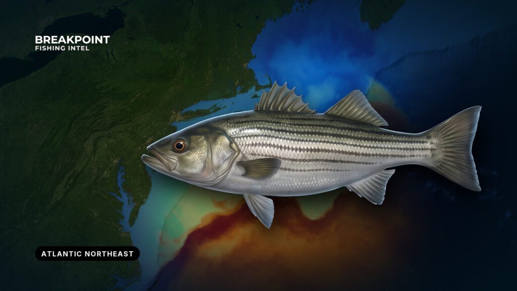
Striped bass fishing in the Atlantic Northeast comes down to three things: moving water, a change in depth, and bait. Stripers sit where current pushes menhaden (bunker) and herring across a shoal, a bar, a point or a rip, and they eat without burning energy. Race Point, the Cape Cod Canal, Buzzards Bay, Vineyard Sound, Block Island Sound, Montauk and Long Island Sound all follow that rule, and once you see why, you can find the same water on any chart.
This page puts the fishery inside the wider Atlantic Northeast fishing picture. It covers when the fish are here, the named grounds, the structure and current that hold them, the methods anglers use, and how federal and state rules divide.
Identification and Biology
Striped bass (Morone saxatilis, family Moronidae) range along the Atlantic coast from the St. Lawrence River to the St. Johns River in Florida, according to NOAA’s Atlantic striped bass profile. They are anadromous: adults live in the ocean and enter fresh or brackish water to spawn in spring.
Adults typically run 16 to 30 inches, according to the U.S. Fish and Wildlife Service. In this region they eat menhaden, herrings, anchovies, squid and crabs. Fish tagged in the Delaware River have been recaptured from North Carolina to Maine, which is why the same fish can show up in Cape Cod water weeks after leaving the Delaware. For identification marks and the rest of the biology, see the full striped bass species profile.
When Striped Bass Are in the Atlantic Northeast
Spawning runs go up the freshwater portion of tidal rivers in spring. The Delaware grounds sit between Wilmington, Delaware, and Marcus Hook, Pennsylvania, and the C&D Canal also holds fish. Spawning happens in water of roughly 57 to 68 degrees, according to Delaware DNREC. After spawning, fish spread along the coast through summer and move south in autumn. Bait sets the pattern, and the summer coastal fishery forms where menhaden and herring schools gather.
The two Cape Cod port areas show how the season and the species mix change:
| Area | Spring | Summer | Autumn |
|---|---|---|---|
| Provincetown and the Outer Cape (Race Point, Stellwagen Bank) | striped bass, haddock | striped bass, bluefin tuna, fluke | striped bass, bluefin tuna, fluke |
| Falmouth and Woods Hole (Vineyard Sound, Buzzards Bay) | striped bass | striped bass, bluefish, bonito, false albacore, black sea bass, bluefin tuna | striped bass, bluefish, bonito, false albacore, black sea bass, tautog, scup, bluefin tuna |
Stripers are present in all 3 seasons at both Cape ports. The species they share the water with, and the water they use, change from season to season.
The fall run south
In autumn, fish move out of the region toward the south. NOAA describes the species as migrating north and south seasonally, and the Delaware tagging returns show how far that travel runs. The fish that leave this water become the Southeast striped bass fishery, and North Carolina waters are covered on that page.
Where Striped Bass Hold: Named Grounds
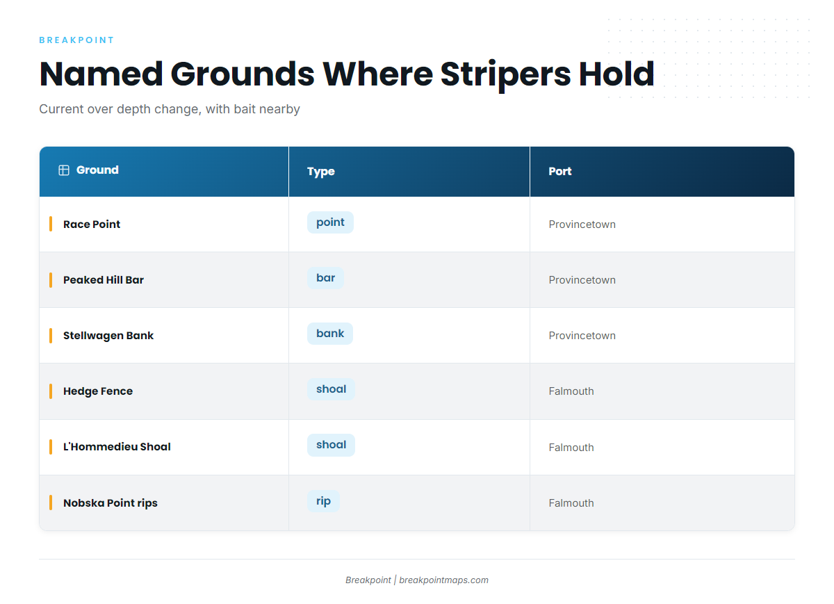
The grounds below share the same ingredients: current pushed over abrupt depth change, with bait nearby. The "why" column comes from NOAA Coast Pilot 2.
| Ground | Type | Port | Why it holds fish |
|---|---|---|---|
| Race Point | point | Provincetown | Tidal current between Race Point and Highland Light is very strong |
| Wood End to Race Point drop-off | drop-off | Provincetown | Shoals rise abruptly from deep water, up to about 0.6 mile from shore |
| Peaked Hill Bar | bar | Provincetown | Least depth 11 feet, about 0.6 mile offshore, runs about 4 miles parallel to the beach |
| Off Herring Cove Beach | shore | Provincetown | Bay-side shoreline next to the Race Point current |
| Stellwagen Bank | bank | Provincetown, Falmouth | Bank rising from surrounding deep water |
| Hedge Fence | shoal | Falmouth | Shoal across the Vineyard Sound current; Port Hunter wreck at the west end in 20 feet |
| L’Hommedieu Shoal (Halfway Shoal) | shoal | Falmouth | Shoal in the 2.3-knot flood and 1.7-knot ebb |
| Middle Ground | shoal | Falmouth | Vineyard Sound shoal in tidal current |
| Nobska Point rips | rip | Falmouth | Point at the Vineyard Sound mouth of Woods Hole |
Stellwagen Bank and parts of the outer Race Point water can sit on either side of the 3-nautical-mile line. Check your position against that line before you fish, and read the Regulations section.
The wider fishery includes the Cape Cod Canal, Block Island Sound, Montauk and Long Island Sound, where the same mechanism applies: current, a depth change, bait.
Falmouth has town ramps that put you on Vineyard Sound and Buzzards Bay: Great Harbor Landing (Woods Hole), Falmouth Harbor Ramp, Waquoit Bay Landing and Megansett Harbor Landing.
Bluefish and false albacore share Falmouth water with stripers in summer and autumn. For the rest of that mix, see the other coastal gamefish pages.
Water and Structure That Hold Stripers
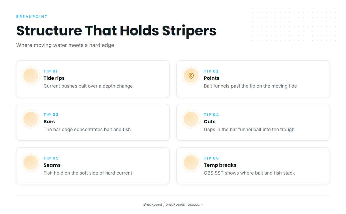
Stripers feed where current moves bait past a change in depth or a hard edge, so the fish spend little energy. Everything below is a version of that mechanism.
Current
Current is the first thing to read. NOAA Coast Pilot 2, Chapter 5, reports that current in the narrow part of Woods Hole Passage at times exceeds 4.5 knots, with 5.0 knots reported, and runs about 3.5 knots in The Strait south of Penzance Point. Buoys in the narrowest part are sometimes towed under. About 1.5 miles south of Falmouth Harbor, the flood sets east-northeast at 2.3 knots and the ebb west-southwest at 1.7 knots.
Fish hold on the soft side of a hard current and ambush along the seam. Which side of a shoal is the down-current side flips with the tide, so the same spot fishes differently on the flood and the ebb.
One navigation fact from the Coast Pilot: the northerly entrance from Great Harbor into The Strait is preferred over Broadway, which has a sharp turn that is difficult in strong current.
Wind against tide
Hedge Fence and L’Hommedieu Shoal produce short, high chop when wind runs against a strong tide. With the 2.3-knot flood, that is where the water stands up.
Buzzards Bay is open to south and southwest winds from spring through fall. Southwesterlies funnel up the bay at speeds often double those at nearby land stations, and they blow harder near the Elizabeth Islands than in mid-bay.
Wind and wave data for the bay are at NDBC Buzzards Bay station BUZM3. The official forecast is the Vineyard Sound marine forecast (ANZ233).
Depth change: bars, drop-offs and shoals
Between Wood End and Race Point, shoals rise abruptly from deep water and extend up to about 0.6 mile from shore. That abrupt rise is the edge, and bait pushed along it by current has nowhere to hide.
Peaked Hill Bar has a least depth of 11 feet about 3.5 miles northeast of Race Point Light. It lies about 0.6 mile offshore and runs about 4 miles parallel to the coast. The Coast Pilot advises a berth of at least 2 miles for vessels. A bar edge concentrates bait because water accelerates over the top and drops into the deeper trough behind it, and stripers sit in that drop.
Shoreline structure types
Each of these works a little differently:
- Tide rips: Current meets a shoal, point or ledge and stands up into a line of broken water. Bait gets pushed into the rip on the stage of tide that drives current across the feature, and fish stack on the seam.
- Points: Current accelerates around a point and leaves a slack eddy on the lee side. Fish hold in the eddy and feed on bait swept past. The productive stage is whichever one pushes the hardest water over the point.
- Jetties: Falmouth Inner Harbor is entered through a dredged channel between two jetties. Rock breaks the flow and holds bait, and fish work the edges where current bends around it.
- Surf troughs and cuts: Troughs run parallel to the beach inside the first bar. Cuts are gaps in the bar where outgoing water funnels bait from the bar into the trough. A cut shows as a break in the wave pattern, where waves do not break as high or as consistently.
- Flats: Shallow, sandy or grassy flats hold crustaceans and small fish. Stripers move onto them on a rising tide and leave as it drops.
- Boulder fields and rocks: Boulders break current into pockets and hold crabs and small fish. Fish sit in the pockets and rush out at bait.
- Tidal rivers and estuaries: Bait funnels through narrow channels on every tide, and fish stage at the mouths and bends. Spawning fish use the freshwater reaches in spring.
Seeing it on a chart
Chart Contours shows the drop-offs, shoals and bars described above. The Wood End drop-off and Peaked Hill Bar are good ones to find first. Contours are survey products, not real-time, and bars on sand beaches move.
OBS SST shows surface temperature breaks where bait and fish can stack. Cloud cover blocks satellite passes, so some days show gaps.
Chart layers are not for navigation.
How Anglers Fish for Stripers Here
Methods in the region follow the water. NCDMF and NOAA list the main ones: trolling, casting or jigging artificials, floating or bottom fishing natural baits, and surf fishing with spoons or heavy lures, all mainly on hook and line.
- Surfcasting: Troughs, cuts and points, with plugs, bucktails and spoons. Low light brings fish closer to the beach.
- Live-lining eels and bunker: Around rips and rocks. Live eels after dark are a common practice around Block Island. Inline circle hooks are required with bait in some states, so read the Regulations section first.
- Three-way rigs: These hold bait near a contour in deeper current, such as shoal edges in Vineyard Sound, where a heavy weight keeps bunker down in the flow.
- Trolling: Shoal edges and channel edges in Buzzards Bay and Long Island Sound, where a pass along the edge covers the seam.
- Fly fishing: Flats and the shallow surf zone, where the water is a few feet deep. Floating or intermediate lines keep the fly off the sand.
Limit handling and air exposure on any fish you release.
To plan a day around this, use Chart Contours to find the edge and OBS SST to find the temperature break. Chlorophyll adds a read on water color where bait may hold. None of it promises fish, but it improves the decision about where to look.
Guides to striped bass fishing from specific ports: New London / Waterford, Indian River Inlet, Bar Harbor / Mount Desert, Ocean City, Barnstable / Cape Cod Bay harbors, Hampton / Seabrook, Atlantic City and Captree.
FAQ
Can you fish for striped bass in federal waters?
No. Fishing for, possessing and retaining striped bass is prohibited in the EEZ, 3 to 200 nautical miles from shore. State rules apply inside 3 miles.
What is the Block Island transit exception?
In the EEZ within Block Island Sound, north of a line from Montauk Light to Block Island Southeast Light and west of a line from Point Judith Light to Block Island Southeast Light, a vessel may carry striped bass. Two conditions apply: no fishing takes place from the vessel while in the EEZ, and the vessel is in continuous transit.
Do I need circle hooks for striped bass?
Massachusetts and New Jersey require inline circle hooks when fishing with bait. Massachusetts excepts natural bait attached to an artificial lure. Check the agency for other states.
What is the striped bass slot limit?
Slots are set by each state under the ASMFC plan and change with management action. Check the state agency pages above. This page prints no figure because the number you need is the one on the agency page the day you fish.
How do I measure a striped bass correctly?
Massachusetts requires you to pinch the tail together when measuring. ASMFC has defined a standard method of measuring total length for size regulations.
Do I need a saltwater fishing license?
Each state runs its own license or registry. Check the state agency before fishing.
How do I tell a striped bass from a bluefish?
Stripers carry dark longitudinal stripes from behind the gills toward the tail. Bluefish have no stripes. Both feed on the same bait in Falmouth water in summer and autumn.