



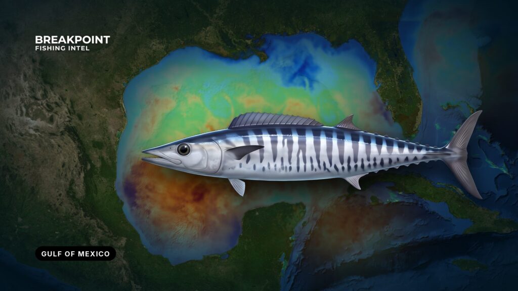
Wahoo fishing in the Gulf of Mexico comes down to three things lining up: blue water, a temperature break, and structure. Timing shifts by sub-region, so start from your own port. This guide covers where to look, how to read the water, how to rig, and which rules apply on each side of the lines. It can sharpen your choice of where to look, but it promises no fish.
The Fish in Brief
A wahoo is a fast, toothy, open-water relative of the mackerels. It strikes hard and cuts monofilament. Identification, biology and how wahoo differ from king mackerel are covered in our wahoo species guide.
Wahoo movement in the Gulf is poorly tracked, so treat seasonal patterns as tendencies rather than schedules. A Florida county fisheries biologist has noted the limited migration data in the Gulf. The fish are nomadic and turn up on edges that hold bait.
Where and When
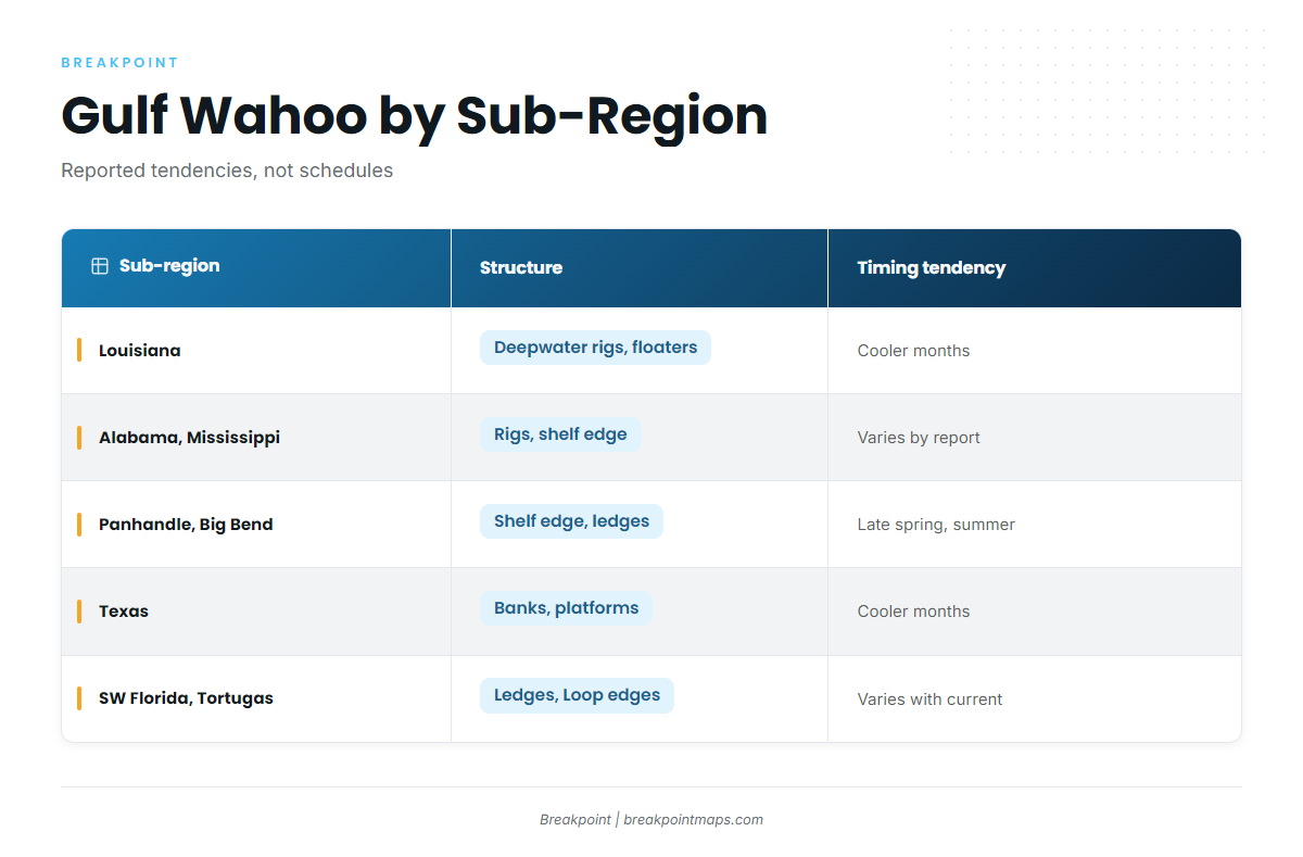
Patterns differ across the Gulf, so start from your own port. Ports, the shelf and the other species are covered in our Gulf of Mexico fishing guide.
Reports disagree on timing, and both sides are probably right for their own water. The western and central Gulf rigs are reported as a cooler-month pattern, and the northeastern Gulf as late spring through summer. Treat both as tendencies.
| Sub-region | Primary structure | Water to look for | Reported timing tendency |
|---|---|---|---|
| Louisiana (Venice) | deepwater platforms, floaters | clean blue water at the rigs, temperature breaks | cooler months, winter rig pattern |
| Alabama and Mississippi | rigs, shelf edge | blue-water edges reaching the shelf | varies; check local reports |
| Florida Panhandle and Big Bend | shelf edge, hard bottom, ledges | warm blue water near structure | late spring and summer reports |
| Texas | Flower Garden Banks, offshore platforms | blue water over the banks | cooler-month reports |
| Southwest Florida and Dry Tortugas | ledges, Loop Current edges | Loop Current blue water | varies with the current |
Louisiana: Venice and the Deepwater Rigs
Off Venice, wahoo stack around deepwater platforms and floaters when clean water reaches the rigs. This winter pattern is the best documented in the Gulf, and magazine reporting describes the winter rig bite off Venice as the main draw.
Venice also has a mixed offshore menu, so a wahoo spread often shares water with other pelagics. That affects the tactics below.
Alabama and Mississippi
Orange Beach is the named port. The structure is rigs and the shelf edge, and wahoo show when blue water pushes onto the edge. Patterns here are less documented than off Louisiana, so rely on recent local reports and your own reading of the water.
Florida Panhandle and Big Bend
Destin is the named port. Fish are reported in late spring and summer near the shelf and over hard bottom and ledges. Work the places where bait and structure overlap.
Texas: Flower Garden Banks and Offshore Platforms
Port Aransas is the named port. The banks and platforms are the structure, and cooler-month reports are the tendency. Check the official sanctuary rules before fishing the banks.
Southwest Florida and the Dry Tortugas
Loop Current influence is strongest here. Fish follow the current edge more than the calendar, so the current’s position matters more than the month.
Water and Structure
Read the water first, then the structure, then find where the two meet.
Temperature Breaks: Which Side to Work
The sharper the break, the better. Reports differ on which side holds fish: some anglers favor the cold side at the rigs, others warm blue water. Work both edges of the break and follow the bait. Look for the break where it crosses the 100-fathom curve.
Color Change and Blue-Water Edges
Troll along the line where green water meets blue. Bait collects there, and wahoo patrol it.
The Loop Current and Eddies
The Loop Current and its eddies push warm blue water and bait toward the shelf. When an eddy edge rides over structure, that spot moves to the top of your list. Eddies move and shed, so yesterday’s map may already be out of date.
The 100-Fathom Curve and the Shelf Edge
This is where the bottom drops away and current upwells bait. The 100-fathom curve is a chart feature that marks the shelf edge, and wahoo do not sit at that depth in particular.
Rigs, Floaters, Banks and Ledges
Platforms create current breaks and hold bait. Work the down-current side.
- Floaters and deepwater platforms sit well offshore and are the main targets off Louisiana.
- Banks and ledges are the natural alternative where there are no rigs.
- Hard bottom along the shelf holds bait in the Panhandle and Big Bend.
- Loop Current edges do the work in the southeast Gulf.
Rigs-to-Reefs and Decommissioning
Platforms keep being removed or converted to artificial reefs, so the available structure changes. Verify that a structure is still there before the run. A reefed site holds bait differently from a standing platform.
Where Water Meets Structure: Reading It on the Map
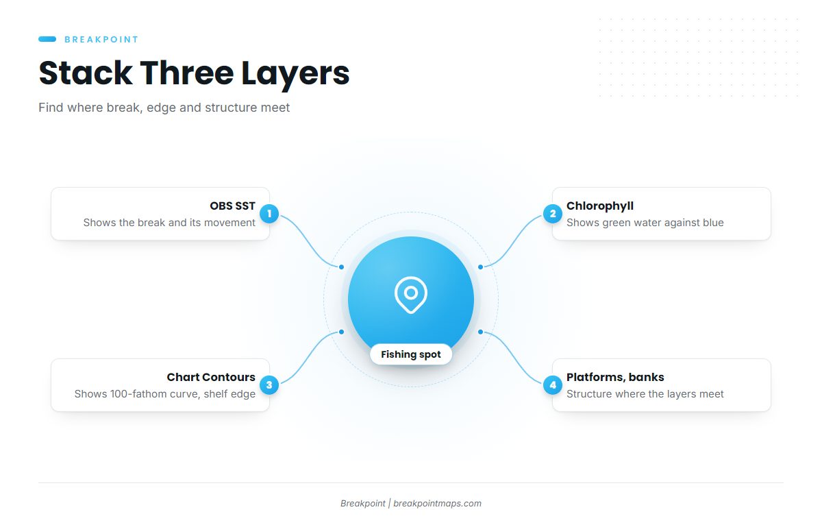
The best spot is a break or blue-water edge pressed against the shelf edge near a platform cluster or bank. Three layers in Breakpoint show it:
- OBS SST shows the break and which way it is moving. Chart layers are not for navigation.
- Chlorophyll shows the color change, green water against blue.
- Chart Contours shows the 100-fathom curve and the shelf edge.
Stacked together, the three show where they meet.
Know the limits. Clouds block satellite passes and leave gaps in the data, and a forecast is only a forecast. Confirm the water at the spot with your own surface temperature reading and your eyes.
How Anglers Fish for Them
High-Speed Trolling
High-speed trolling is the main method in the Gulf. Wahoo hit fast, and covering ground finds scattered fish.
Wire Leaders, Planers and Trolling Leads
Run wire on the wahoo rods, because mono and fluorocarbon get cut. Planers and trolling leads put baits deep. A trolling lead is a weighted section ahead of the leader that takes the bait down.
Lures: Wahoo Bombs, Jet Heads and Deep-Diving Plugs
Lure types that earn their place:
- Wahoo bombs and other purpose-built high-speed lures
- Jet heads and skirted lures
- Large-lipped deep-diving plugs, which are reported to work off Venice
The Hybrid: Find Them Fast, Then Slow Down With Ballyhoo
Troll fast to locate active fish. Once you find them, throttle back to rigged ballyhoo, such as horse ballyhoo under a skirt.
Working Rigs on the Down-Current Side
Make your passes on the down-current side of the platform. Keep a good distance from the structure and leave room for other boats.
Adding a Wahoo Pass to a Bottom Trip
If your trip is mostly bottom fishing, troll the edge on the way out and keep wire rods ready. A mixed spread also draws yellowfin tuna, blackfin tuna and mahi-mahi. More on those species is in our coastal and offshore gamefish guides.
Common Mistakes
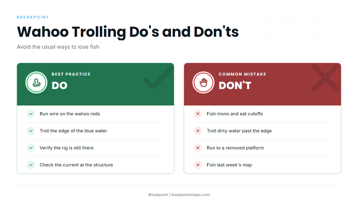
- Losing fish to cutoffs on mono
- Trolling dirty water while missing the edge
- Running to a removed rig
- Ignoring which way the current runs at the structure
- Fishing last week’s map
Guides to wahoo fishing from specific ports: Dauphin Island, Apalachicola, Cocodrie, Biloxi, Corpus Christi, Orange Beach, Boca Grande and Grand Isle.
FAQ
Are wahoo federally managed in the Gulf?
No. The federal dolphin and wahoo rules in 50 CFR part 622 are written for the Atlantic, and Gulf federal waters list no size or bag limit for wahoo. State agencies set their own wahoo rules, so check FWC, LDWF, ADCNR, MDMR or TPWD for the state you fish from and land in.
Is there a wahoo bag limit in Gulf federal waters?
There is no federal limit. The Gulf size and bag limit sections of 50 CFR part 622 list none for wahoo. State rules can still reach you: Louisiana’s limit applies to wahoo possessed in or outside its waters, so check your state agency before the trip.
Which rules apply when I cross state and federal lines?
State waters run to 9 nm off Florida’s Gulf coast. Off Alabama the line is 9 nm for reef fish and 3 nm for other species, and off Louisiana it is generally 3 nm. Louisiana’s wahoo limit follows the fish outside its waters. Check the agency of the state where you land.
What are the best months for Gulf wahoo?
It depends on the sub-region. The winter rig pattern is reported off Louisiana and Texas, and late spring and summer reports come from the Panhandle. Treat these as tendencies rather than schedules, and check recent local reports.
How do I tell a wahoo from a king mackerel?
Look at the body and the stripes. Wahoo are long and slender with vertical bars, while a king mackerel is deeper-bodied and usually unbarred. The full comparison is in our wahoo species guide.
Wire or mono for wahoo?
Wire on the wahoo rods. Wahoo teeth cut through mono and fluorocarbon, and a cutoff is the most common way to lose a fish.
How is Gulf wahoo fishing different from other regions?
The Gulf is built around rigs, floaters and the Loop Current, and it has no federal wahoo plan. For comparison, see wahoo fishing in the Atlantic Northeast and the Pacific Southwest.
How do cold fronts affect a fall or winter trip?
Fronts bring wind shifts and sea changes. Read the wind speed and direction, wave height and wave period, then decide. Fronts can also sharpen temperature breaks. Use the NWS marine forecast for the official numbers.
Before You Run
Check the break, the edge and the structure in OBS SST, Chlorophyll and Chart Contours before you leave the dock. If you want the same read for your own port, download Breakpoint from the App Store or Google Play.