



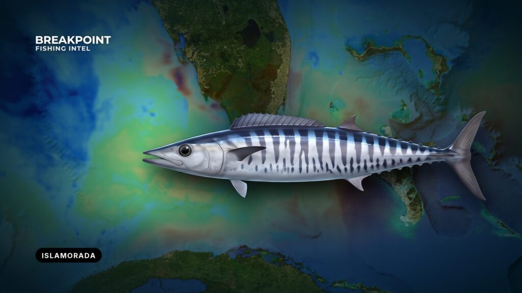
The Islamorada Hump is a seamount in the Gulf Stream off Islamorada. Current striking the structure concentrates bait, and wahoo work its edges. This guide covers the run from the ramp to the hump, how to read the conditions, where to work the structure, and the rules that apply out there. It can’t promise fish, but it should help you decide where to look. For wahoo behavior and general tackle, see our wahoo fishing guide.
Launching from Islamorada
Islamorada spans Matecumbe, Plantation and Long Keys, with marinas on the oceanside. Boats cross Hawk Channel to the reef line and continue on to the Gulf Stream.
The FWC Florida Keys ramp guide lists the public ramps. The table below covers the ramps and marinas to start with.
| Name | Type | Note |
|---|---|---|
| Founder’s Park | Public ramp | Listed in FWC Keys ramp guide |
| Plantation Key Boat Ramp | Public ramp | Listed in FWC Keys ramp guide |
| Harbor Lights at Holiday Isle | Ramp | Listed in FWC Keys ramp guide |
| Indian Key Fill Boat Ramp | Public ramp | Listed in FWC Keys ramp guide |
| Sea Bird Marina (Long Key) | Ramp | Listed in FWC Keys ramp guide |
| Bud n’ Mary’s Marina | Marina | Fuel listed |
| Whale Harbor Marina | Marina | Oceanside, at Whale Harbor Channel |
| Robbie’s Marina | Marina | Oceanside |
Confirm fuel, ramp status and parking with the facility before you trailer down.
The Run Offshore
The Florida Reefs lie an average of about 5 miles off the keys. In smooth weather they aren’t marked by breakers, and the water shoals abruptly on the outer edge of the reefs and between them. In clear weather the lights and daybeacons make the reef line easy to follow; in thick weather, soundings are the better guide. The NOAA Coast Pilot 4 notes for this stretch cover the channels, currents and wind described below.
The Channels Out
Three named channels lead through the keys:
- Whale Harbor Channel. An oceanside route out of Whale Harbor Marina.
- Indian Key Channel. About 200 yards wide and marked by daybeacons. Reported controlling depth is 6 ft, with a fixed bridge at 27 ft clearance. It tends to deepen with westerly winds and fill in with southeasterlies.
- Channel Five. About 8.4 miles west of Alligator Reef Light. Reported controlling depth is 7 ft, with a fixed bridge at 65 ft clearance. A strong current at times sets through it.
Those depths are reported figures and shift with the wind, so check the current NOAA chart and your sounder rather than relying on memory.
Hawk Channel and the Reef Line
Tidal currents run strong through the openings between the keys, and wind can modify their velocity. Expect cross currents in Hawk Channel near those openings.
The Coast Pilot calls Hawk Channel comparatively smooth water in most winds. The exception is passing the large reef openings in southerly winds, principally between Alligator Reef Light and American Shoal Light. Alligator Reef is the reef-line landmark off Islamorada.
Reading the Conditions
The forecast to read is the NWS Key West coastal forecast, which covers Hawk Channel and the Straits of Florida.
The Coast Pilot gives the local wind picture:
- Easterlies and northeasterlies are persistent.
- Trades usually blow 10 to 20 knots.
- Winds of 22 knots or more blow about 7 to 12 percent of the time from October through March, which overlaps the wahoo months.
Two things matter when you read the numbers:
- Wind against the Stream’s set. The Gulf Stream sets to the northeast off the Keys. Wind with a north or northeast component opposes it and stands the sea up over the current. Wind with the set lies down.
- Wave height and period together. A short period at a given height means steeper seas than the same height at a long period.
Read the forecast the night before and again at the ramp, and make the call on the numbers.
The Islamorada Hump and the Current
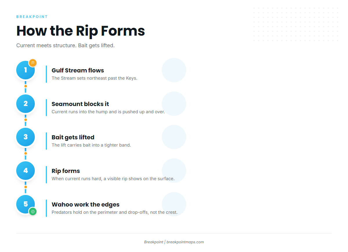
How the Rip Forms
The Gulf Stream runs into a seamount and is pushed up and over it. That lift carries bait into a tighter band. When current runs hard, a visible rip forms on the surface over the hump, and predators work the bait the structure holds.
Work the Edges, Not the Top
Wahoo tend to hold on the perimeter and drop-offs rather than directly over the crest. The up-current edge is where the Stream first meets the structure and lifts bait, so start there and set up drifts and live-bait work on that side.
Nearby Humps
Local boats also work the 409 Hump and the Marathon Hump. Both are separate seamounts, and both draw the same mix of pelagics.
Before you run, read the hump’s edges and drop-offs on Chart Contours and check where the Gulf Stream edge sits on OBS SST. Chart layers are not for navigation, so plot your route on the NOAA chart. Cloud can block a satellite SST pass, so check the pass time and coverage.
When Wahoo Show on the Humps
Wahoo show off Islamorada in winter, spring and autumn. They drop out of the summer lineup, when mahi-mahi and swordfish lead the list.
| Season | Species on the list |
|---|---|
| Winter | Sailfish, king mackerel, blackfin tuna, wahoo |
| Spring | Sailfish, mahi-mahi, blackfin tuna, wahoo, amberjack, swordfish |
| Summer | Mahi-mahi, swordfish |
| Autumn | Mahi-mahi, tuna, king mackerel, sailfish, wahoo, yellowtail snapper, mutton snapper, swordfish, permit |
The cooler months overlap the stretch when the stronger-wind percentages apply, so the conditions read matters most when wahoo are most likely to be there.
Tactics That Suit the Hump
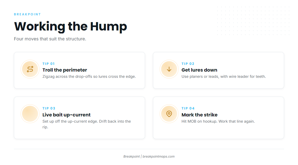
High-Speed Trolling the Perimeter
High-speed trolling is the hump’s main method. Troll the perimeter and zigzag across the drop-offs so your lures cross the edge repeatedly.
Getting Lures Down
Planers and trolling leads put lures below the surface over the structure. Use wire leader because of wahoo teeth. Rigging and leader details are in our wahoo fishing guide.
Live Bait Up-Current
Power up-current and set up just off the up-current edge, so baits drift back over the edge and into the rip. Blackfin tuna share the hump and often show first. Free-lined baits and a little live chum keep the drift alive.
Mark the Strike
On hookup, hit the MOB or waypoint button, then work that line across the edge again after the fish is boated.
Before you leave the dock, check Chlorophyll and OBS SST for clean blue water on the up-current side.
Sharing the Hump
The hump is small and draws a crowd. A few habits keep it workable:
- Get lines in early, because traffic builds through the morning.
- Watch which way the fleet is trolling and go the same direction.
- Make wide turns and keep spacing.
- Do not cut across another boat’s spread.
- When birds or bait are working, circle wide so your lures pass through the action and your hull does not put the fish down.
FAQ
Is there a size limit for wahoo at the Islamorada Hump?
There is no minimum size in federal Atlantic waters under 50 CFR part 622. The bag limit is 2 per person per day, with no closed season. Check NOAA Fisheries bulletins for changes before you fish.
Do I need a federal permit to fish for wahoo from my own boat?
Private recreational anglers need no federal permit for wahoo. For-hire vessels need the Atlantic dolphin and wahoo charter/headboat permit. You still need a Florida saltwater fishing license on a private boat, so check FWC for the current requirements.
Can I fillet wahoo at sea?
No. Federal rules require wahoo to be landed with head and fins intact. Gutting, gilling and scaling are allowed. Fillet at the dock.
What months are best for wahoo off Islamorada?
Wahoo show in winter, spring and autumn, and drop out of the summer lineup when mahi-mahi and swordfish lead. We don’t put dates on it. The conditions read and the Gulf Stream edge on OBS SST tell you more than a calendar.
Which ramp should I use?
The FWC Keys ramp guide lists Founder’s Park, Plantation Key Boat Ramp, Harbor Lights at Holiday Isle, Indian Key Fill Boat Ramp and Sea Bird Marina on Long Key. Bud n’ Mary’s Marina lists fuel. Confirm ramp status and parking with the facility before you go.
Is the Islamorada Hump inside the Florida Keys National Marine Sanctuary?
Check the Marine Sanctuary Explorer app for zones before you fish. It is the sanctuary’s own tool, and it shows the rules that apply where you will be working.
What forecast should I read before running out?
The NWS Key West Coastal Waters Forecast. Read wind speed and direction against the Stream’s northeast set, plus wave height with period. Then read it again at the ramp.