



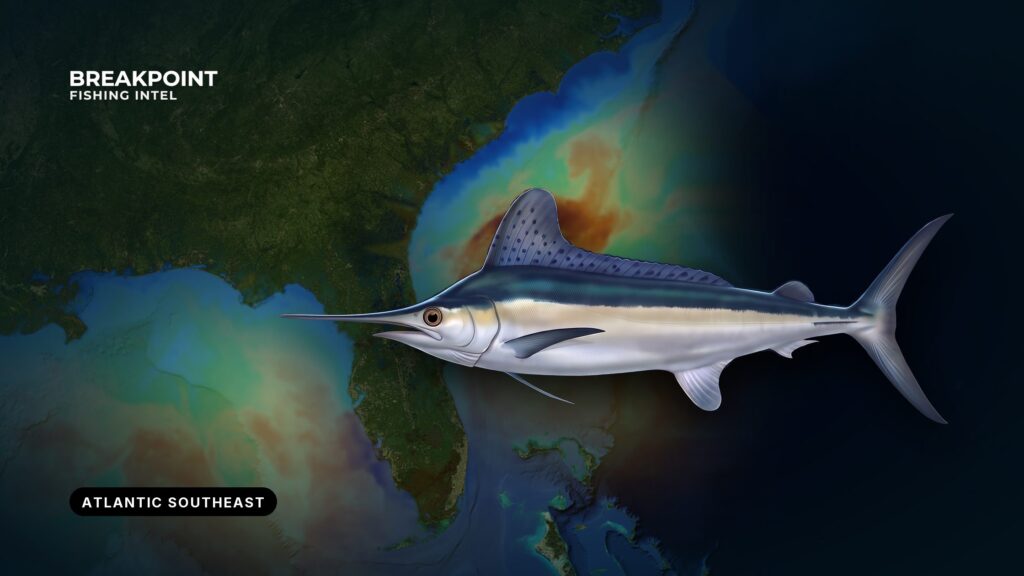
White marlin fishing in the Atlantic Southeast follows the Gulf Stream. The fish hold where its edge meets bottom structure, from Oregon Inlet and Cape Hatteras down to Florida’s east coast. This guide covers where to look, why fish stack there, and what the rules are.
Our Atlantic Southeast fishing guide covers the full run of species along this coast, which we define here as North Carolina to Florida’s Atlantic coast. This page stays on white marlin. It can’t promise a bite, but it should help you decide where to run.
Identification and Biology
White marlin are a billfish managed as an Atlantic highly migratory species (HMS). They run smaller than blue marlin and are prized on lighter tackle. Most white marlin caught for sport are released.
Roundscale spearfish look enough like white marlin that anglers confuse the two, and under federal rules they count with white marlin. Our white marlin species guide covers identification, including how to tell a white from a roundscale spearfish.
Where and When to Find White Marlin in the Southeast
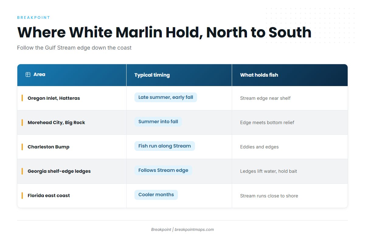
White marlin start in the Caribbean and migrate up the Gulf Stream, working the east side of the current. They spread along the shelf as they go, following water temperature and bait. The largest summer fishery for whites runs from Cape Cod to Cape Hatteras. If you follow the fish north of Hatteras, see white marlin in the Atlantic Northeast.
Work the coast from north to south:
| Area | Typical timing | What holds fish |
|---|---|---|
| Oregon Inlet and Cape Hatteras | Late summer into early fall. Peak runs late July through August and September. | The Gulf Stream edge where it swings close to the shelf |
| Morehead City, Cape Lookout and the Big Rock area | Summer into fall | The shelf edge, and places where the Stream edge meets bottom relief |
| South Carolina and the Charleston Bump | Fish pass through on the run along the Stream | Bottom relief that deflects the Gulf Stream offshore and pushes up eddies and edges |
| Georgia shelf-edge ledges | Fish follow the Stream edge as it passes the shelf break | Ledges that lift water and hold bait |
| Florida’s east coast | Cooler months | The Stream runs close to shore, so fish sit within reach of shorter runs |
As fish move south along the Stream in fall, the window shifts down the coast. A fish that was off Hatteras in August is a Georgia or Florida fish later in the year, so plan the trip around where the edge is as well as the calendar.
Hatteras, Oregon Inlet and Morehead City are the main North Carolina jumping-off points.
Water and Structure That Hold White Marlin
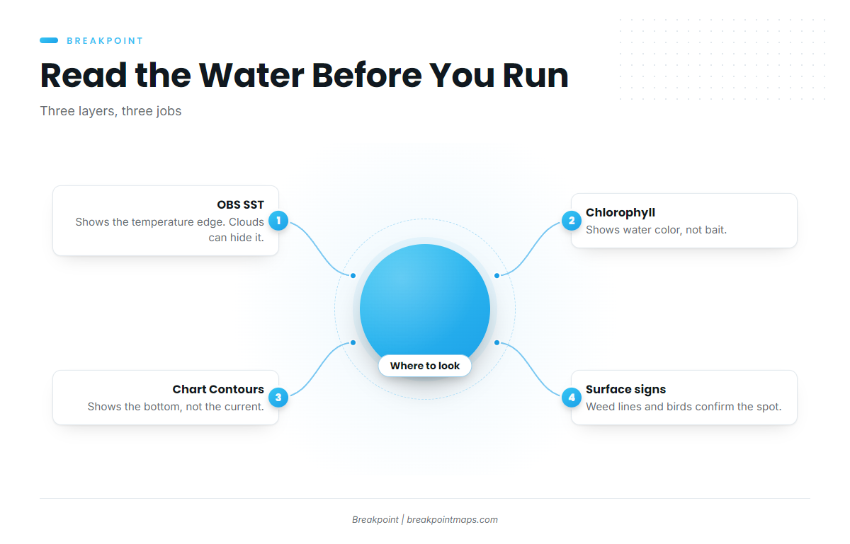
Start with the biggest feature and work down to the smallest. The Gulf Stream sets the region, temperature and color edges narrow it, and bottom relief tells you where along the edge to slow down. Surface signs then confirm what the data suggested.
The Gulf Stream Edge and Temperature Breaks
The edge is where warm Stream water meets cooler shelf water. Bait gathers on the break, and white marlin work it. According to the NC Division of Marine Fisheries profile, white marlin hold in the upper 40 to 100 feet of the water column, in water warmer than 66°F. Because the fish feed near the surface, surface temperature data speaks directly to where they are.
OBS SST shows the edge, with one limit: cloud blocks a satellite pass, so a clean edge on one pass can disappear on the next. Use the composites to see whether an edge holds over several days before you commit fuel to it.
Color Changes and Chlorophyll
Blue Stream water against greener shelf water marks a color change, and bait often holds on the clean side of that line.
Chlorophyll shows water color, not bait. It tells you where the line is, but you still have to find out what is on it.
Bottom Features: the Charleston Bump, Ledges and the Shelf Edge
Bottom relief shapes where the water does interesting things:
- Charleston Bump: Relief on the bottom deflects the Gulf Stream offshore. That deflection sets up eddies, edges and upwelling that push water and bait toward the surface.
- Georgia ledges: Current running into a rise lifts nutrient-rich water. The ledge stacks bait, and the bait draws fish.
- North Carolina shelf edge: The same mechanism applies where the Stream edge swings in against the break.
Slow down where the edge crosses the ledge.
Chart Contours shows the bottom, not the current. Pair OBS SST and Chlorophyll with Chart Contours to see where a temperature edge crosses a ledge or the Bump. Chart layers are not for navigation.
Surface Signs: Weed Lines and Birds
Sargassum collects in weed lines where currents converge, and bait and birds mark life on the line. Treat these as confirmation on the water, after the data has picked the area, not as a reason to pick the area.
How to Fish Them
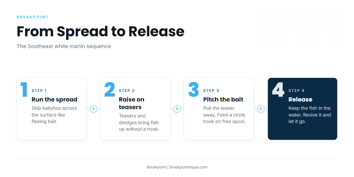
The Southeast spread is a standard troll with a few moves that raise fish and convert them.
- Troll a ballyhoo spread. Ballyhoo is the standard natural bait. Rig it to skip across the surface like fleeing bait.
- Run teasers and dredges. These raise fish to the boat without a hook. Keep the spread tight enough that a fish coming up has something to look at.
- Pull the teaser and pitch a bait. When a white marlin locks onto the teaser, take the teaser away and present a pitch bait.
- Feed the bait on free spool. Let the circle hook find the corner of the jaw. Come tight with steady pressure, not a hard set.
- Feed it again if the first bite misses. White marlin often come back for a second look.
- Release the fish. Keep it in the water, control it at the leader, revive it and let it go. The Regulations section and NOAA set the legal requirement.
The same spread also raises blue marlin and sailfish. See our billfish guides for each.
Before you leave the dock, plan the run on the map: OBS SST for the edge, Chart Contours for the ledge beneath it. Breakpoint is in the App Store and on Google Play if you would like to see how those layers read together.
Guides to white marlin fishing from specific ports: Boynton Beach, Savannah, Hatteras Village, Edisto Beach, Fort Lauderdale, Morehead City, Folly Beach and Fort Pierce.
FAQ
What are the best months for white marlin off North Carolina?
Late summer into early fall. Peak timing runs from late July through August and September off Oregon Inlet and Hatteras. As the fish move south along the Gulf Stream in fall, the window shifts down the coast toward Georgia and Florida.
Do I need a federal permit to fish for white marlin?
Yes. A private boat needs an HMS Angling permit, and a for-hire boat needs an HMS Charter/Headboat permit. NOAA Fisheries issues both. Check the NOAA HMS page for current permit steps before you fish.
What is the size limit for white marlin?
The federal minimum is 66 inches lower-jaw fork length, per NOAA, measured from the tip of the lower jaw to the fork of the tail. Check NOAA before you keep a fish, because the rules can change.
Which rules apply inside 3 miles?
Federal permit holders follow federal rules in state waters unless the state rule is stricter, and limits do not stack. Georgia adopts the federal billfish rules in its waters. Check the state agency for North Carolina, South Carolina and Florida.
Do roundscale spearfish count as white marlin?
They count with blue and white marlin under the combined federal landings limit. Our white marlin species guide covers identification. Check NOAA HMS for the current status of that limit.
Can I boat a white marlin for a photo?
Fish that are not kept must be released in a way that gives them the best chance of survival. Where required, that means without removing the fish from the water. Check NOAA HMS for the current rule before you pull a fish aboard.
What water temperature do white marlin hold in?
They hold in water warmer than 66°F, in the upper 40 to 100 feet of the water column, per the NC Division of Marine Fisheries.