



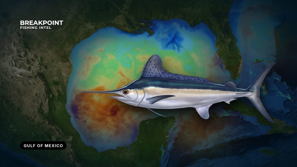
White marlin fishing in the Gulf of Mexico (Gulf of America in federal documents) is blue-water fishing along the northern slope, where Loop Current water, canyons and rigs gather bait. Most white marlin caught here are released. This guide covers where to look, what water holds the fish, how crews fish it and how the rules divide between NOAA and the states. For broader Gulf ports, structure and seasons, see our Gulf of Mexico fishing guide.
Identification and Biology
White marlin are the smaller Atlantic marlin, distinguished by rounded tips on the dorsal and pectoral fins. Roundscale spearfish look very similar at the boat and fall under the same federal billfish rules, so identify the fish carefully before keeping one. The Gulf is one of the species’ spawning areas. For full identification and biology, read the white marlin species guide.
Where White Marlin Are Found in the Gulf
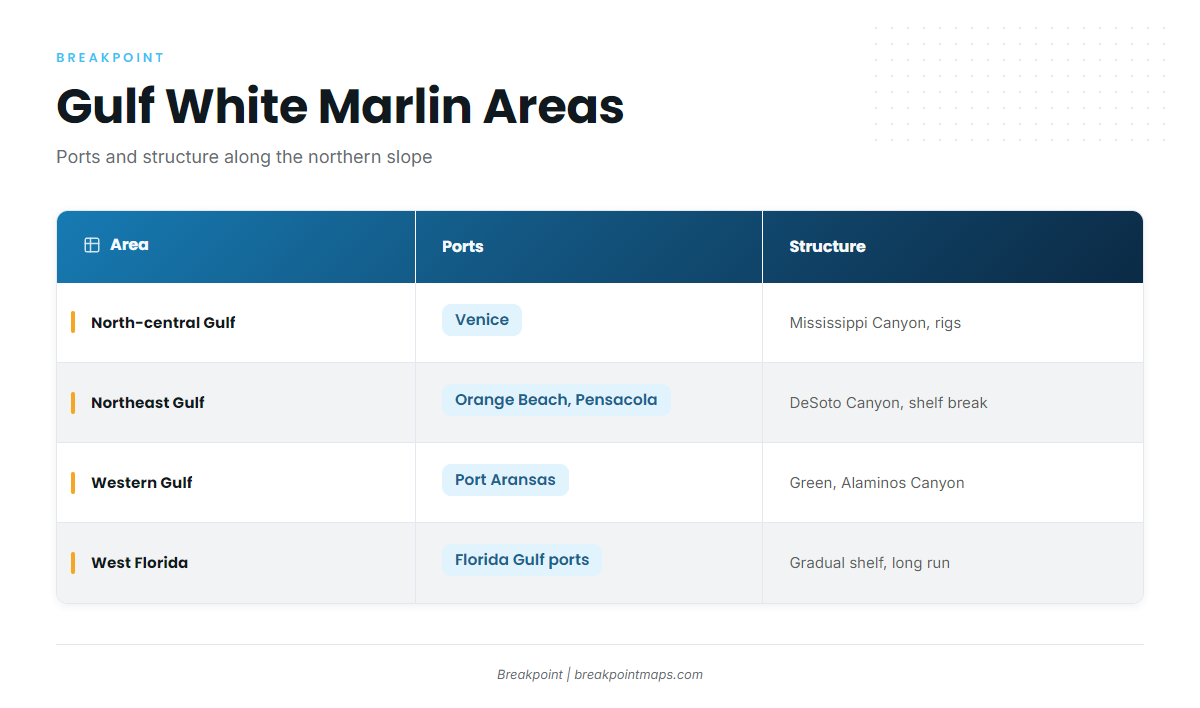
White marlin hold where Loop Current blue water crosses the shelf break and canyon walls of the northern slope. The fish follow bait, and bait stacks where moving water meets steep bottom. Four areas account for most of the fishing.
North-central Gulf. Mississippi Canyon, Viosca Knoll and the rig fields off Louisiana draw most of the effort, and boats run from Venice. The slope is close and steep, and production platforms over deep water hold bait in blue water.
Northeast Gulf. DeSoto Canyon is the main feature, fished from Orange Beach, Pensacola and Destin. It pulls the shelf break toward the coast, giving Loop Current and eddy water a wall to work against.
Western Gulf. Green Canyon, Alaminos Canyon and the deep water off Port Aransas hold fish. The targets are deep slope water and floating production platforms.
West Florida. The West Florida Shelf is wide and gradual, with no rigs. Runs to the edge are long and often overnight.
| Area | Nearby ports | Structure |
|---|---|---|
| North-central Gulf | Venice | Mississippi Canyon, Viosca Knoll, rig fields |
| Northeast Gulf | Orange Beach, Pensacola, Destin | DeSoto Canyon, shelf break |
| Western Gulf | Port Aransas | Green Canyon, Alaminos Canyon, floating platforms |
| West Florida | Gulf coast ports of Florida | Gradual shelf, long run to the edge |
When to Fish for Gulf White Marlin
The northern Gulf season runs from late spring through early fall. The bite follows Loop Current water and bait more closely than the calendar, so a warm-water intrusion or an eddy parked near a canyon matters more than the date.
Before you book or burn fuel, check three things:
- Recent imagery, to see where blue water sits relative to the canyon or rig field you plan to fish.
- Whether the edge is holding or sliding away from structure.
- Wind, wave height and period in the National Weather Service marine forecast.
No tool promises fish. What you get is a better-informed decision about where to look.
Water and Structure That Hold White Marlin
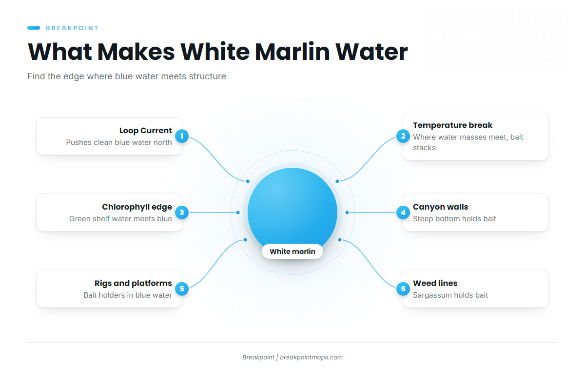
White marlin water is where clean Loop Current water meets the slope and bait.
Loop Current and Warm-Core Eddies
The Loop Current pushes north into the Gulf and sheds warm-core eddies. These intrusions carry clean blue water and bait over the steep northern slope near DeSoto and Mississippi Canyons. The current and its eddies shift constantly, so last week’s edge will not be this week’s.
Temperature Breaks
A temperature break marks where two water masses meet. Bait collects along the seam and marlin work it. The break itself matters more than any single temperature reading on either side.
Color Changes and the Chlorophyll Edge
Greener shelf water meets clean offshore water along a visible line. That blue-to-green edge concentrates bait, and the cleanest blue side is the one to fish.
Shelf Break, Canyon Walls and the 100-Fathom Curve
Edges that cross the shelf break or a canyon wall are the strongest bets, because moving water hits steep bottom and holds bait there. A temperature or color edge over flat bottom is weaker than the same edge on a wall.
Rigs, Floating Production Platforms and Weed Lines
Rigs and floating production platforms hold bait in blue water. Sargassum weed lines do the same on the surface, but they can break up when the current changes, so treat a line as a clue rather than a fixture.
Reading the Layers
Three layers cover most of the work:
- OBS SST locates the temperature edge.
- Chlorophyll locates the blue-to-green break.
- Chart Contours show where those edges cross the shelf break and canyon walls.
Stacked together, they narrow the search to spots where edge and structure line up. Chart layers are not for navigation.
What the Data Cannot See
Cloud blocks satellite SST passes. When that happens, rely on the last clear image plus Chlorophyll. Surface temperature does not show a thermocline, and chlorophyll is not a measure of fish. Bathymetry shows structure for planning but does not replace an official nautical chart.
How Anglers Fish for White Marlin Here
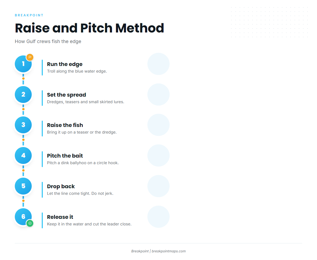
Most Gulf crews troll a raise-and-pitch spread along the edge and feed the fish a circle-hook bait. The spread is shared with blue marlin and sailfish, so the billfish fishing guides cover the common ground.
A typical spread carries:
- dredges
- surface teasers
- small skirted lures
- dink ballyhoo
The work happens in the cockpit. The crew keeps rigged dink ballyhoo on circle hooks ready as pitch baits, raises the fish on a teaser or the dredge, then pitches the bait and gives a drop-back. Let the circle hook set as the line comes tight, without jerking the rod.
Around rigs that hold bait, some crews slow down and fish live bait instead of trolling.
To release a fish with care:
- Keep the fish in the water.
- Cut the leader close to the hook.
- Use circle hooks.
- Revive the fish briefly if needed.
Pick the edge on OBS SST and Chlorophyll before leaving the dock, so the fuel goes toward a run with water worth fishing.
Guides to white marlin fishing from specific ports: Orange Beach, Destin, Grand Isle, Biloxi, Corpus Christi, Venice, Port Aransas and Port Mansfield.
Frequently Asked Questions
When is the best time for white marlin fishing in the Gulf of Mexico?
Late spring through early fall in the northern Gulf. The bite follows Loop Current water and bait more closely than dates, so a blue-water edge sitting on a canyon wall or rig field is a better signal than the calendar. Check recent imagery before committing to a run.
Can you keep a white marlin in the Gulf?
Yes, with an HMS permit, at or above the federal minimum size, within NOAA’s landing limit, and with a report to NOAA. Most are released. Texas also sets its own minimum lengths for white marlin, so a fish landed there has to meet both rules.
Do I need a federal permit for white marlin?
Yes. Private anglers need the HMS Angling permit, and for-hire vessels need the HMS Charter/Headboat permit. Both come from NOAA Fisheries, and the permit holder follows federal HMS rules in state waters unless the state rule is stricter.
Are circle hooks required for white marlin?
In billfish tournaments, natural bait requires non-offset circle hooks, and J-hooks are allowed only with artificial lures. Outside tournaments, circle hooks are still the standard choice because they improve release survival. Check NOAA Fisheries for the current hook rules.
How do you tell a white marlin from a roundscale spearfish?
The differences are subtle and sit in the fins and scales, so the fish look nearly identical at the boat. It matters because both fall under the same federal billfish rules. For details, see the white marlin species guide.
How does Gulf white marlin fishing differ from the Atlantic?
There is no Gulf Stream here. The Loop Current and its eddies drive the fishing, runs are longer (especially off West Florida), and rigs act as structure. For the other coast, see white marlin fishing in the Atlantic southeast and the Atlantic northeast canyons and eddies comparison.
Is the Gulf of Mexico the same as the Gulf of America?
Yes. Federal documents use "Gulf of America," and the HMS rules apply the same way in the same water. The fishing, the structure and the permits do not change with the name.
Can Breakpoint chart layers be used for navigation?
No. Use official nautical charts. Chart Contours shows structure for planning, and it does not replace a chart, a plotter or the National Weather Service marine forecast.
If you want the edge, the structure and the reasoning in one place before you leave the dock, download Breakpoint from the App Store or Google Play.