



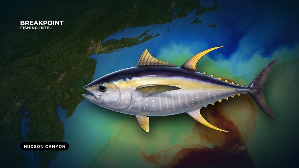
Yellowfin tuna at the Hudson Canyon depend on where warm, blue water rides up onto the canyon’s edges. The Hudson is a large shelf canyon, and when the right water lines up with the right structure, fish show. When it doesn’t, they sit somewhere else.
This guide covers one place: the ports, the structure and water, the season, the tactics that fit each condition, the other fish you’ll meet, and the rules. Biology and general rigging are in our yellowfin tuna fishing guide. This page stays at the Hudson.
We use OBS SST, Chlorophyll and Chart Contours to decide where to look. We can’t promise fish, only a better decision about where to look.
Ports and the Run
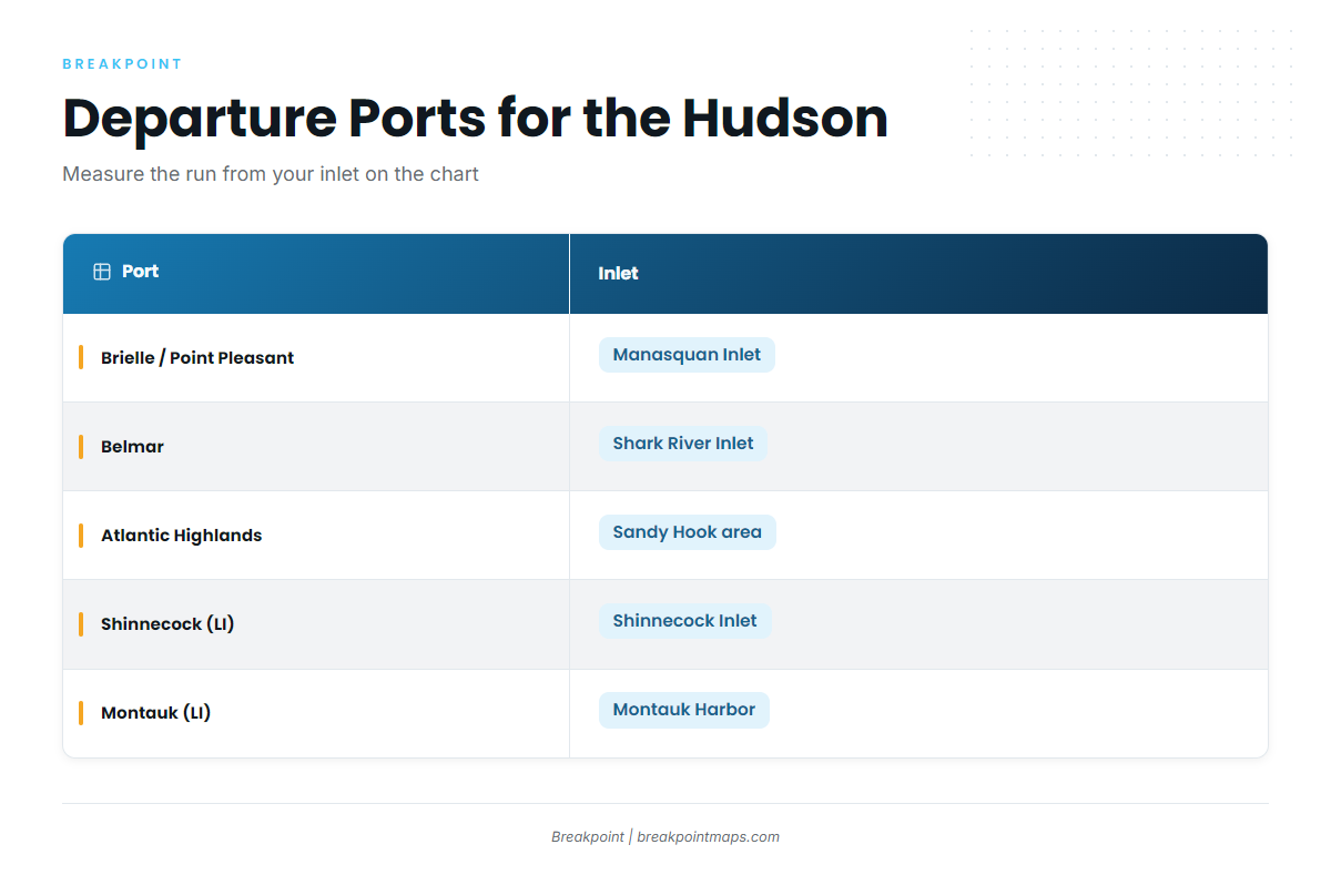
The Hudson is an offshore run from both New Jersey and Long Island. Measure the run from your own inlet on the chart, since distance depends on the inlet and on which part of the canyon you fish.
| Port | Inlet | Notes |
|---|---|---|
| Brielle / Point Pleasant | Manasquan Inlet | Common NJ departure for overnight canyon trips |
| Belmar | Shark River Inlet | NJ departure named in regional reports |
| Atlantic Highlands | Sandy Hook area | Northern NJ departure |
| Shinnecock (Long Island) | Shinnecock Inlet | Long Island south shore departure |
| Montauk (Long Island) | Montauk Harbor | Eastern Long Island departure; measure the run on the chart |
Run planning
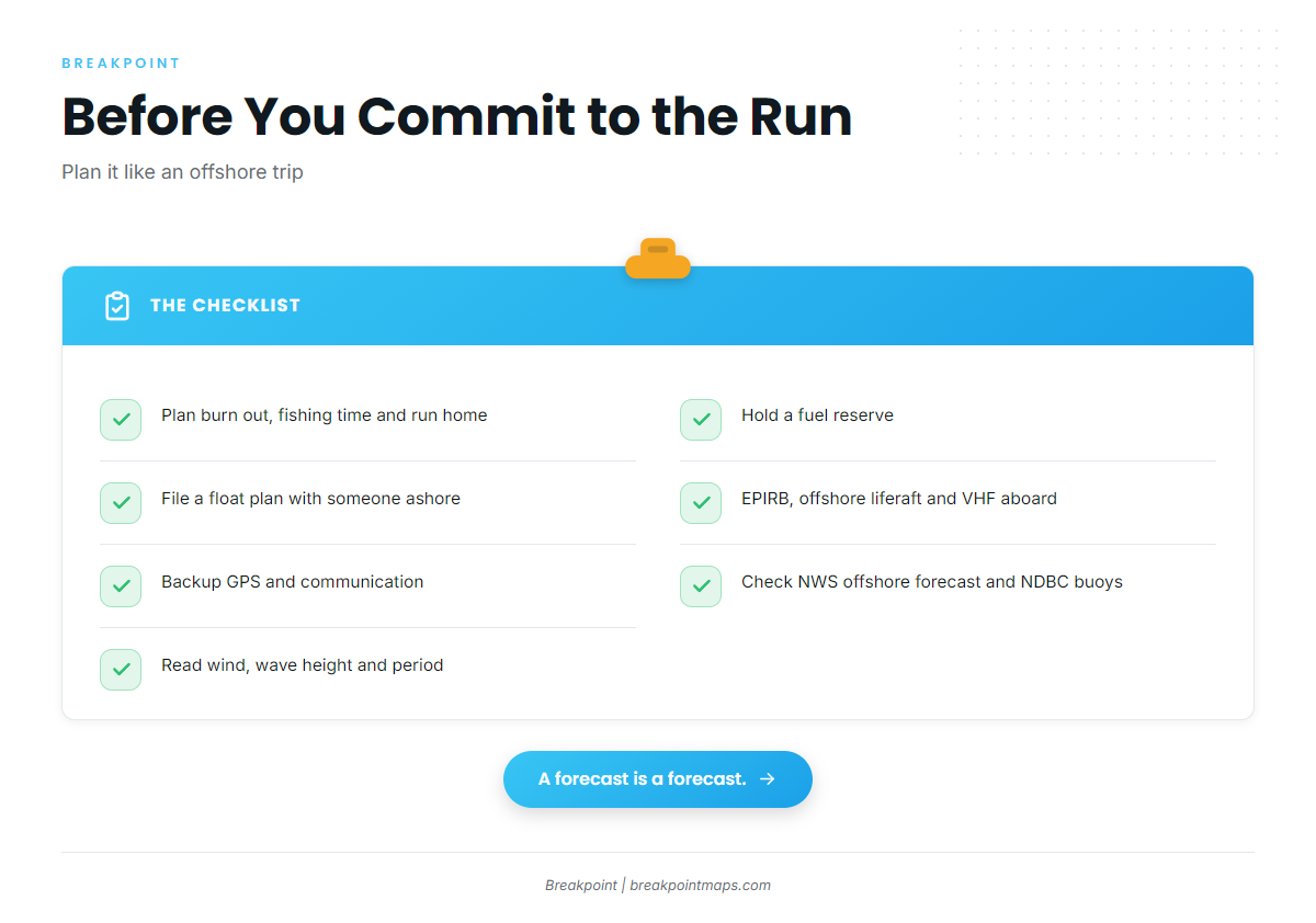
A day trip and an overnight trip call for different plans. An overnight lets you troll by day and chunk the walls at night. Plan the run with these in mind:
- Fuel reserve: Add up the burn out, the fishing time on site (trolling and drifting), and the run home, then hold a reserve on top of that.
- Float plan: File it with someone ashore, including the departure inlet, the planned area and the return window.
- Redundancy: Carry an EPIRB, an offshore liferaft, a VHF, and backup GPS and communication.
- Weather: Check the NWS offshore forecast and NDBC buoys before you commit. Read the wind, wave height and period.
Structure and Water
You need both structure and water lined up, with structure coming first.
The structure: head, walls, tip
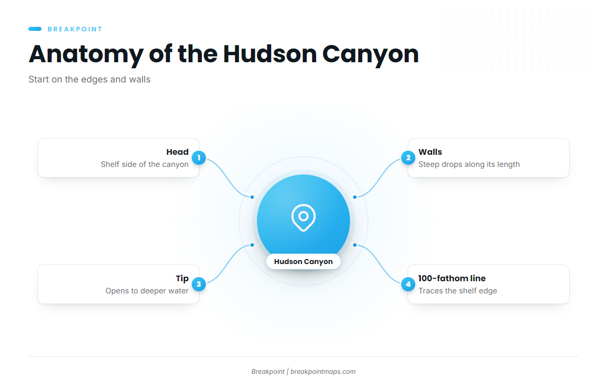
The Hudson is a large canyon cut into the continental shelf. The head sits on the shelf side, the walls drop steeply along its length, and the tip opens to deeper water. The 100-fathom line traces the shelf edge across it.
Steep walls and tight contours concentrate bait where current pushes against them. Yellowfin can get penned into corners of the canyon depending on how the water flows. Start on the edges and walls where Chart Contours tighten and the SST break crosses them.
The water over it
Warm-core eddies spin off the Gulf Stream and push warm, blue water onto the shelf edge, where it meets cooler, greener shelf water. That meeting line is the temperature break, and bait gathers along it. You want the warm, blue side of the break.
Color matters too. The Chlorophyll edge shows where green shelf water meets cleaner offshore water. A break that lines up with both a temperature edge and a color edge over the walls is worth the look.
The data has limits:
- The satellite cannot see through cloud. A blocked pass leaves a gap, and an older pass shows where the edge was, not where it is.
- SST shows the skin of the water, not the thermocline the fish may be under.
- Chlorophyll has gaps for the same cloud reason.
Check the OBS SST and Chlorophyll layers for the edge position before you commit fuel to the run, then confirm the break on your sounder’s temperature readout when you arrive.
Season
Yellowfin show at the Hudson from summer into fall, and a late-fall window opens when warm water pushes close to the canyon edge.
The calendar sets the window, but the water determines whether fish are in it. A warm eddy parked on the walls makes the Hudson fishable; when the warm water sits somewhere else, the fish do too. Look at OBS SST before every trip, not just at the start of the season.
Tactics for Yellowfin Tuna at the Hudson Canyon
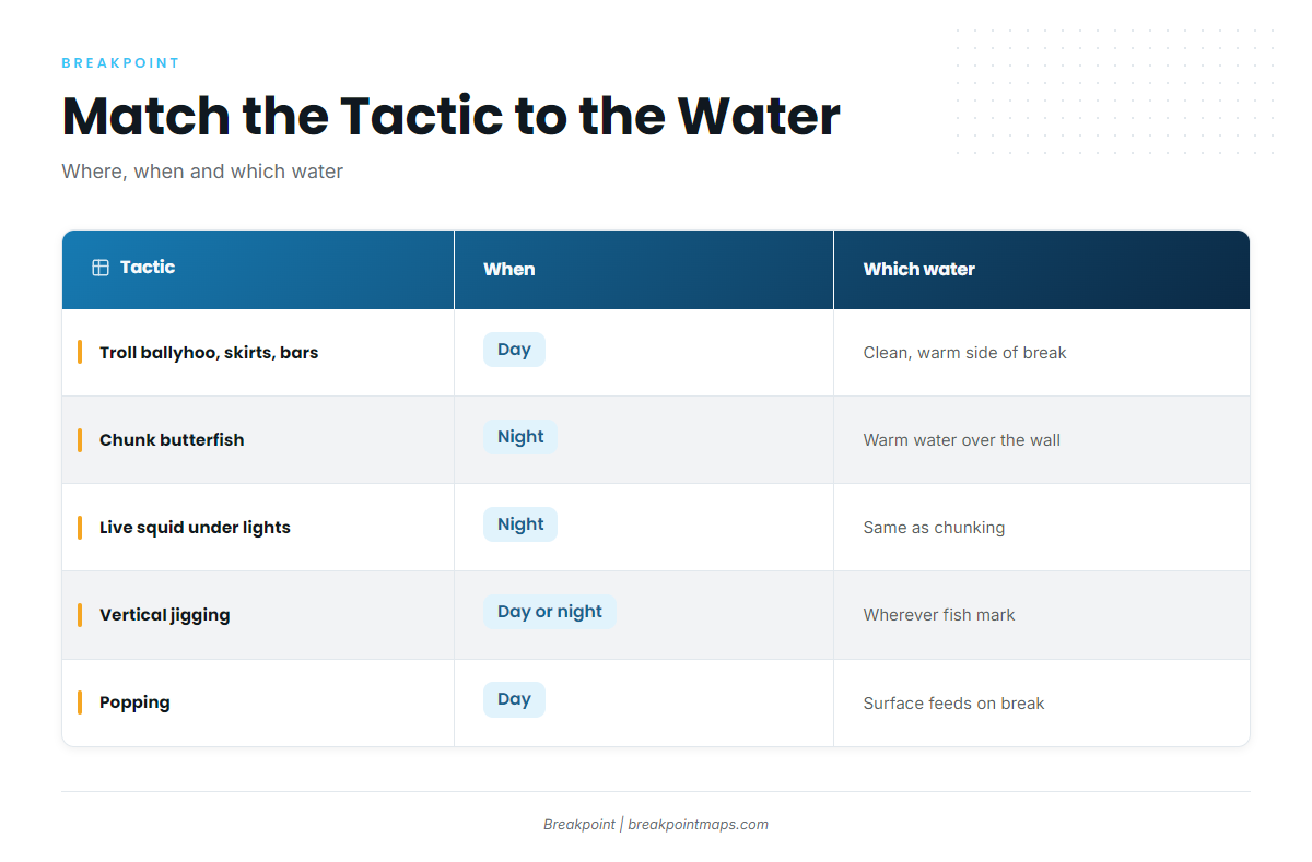
Match the tactic to what the water is doing.
| Tactic | Where in the canyon | When | Which water |
|---|---|---|---|
| Trolling ballyhoo and skirts, spreader bars, cedar plugs | Along the temperature break where it crosses the walls and 100-fathom line | Day | The clean, warm side of the break |
| Chunking butterfish | Drifting along the walls and edge | Night (also day once fish are located) | Warm water sitting over the wall |
| Live squid under the lights | On the drift at the walls | Night | Same as chunking |
| Vertical jigging | Over fish marked on the sounder near the walls | Day or night | Wherever the fish mark |
| Popping | At breaking schools | Day | Surface feeds on the break |
Day: troll the break
Troll the clean side of the break where it crosses the walls, using ballyhoo and skirts, spreader bars and cedar plugs. When you mark fish or get bites, note the spot and work it. Spread details are in our yellowfin tuna fishing guide.
Night: chunk and squid on the walls
When fish hold on the wall overnight, chunk the drift along it. Set the drift along the wall, keep a steady butterfish slick going, and fish baits back in it. Lights bring squid, so fish live squid in the slick.
Jigging and popping
Jig fish marked on the sounder, and throw poppers when schools break on the edge. Keep that gear rigged and on deck so it’s ready when it happens.
Pull up Chart Contours over the canyon to plan which wall and contour to work, then lay the OBS SST break over it. Chart layers are not for navigation.
Other Fish on the Same Water
Three other species share this water, each with its own rules.
- Bigeye: They share the same water and walls. The minimum is 27 inches curved fork length, with no bag limit. Measure before you keep one.
- Bluefin: They can show on the same drift. NOAA sets limits by size class and changes them by quota and in-season action, so check before you keep one. Report bluefin within 24 hours if you retain one or it is dead-discarded.
- Mahi: They show around weed and warm water. Check the federal dolphin rules before you keep any.
FAQ
Do I need an HMS permit to keep yellowfin at the Hudson?
Yes. You need an HMS Angling or HMS Charter/Headboat vessel permit. NOAA Fisheries Atlantic HMS issues it and sets the rules.
What is the size and bag limit?
The minimum is 27 inches curved fork length. The bag limit is 3 per person per day, with no more than 3 per person aboard regardless of trip length. The fishery is open all year.
Do I need a NJ or NY registry?
New York’s Recreational Marine Fishing Registry is free, covers anglers 16 and older, and is valid in federal waters. New Jersey Saltwater Registry requirements come from NJDEP, so check them there.
Whose rules apply when I land in NJ?
New Jersey rules apply to any fish landed in New Jersey. A federal HMS permit holder follows federal rules unless the state rule is stricter.
Can I fillet at sea?
No. The federal landing-form rule calls for fish round, or eviscerated and headless with the tail and at least 1 pectoral fin attached. A headless fish must measure at least 27 inches from the cut to the fork of the tail. Filleting does not meet that form. Check NJDEP for state landing rules.
What if I hook a bluefin?
Bluefin limits change by size class, quota and in-season action, so check NOAA HMS before you keep one. Report every retained or dead-discarded bluefin within 24 hours.
When do yellowfin show at the Hudson?
Summer into fall, with a late-fall window. The timing follows warm water pushing onto the edges, so the satellite picture matters more than the calendar.