



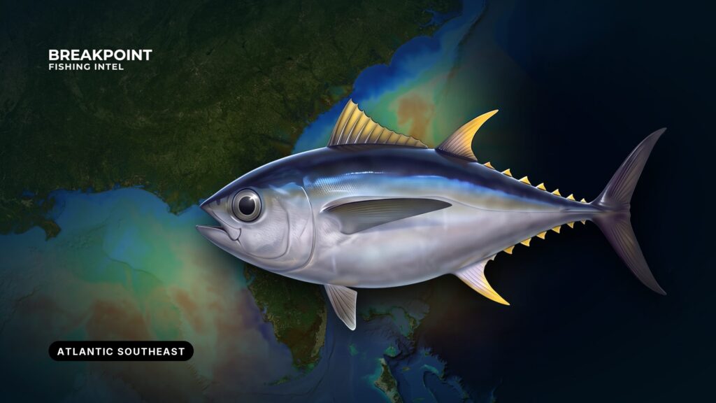
Bigeye tuna fishing in the Atlantic Southeast is shelf-edge fishing. The fish live where the Gulf Stream runs close to steep bottom, feed deep by day, and rise toward the surface at dusk and through the night.
This guide works from features you can see on a chart: the Gulf Stream edge, the 100-fathom curve, the Point off Cape Hatteras, Big Rock and the Charleston Bump. It covers where bigeye hold in North Carolina, South Carolina, Georgia and Florida’s Atlantic coast, the water that concentrates them, how anglers fish for them here, and which federal and state rules apply.
Bigeye tuna at a glance
NOAA Fisheries gives the short version of the biology:
- The western Atlantic range runs from southern Nova Scotia to Brazil.
- Bigeye are at or near the surface and dive to about 800 feet during the day.
- The diet is fish, squid and crustaceans.
- Lifespan is up to 9 years, and maturity comes at 3.5 years.
- They are fast growing and highly migratory.
Bigeye tend to group near seamounts and submarine ridges, which is why structure matters so much below. Our full bigeye tuna identification and biology page covers the rest.
Telling bigeye from yellowfin has legal consequences, explained in the Regulations section.
Where and when bigeye tuna are found in the Atlantic Southeast
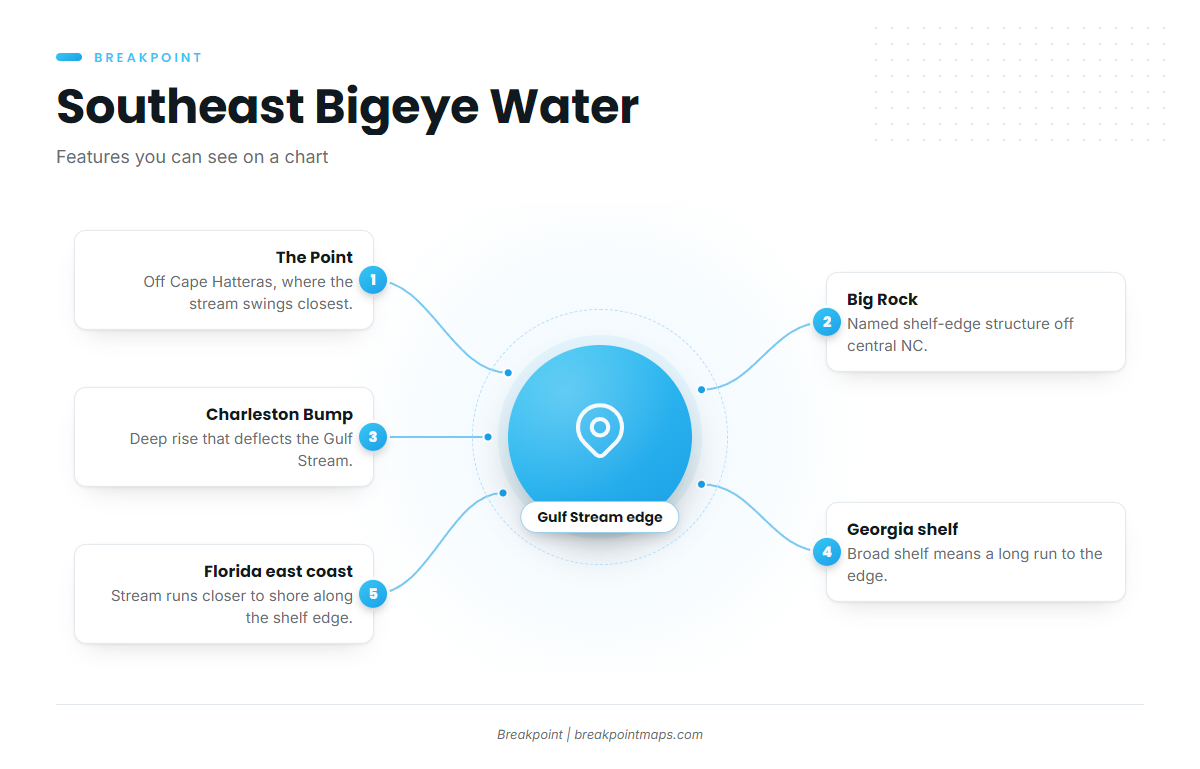
NOAA lists U.S. wild-caught Atlantic bigeye from Massachusetts to Florida. In the Southeast, the fishery follows the Gulf Stream and the shelf edge. The Atlantic Southeast fishing guide covers the ports and the run offshore.
The four areas below run north to south.
North Carolina: the Point and Big Rock
The Point off Cape Hatteras is where the Gulf Stream swings closest to the shelf edge and meets cooler water from the north, producing sharp temperature breaks over steep bottom. Big Rock, off the central North Carolina coast, is named shelf-edge structure that anglers work.
The Gulf Stream and the fishery continue past Hatteras toward the Mid-Atlantic. For that stretch, see bigeye tuna fishing in the Northeast canyons.
South Carolina: the Charleston Bump
The Charleston Bump is a deep rise in the bottom offshore that deflects the Gulf Stream. Bent current over deep relief can concentrate bait, and bait is what holds tuna.
Georgia: the Gulf Stream offshore
Georgia’s shelf is broad, so bigeye water means a long run to the Gulf Stream edge and the shelf break. Check the official NOAA marine forecast before you commit.
Florida (Atlantic coast): shelf edge and deep structure
Along parts of Florida’s east coast the Gulf Stream runs closer to shore. Look at the shelf edge and deep structure. Yellowfin tuna and blackfin tuna share these waters.
When the fish show up
Timing follows conditions rather than the calendar. Bigeye show where the Gulf Stream’s position puts warm, clean water and a temperature break over steep bottom. When that combination sets up, the area is worth a look. When it moves, the fish move with it.
| Area | Feature to look for | What it does |
|---|---|---|
| North Carolina | The Point, Big Rock | Gulf Stream meets cooler water over steep bottom |
| South Carolina | Charleston Bump | Deep rise deflects the Gulf Stream |
| Georgia | Gulf Stream edge, shelf break | Long run to the blue water |
| Florida (Atlantic) | Shelf edge, deep structure | Stream runs closer to shore |
The water and structure that hold them
Bigeye hold where deep water, bait and current line up. Three features do most of the work, and all of them can be found on a chart.
Why the 100-fathom curve matters
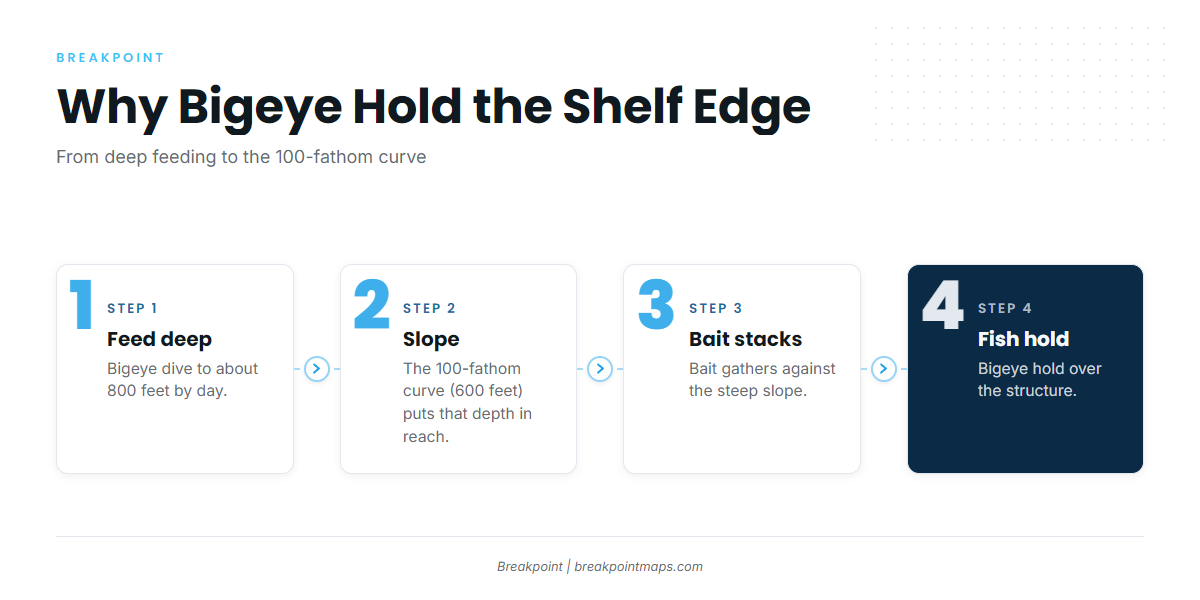
The logic runs in four steps:
- Bigeye feed deep by day, to about 800 feet, according to NOAA.
- A steep slope along the 100-fathom curve (600 feet) puts that depth within reach of shelf-edge bait.
- Bait stacks against the slope.
- The fish hold over it.
Ledges, seamounts and ridges along that edge add relief, and relief adds bait.
Temperature breaks and color changes
A Gulf Stream temperature break or a green-to-blue color change concentrates bait. Where that break crosses the 100-fathom curve, the surface edge and the bottom structure work together, and that crossing is the spot to mark.
Eddies and rip lines
Warm eddies spun off the Gulf Stream push clean blue water over the shelf edge. Rip lines and current edges gather bait and weed. Moving current tends to matter more than slack.
Stacking the layers
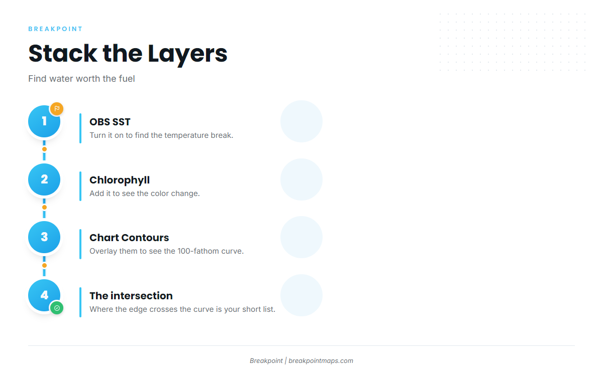
You can build the short list the night before. Turn on OBS SST to find the temperature break. Add Chlorophyll to see the color change. Overlay Chart Contours to see where that edge crosses the 100-fathom curve. The intersection is the water worth the fuel. Chart layers are not for navigation.
How anglers fish for bigeye here
Bigeye bite best when they are shallower, so anglers troll the break at dawn and dusk and fish deep by day. Night tactics work because the fish rise after dark.
Trolling spreads
Anglers here troll spreader bars, daisy chains and rigged ballyhoo under skirts along the break. Cover the edge, then work back through where you marked fish or bait.
Dredges and deep plugs
Weighted dredges and deep-diving plugs draw fish holding well below the surface by putting a visual in the water column where the fish actually are.
Chunking and deep drop
Chunking on a drift along the slope works, especially at night. Deep-drop drifts put baits down to where the fish feed by day.
Night tactics
Night trolling and chunking take advantage of bigeye rising toward the surface after dark. Some anglers favor the full moon for night work, though that is a preference and not a rule.
Mixed tuna schools
Yellowfin and blackfin often share the spread, and NOAA notes that juvenile bigeye school with yellowfin and skipjack. Identify every fish before you keep it, because the rules differ by species (see Regulations below). For the other species you will meet on the same water, see our guides to the other tuna species.
Reading the charts, and what they cannot see
Satellite and model layers narrow the search but do not find the fish. Know the limits:
- Cloud cover blocks OBS SST passes, so a clear edge may not show on a given day.
- SST shows only the surface, not the thermocline, while bigeye feed hundreds of feet down by day.
- Chlorophyll shows color, not fish.
Use the surface edge to choose the area, then use the sounder and the structure on Chart Contours to choose the depth. The maps will not put a fish on the line, but they give you a better decision about where to look.
Guides to bigeye tuna fishing from specific ports: Sebastian Inlet and Hatteras Village.
FAQ
Do I need a permit to fish for bigeye tuna?
Yes. You need an HMS Angling or HMS Charter/Headboat permit. The federal tuna permit is required in coastal state waters too, which covers North Carolina, South Carolina, Georgia and Florida.
What is the minimum size for bigeye tuna?
The federal minimum is 27 inches curved fork length. A headless fish must measure at least 27 inches from the forward edge of the cut to the fork of the tail. A shark-damaged fish must still measure at least 27 inches, and you may not trim the damaged area.
Is there a bag limit on bigeye tuna?
No federal bag limit applies to bigeye tuna. A stricter state rule would control, so check your state agency before you fish.
Does a state fishing license cover bigeye tuna?
No. The federal HMS permit is still required. For state license rules, check your state agency.
How is bigeye tuna different from yellowfin under the rules?
Both share the 27-inch minimum. Yellowfin carry a 3-per-person-per-day bag limit and bigeye carry none, so correct identification matters. Our full bigeye tuna identification and biology page covers how to tell them apart.
Can I keep tuna with a hammerhead aboard?
No. No tunas may be retained with a hammerhead shark aboard. NOAA’s recreational tuna page also lists oceanic whitetip, including sharks already offloaded.
Do North Carolina, South Carolina, Georgia and Florida add their own tuna rules?
Where a state rule is stricter than the federal rule, the stricter one controls. Limits do not stack. States set their own blackfin tuna rules. The agencies are NCDMF, SCDNR, Georgia DNR Coastal Resources Division and Florida FWC.