



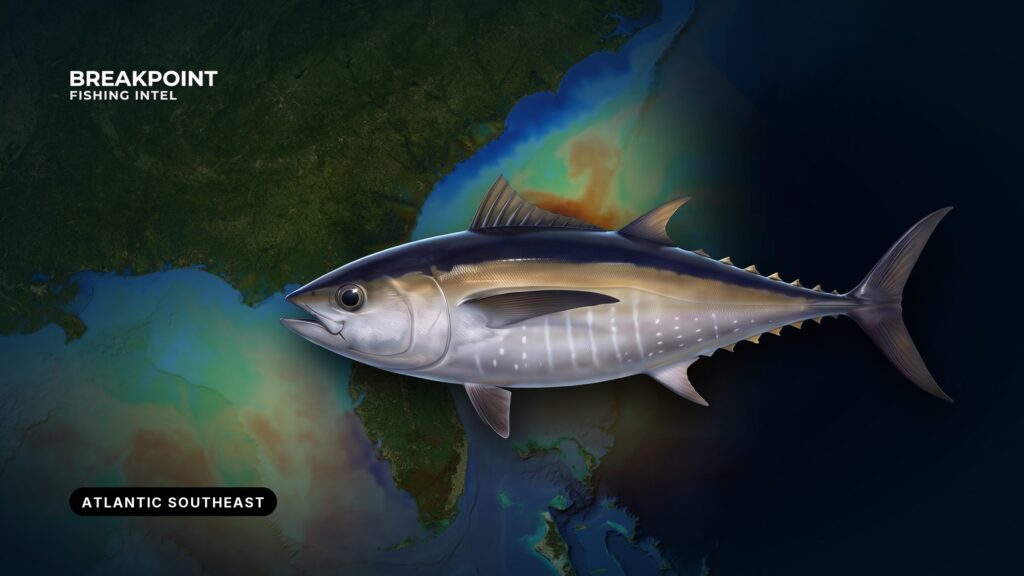
How far the Gulf Stream runs from your inlet determines where blackfin sit and how far you have to go to reach them. That is the starting point for blackfin fishing in the Atlantic Southeast, a region that runs from Cape Hatteras through North Carolina, South Carolina, Georgia and Florida’s Atlantic coast to the Keys.
Breakpoint reads SST and chlorophyll for a living, and this guide explains the water those layers show. It can’t promise fish, but it should help you decide where to look. It covers where and when blackfin show, the water and structure that hold them, how anglers fish them, and the rules. The Regulations section stands on its own if you want to jump straight to it. For the wider region, see the Atlantic Southeast fishing guide.
What blackfin are: a short summary
Blackfin tuna (Thunnus atlanticus) are the smallest of the Atlantic’s fished tunas. FWC lists them as common to 28 inches, and ICCAT puts the largest recorded fish at 108 cm fork length and 20.6 kg. They live only in the western Atlantic, from Martha’s Vineyard to Rio de Janeiro, according to FishBase range and biology. The Southeast is a core fishing area, not the northern limit of their range.
Blackfin school tightly, and ICCAT notes they often school with skipjack, yellowfin and little tunny. The Florida Museum species profile says they move into water above 70°F (21°C) in summer. For identification, growth and spawning, read the blackfin tuna species guide.
Where and when blackfin show, north to south
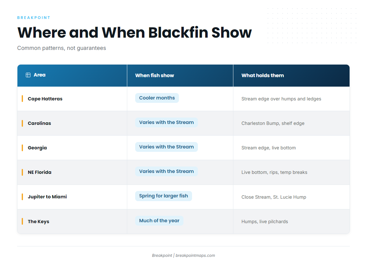
Timing shifts with how close the Gulf Stream runs to each inlet. Where the Stream sits near the beach, the run is short. The seasons below are common patterns, not guarantees.
- Cape Hatteras: Commonly fished in the cooler months, when the Stream swings closest to the cape. Anglers work humps and ledges along the shelf edge.
- The Carolinas and the Charleston Bump: Boats run from Morehead City and Charleston. The Charleston Bump is shelf-edge bottom that deflects the Gulf Stream, setting up upwelling and a strong edge.
- Georgia: Fish sit far offshore at the Stream edge and around live bottom. Shrimp boats closer in are a known draw.
- Northeast Florida (Jacksonville): Fish are commonly found well offshore near live bottom, temperature breaks and current rips. The North Florida MPA restricts snapper-grouper, not blackfin. Check the South Atlantic MPA rules for the boundaries.
- Jupiter to Miami: The Stream runs close to the beach, so the run is short. Larger fish are commonly reported moving through in spring. The St. Lucie Hump MPA restricts snapper-grouper, not blackfin.
- The Keys: The humps produce through much of the year. The East Hump MPA restricts snapper-grouper, not blackfin. Anglers commonly anchor up with live pilchards.
| Area | When fish show | What holds them |
|---|---|---|
| Cape Hatteras | Cooler months | Stream edge over humps and ledges |
| Carolinas (Morehead City to Charleston) | Qualitative: varies with Stream position | Charleston Bump, shelf-edge bottom, Stream edge |
| Georgia | Varies with Stream position | Far offshore Stream edge, live bottom, shrimp boats |
| Northeast Florida | Varies with Stream position | Live bottom, temperature breaks, current rips |
| Jupiter to Miami | Spring for larger fish | Stream edge close to the beach, St. Lucie Hump |
| The Keys | Much of the year | Humps, wrecks and reefs, East Hump |
Water and structure that hold blackfin
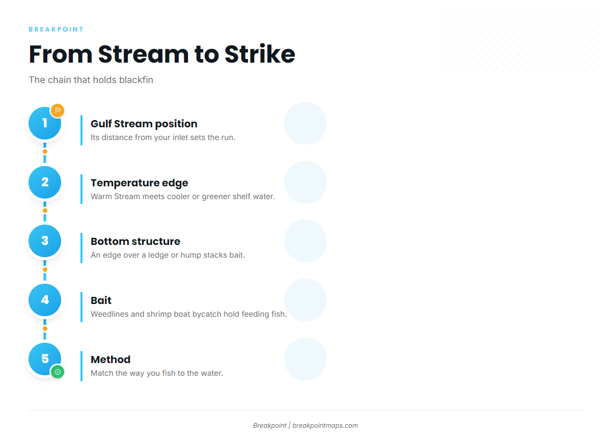
Read the water in this order: find the temperature edge, see where it crosses bottom structure, then look for bait.
Temperature breaks and color changes
Where warm Stream water meets cooler or greener shelf water, bait gathers along the seam and tuna work the edge. The best numbers on blackfin and temperature come from the northern Gulf of Mexico rather than the Atlantic. In ICCAT’s blackfin tuna species manual, tagged fish spent 89% of their time in 21.9 to 26.6°C water and 90% of their time between 0 and 57 m. Treat that as Gulf data. For that region, see the Gulf of Mexico blackfin guide.
Weedlines and sargassum
Floating weed shades and holds baitfish, and blackfin feed under and along it. Run the weed edges you find on the way to the break.
Ledges, humps, wrecks and the Charleston Bump
A temperature break riding over a ledge or hump stacks bait, and that overlap is the target. The Charleston Bump, the Hatteras humps, the Keys humps and offshore wrecks all work this way.
Shrimp boats
Blackfin key on the bycatch the shrimp fleet culls overboard. Anglers describe chumming behind the shrimp fleet with that bycatch.
Reading the water on the map
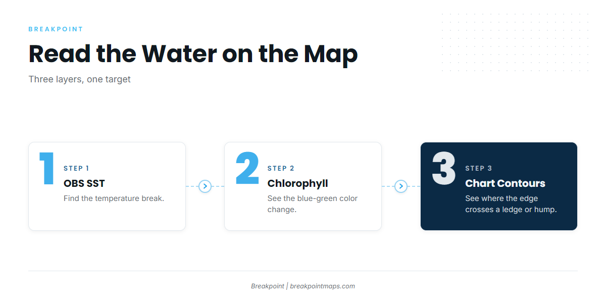
We build Breakpoint to show this chain. Use the OBS SST layer to find the break, the Chlorophyll layer to see the blue to green color change, and Chart Contours to see where that edge crosses a ledge or hump.
The data has limits. Cloud blocks satellite passes, so a gap in the imagery does not mean the edge is gone. Chart layers are not for navigation, and a forecast is only a forecast.
How anglers fish for blackfin
The Florida Museum notes that blackfin are taken by trolling and drift fishing. ICCAT calls them a common target of the U.S. recreational rod-and-reel fishery. Match the method to the water you find.
Trolling feathers, cedar plugs and ballyhoo
Use this to search a break or color change. Pull small lures through the seam and along the weed edges until you find fish.
Chunking at anchor or on the drift
Use this over wrecks and humps. Cut bait into the current and build a chum slick that pulls fish up from the structure.
Live pilchards at anchor
This is a Keys approach. Captains there describe anchoring up with live pilchards over offshore wrecks and reefs.
Jigging
Jig when fish mark deep over structure. It is also the fallback when chum runs short.
Popping, light tackle and fly
Use these when schools show on top with birds over them. ICCAT notes that surface schools are easy to see when birds are present.
Sharks, bleeding and ice
Sharks take hooked fish. Common responses are to land fish faster and to move off a spot once sharks show up. Bleed fish promptly and get them on ice quickly.
Before you run offshore, check the NWS marine forecast for wind, wave height and period. Before you pick an inlet, check where the Gulf Stream edge sits on the map.
Guides to blackfin tuna fishing from specific ports: Boynton Beach, Golden Isles, Hatteras Village, Charleston, Fernandina Beach, Savannah, Morehead City and Edisto Beach.
Frequently Asked Questions
Do I need an HMS permit for blackfin tuna?
No. Blackfin is not an HMS-managed tuna. Yellowfin, bigeye, albacore, skipjack and bluefin do need the permit, even in state waters.
What is the Florida blackfin bag limit?
It is 2 per person or 10 per vessel per day, whichever is greater. There is no minimum size and the season is open year-round, per FWC.
Do Florida rules apply in federal waters?
Yes. FWC’s blackfin rules apply in state waters and in adjacent federal waters off Florida.
What are the best months for blackfin tuna fishing in the Atlantic Southeast?
It depends on the area and on where the Gulf Stream sits. Hatteras is commonly fished in the cooler months, Jupiter to Miami sees bigger fish in spring, and the Keys humps produce through much of the year. The table above shows each area.
How do I tell blackfin from yellowfin or little tunny?
ICCAT notes the three often school together, so look closely before you keep a fish. The species guide linked above covers the field marks.
Are blackfin good to eat, and how should I handle them?
Blackfin are widely kept for the table. Bleed them promptly and ice them quickly.
Closing
The sequence runs from Stream position to the edge, then structure, bait and method. Rules come from FWC, NOAA HMS or your state agency, so check before you fish.
If you want that sequence on one map, download Breakpoint from the App Store or Google Play and see where the edge sits before you pick your inlet.