



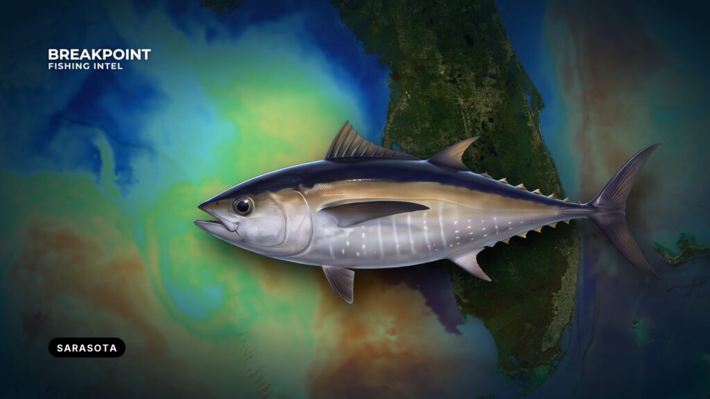
Blackfin tuna off Sarasota hold over offshore structure and along edges, and finding them starts with which pass you take out of the bay. For the species picture, read how blackfin feed and where they hold. This local guide covers the water between the barrier islands and the structure beyond them.
Sarasota Bay sits behind Siesta Key, Lido Key and Longboat Key. Boats reach the Gulf of America (Gulf of Mexico) through Big Sarasota Pass, New Pass or Longboat Pass, and Venice Inlet is the jettied option to the south. Blackfin hold over offshore structure where a temperature or color edge pushes bait together. For anglers who run grouper trips, the shift is from the bottom to the water column. This page covers the passes and their Coast Pilot numbers, how to read the water with our layers, how to raise fish, and the rules. It will help you decide where to look, but it cannot promise fish.
Getting Out of Sarasota
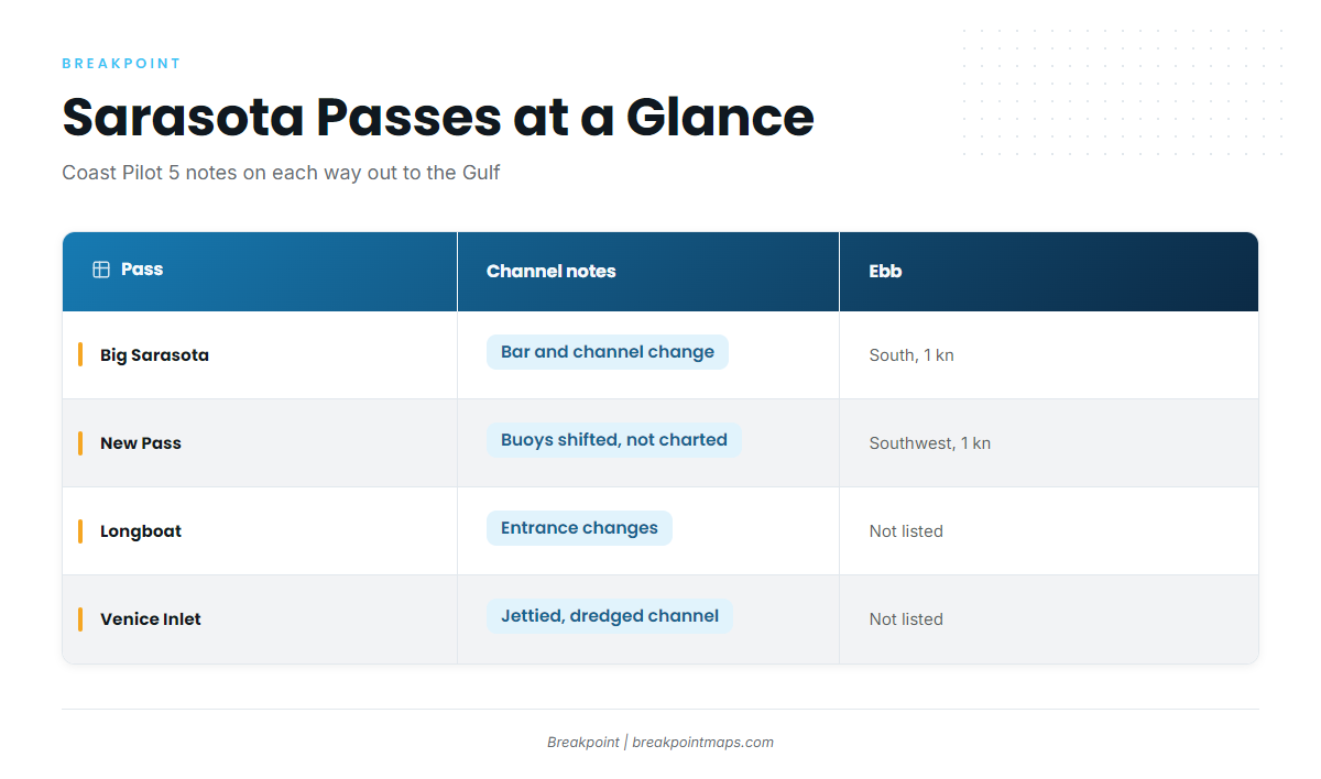
Plan around the NOAA Coast Pilot 5, Chapter 4 description of the three barrier passes. All three change. The bar approach and channel at Big Sarasota Pass are subject to continual change, Longboat Pass has an entrance that changes, and New Pass has a dredged channel that shoals.
New Pass needs the most care. Its buoys are shifted to mark the best water and are not charted, so a chartplotter track saved from an earlier trip can lead you across water that has since shoaled. On a predawn run, read the buoys rather than the screen, and slow down in the channel.
The ebb sets south at Big Sarasota Pass and southwest at New Pass, out toward the Gulf. A west wind pushes against that outgoing current and makes the waves on the bar shorter and steeper. Time the bar against the tide, and check the wind reading before you commit.
| Pass | Location | Channel notes | Current (flood/ebb) |
|---|---|---|---|
| Big Sarasota Pass | Reference point | Bar approach and channel subject to continual change. Marked by private daybeacons and a light. | Flood north at 1.5 kn average. Ebb south at 1 kn. |
| New Pass | Between Lido Key and Longboat Key | Dredged channel with a light at the approach. Buoys are shifted and not charted. Subject to shoaling. SR 789 bascule has 23 ft clearance (see 33 CFR 117.311). | Flood northeast at 1.6 kn average. Ebb southwest at 1 kn. |
| Longboat Pass | About 9 miles north-northwest of Big Sarasota Pass | Entrance changes. | Not listed. |
| Venice Inlet | 12 miles south-southeast of Big Sarasota Pass | Dredged channel between parallel jetties. | Not listed. |
The SR 789 bascule over New Pass clears 23 ft, so many center-consoles with a T-top or outriggers up will need an opening. The Ringling Causeway Bridge on the Intracoastal Waterway is a fixed span with 65 ft of vertical clearance and 100 ft of horizontal clearance, according to Coast Pilot 5, Chapter 12. The City Island marina entrance runs alongside the New Pass channel and is narrow, with strong currents.
Ramps and Fuel
Launch and fuel options near the passes:
- Ken Thompson Park boat ramp on City Island, right on the New Pass channel
- Centennial Park boat ramp
- Marina Jack, with fuel listed
- MarineMax Sarasota on Ken Thompson Parkway, with fuel listed
Where Blackfin Tuna Hold off Sarasota
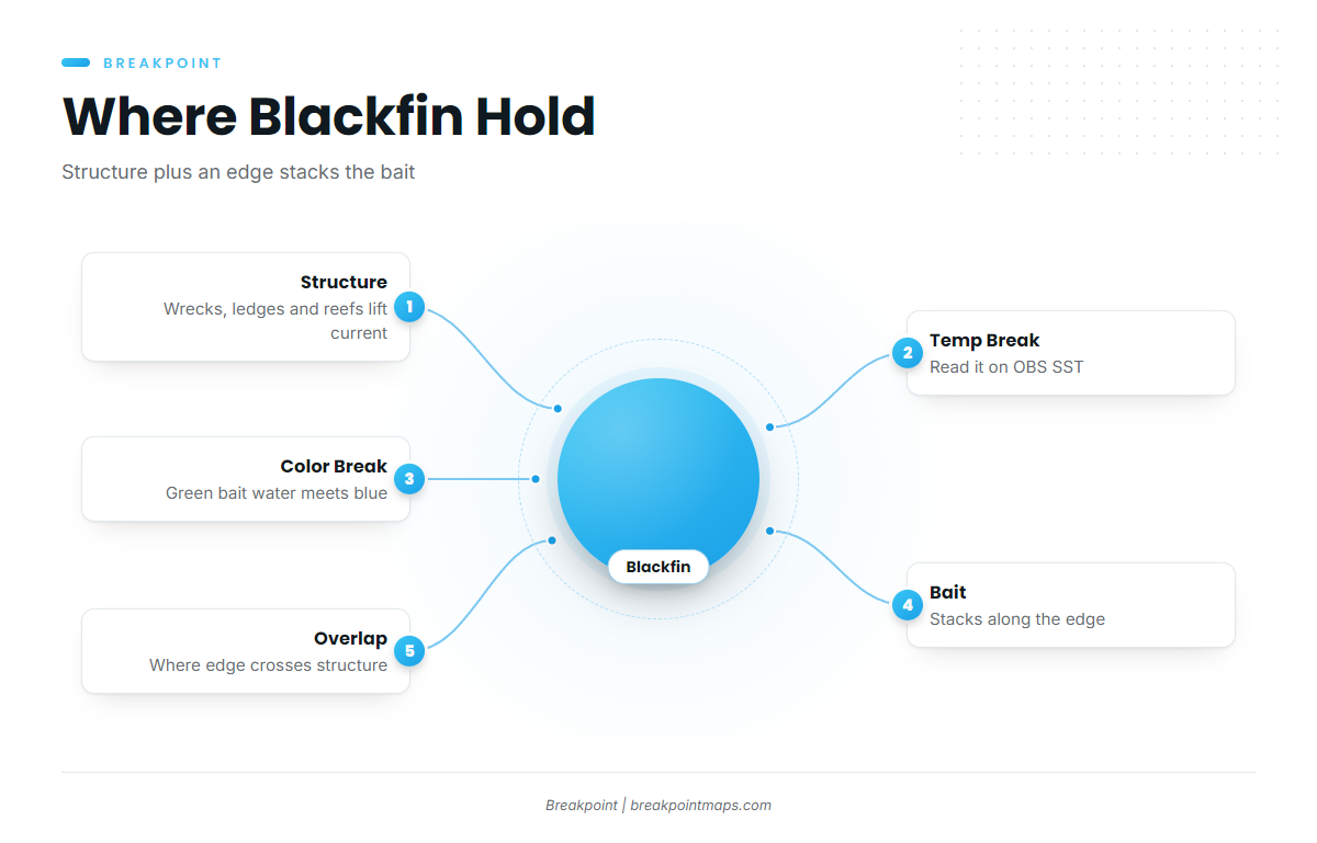
Structure and edges do separate jobs. Wrecks, ledges, hard bottom and artificial reefs push current upward and hold bait in place, while temperature and color breaks stack plankton and bait along a line. Blackfin work the places where the two overlap. The species guide covers the biology.
Sarasota County artificial reefs are public, permitted structure with published coordinates. Those coordinates mark deployment points, and material settles, scatters or gets buried, so confirm the structure on your sounder before you set up. Anglers who already fish grouper on public structure know this ground. What changes is that you now watch the water column and the surface above it.
Reading the Edge on OBS SST
On OBS SST, an edge shows as a tight band where colors change quickly over a short distance. Look for closely spaced isotherms rather than a single temperature. Note which side is warmer and which way the edge is moving between passes.
Satellite SST has limits:
- Cloud blocks satellite passes, so a clear-looking gap may simply be missing data.
- Compare more than one pass before you trust an edge’s position.
- An edge that holds its shape across passes is a stronger lead than one that appears once.
Chlorophyll and Chart Contours
Chlorophyll shows the color break, with green bait water against bluer water. A color edge that lines up with an SST edge is a stronger lead than either one alone. Chart Contours show where bottom relief tightens, which means ledges and drop-offs.
In the app, overlay OBS SST and Chlorophyll on Chart Contours and look for where a surface edge crosses structure off Sarasota. That intersection is your first waypoint. Chart layers are not for navigation.
Season and Conditions
Follow the temperature edge and the bait on the layers rather than the calendar, since blackfin go where the edge and the bait sit. Weather sets the windows, and the Coast Pilot describes the pattern:
- Cold fronts occasionally reach these waters from fall through spring and bring strong, gusty winds.
- Thunderstorms are most likely June through September, in the late afternoon and evening.
- At sea, thunderstorms frequently occur at night.
The usable windows fall between fronts. In summer, plan the return around afternoon storm timing, and read the wind and wave numbers rather than the descriptive wording in a forecast.
Tactics That Work Here
Blackfin respond to bait and movement over structure, and the goal is to pull fish up off the bottom. Rigging and leader detail is in the species guide.
Live-Bait Chumming
Use pilchards or threadfin herring. Anchor or drift up-current of the structure and feed a steady trickle of live baits so the chum line drifts back over the spot. You are pulling fish up off the structure, not dropping baits down to it.
Flat-Lines
Drift unweighted live baits back in the chum line on light leaders. Blackfin are line-shy, so a lighter, low-visibility leader matters.
Speed Jigs over Wrecks
Fish vertical jigs over wrecks and ledges when fish mark deep but will not rise. Match jig weight to the depth and current you see on the sounder.
Trolling Between Spots
Troll feathers or cedar plugs while moving between waypoints, especially along an edge. This covers ground and finds fish that are not sitting on the marked structure.
Shrimp Boats at Anchor
Gulf shrimp boats at anchor that are culling bycatch attract bait and tuna. Approach with courtesy, keep your distance from the vessel and its gear, and chum or drift baits in the bycatch slick.
Mixed Bag on the Same Structure
King mackerel, amberjack and grouper share these spots, and keeping them triggers extra rules. See Regulations below.
Planning the Run
Fuel is listed at Marina Jack and MarineMax. Plan range against your own burn, with a reserve. Check wind at NDBC station VENF1 at Venice, and read wind speed, gusts and direction against the tide at the pass. Read the NWS marine forecast for the coastal and offshore zones, and recheck it on the morning of the trip.
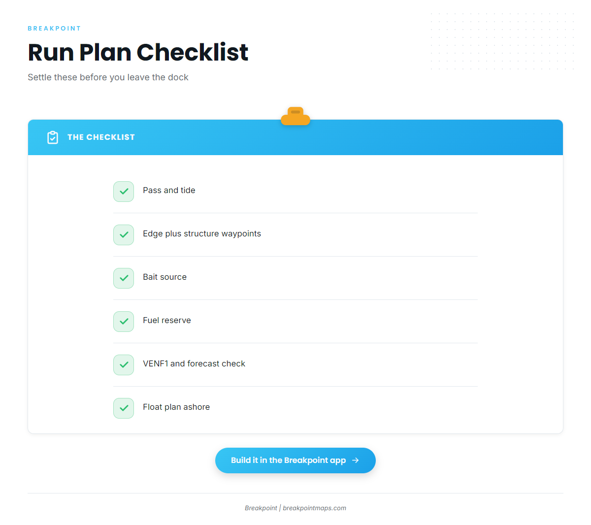
Run the plan in this order:
- Pass and tide
- Edge and structure waypoints
- Bait source
- Fuel reserve
- VENF1 and forecast check
- Float plan left with someone ashore: your pass, waypoints and return time
Build the run plan in the app before you leave the dock. Mark the pass, the edge and the structure you want to check, then compare the latest OBS SST pass against it in the morning.
FAQ
Do I need an HMS permit for blackfin off Sarasota?
No. According to FWC, blackfin tuna need no federal HMS Angling Permit in state or federal waters. Yellowfin are different: keeping one requires a vessel HMS Angling Permit, even in state waters.
What is the blackfin bag limit?
2 per person or 10 per vessel per day, whichever is greater. There is no minimum size, and the season is open year-round. Check FWC before you fish.
Where do state waters end on the Gulf coast?
At 9 nautical miles from shore. Blackfin rules are the same on both sides of the line. Other species can differ, so check the agency rules for everything in the box.
Which pass is best for an offshore run?
We do not rank them. Big Sarasota Pass and Longboat Pass have entrances that change. New Pass has uncharted, shifted buoys, and its bascule clears 23 ft. Venice Inlet is jettied and lies 12 miles south-southeast of Big Sarasota Pass. The choice depends on your boat, the tide and the wind.
What if I catch a yellowfin?
Keeping it requires a vessel HMS Angling Permit, even in state waters. Without the permit, release it. NOAA HMS issues the permit and sets the tuna rules.
Do I need the State Reef Fish Angler designation on a tuna trip?
Yes, if anyone 16 or older on a private vessel intends to harvest or possess listed species such as amberjack or gag. It is free and renewed yearly.