



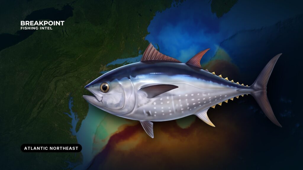
Atlantic bluefin move through the Northeast from late spring into fall. They gather where bait meets structure and temperature edges, and every fish you keep falls under federal rules first. The region runs from the Gulf of Maine to Long Island and covers Maine, New Hampshire, Massachusetts, Rhode Island, Connecticut and New York. This guide ties the fish to named banks, ledges and water features, then lays out how federal and state rules divide. It covers where and when to look, what water holds bait and fish, how the methods differ, what permit you need and what you can keep.
Identification and biology
Bluefin are the largest Atlantic tuna. They migrate into Northeast waters to feed in the warmer months. Rules sort them by size class, measured as curved fork length, which the Regulations section explains below. For identification, the difference between bluefin and yellowfin tuna, and life history, see the Atlantic bluefin tuna species guide.
Where and when bluefin show up in the Northeast
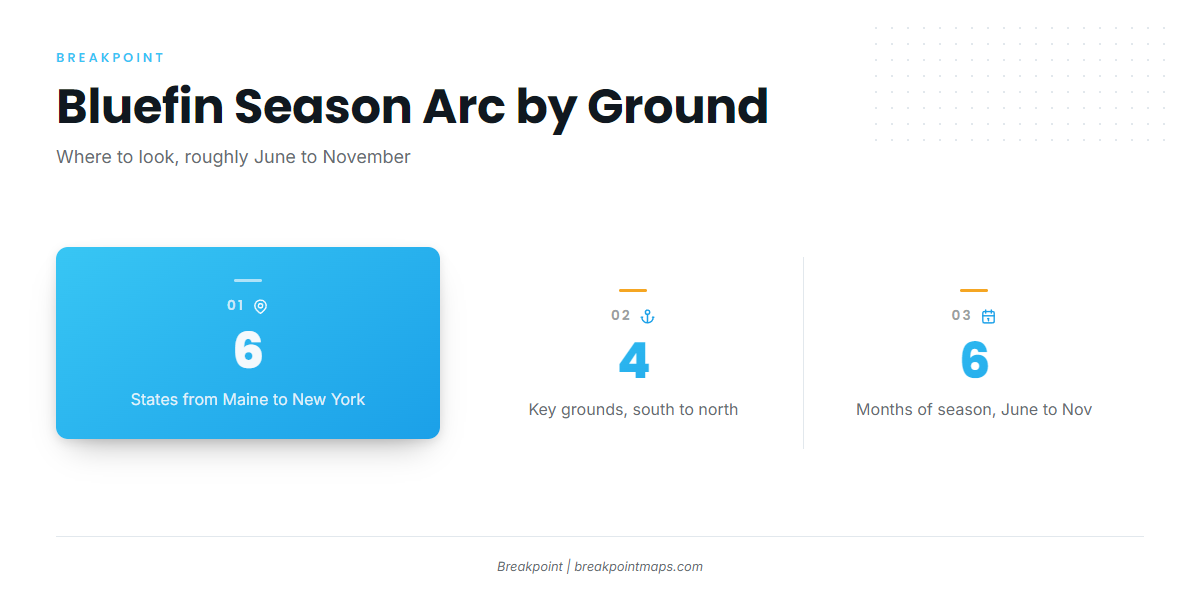
Fish arrive in the south first, push north through summer and leave in late fall. For fishing the Atlantic Northeast from the Gulf of Maine to Long Island, plan on a season that runs roughly June through November. Timing varies by area and by size class.
Southern grounds: south of Martha’s Vineyard and Nantucket, Block Island and the Mud Hole
Early-season fish show first south of the Islands in late spring and early summer. Block Island and the Mud Hole are the southern New England grounds and often hold school-class fish. Boats from Montauk and Point Judith run here.
The Great South Channel is the deeper passage east of Cape Cod. Fish use it moving in and out of the region.
Cape Cod Bay and Stellwagen Bank
Stellwagen Bank sits between Cape Ann and Provincetown. Its southwest corner toward Provincetown and Cape Cod Bay are the best-known grounds for surface-feeding school fish through summer and into fall.
Boats from Plymouth, Scituate, Boston, Gloucester and the north side of Cape Cod reach it. If you are moving up from striped bass, start here, since a capable center console can reach fish on several methods.
Jeffreys Ledge and the Gulf of Maine
North of Cape Ann, Jeffreys Ledge and the wider Gulf of Maine hold larger fish, especially mid-to-late season. Anglers often fish at anchor along the ledge edge. Boats from Gloucester, New Hampshire and Maine ports run here.
Fall departure
From September through November, fish begin moving out of the region, south or offshore. Late fall fishing depends on weather windows. Check the official marine forecast for wind, wave height and period, and decide from the numbers. Where the fish go next is covered in bluefin off the Southeast coast in winter.
Season arc by area
| Area | When fish typically show | What to expect |
|---|---|---|
| South of Martha’s Vineyard and Nantucket, Block Island, Mud Hole | Late spring into early summer | School fish, often on bait near the surface |
| Stellwagen Bank and Cape Cod Bay | Summer into fall | School fish on surface feeds, larger fish later |
| Jeffreys Ledge and Gulf of Maine | Mid to late season | Larger fish on bait along the ledge edge |
| Great South Channel | Movement through the season | Fish passing in and out of the region |
Patterns shift with bait from year to year.
Water and structure that hold bluefin
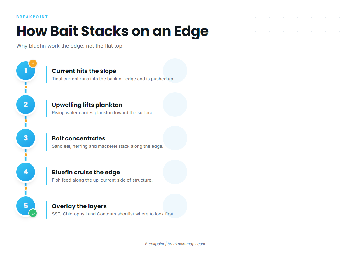
Bluefin follow bait, and bait collects on edges.
Bank edges, ledges and current breaks
Tidal current runs into the slope of a bank or ledge and is pushed up. That upwelling carries plankton and concentrates bait along the edge, and bluefin cruise the edge to feed.
Fish the edge and the up-current side of structure rather than the flat top. Stellwagen Bank and Jeffreys Ledge both work this way. At anchor on Jeffreys, set up close to the edge or over the structure.
Temperature breaks and color edges
A temperature break marks where two water masses meet. A chlorophyll edge marks where plankton, and the bait that eats it, concentrate. Where both lines sit over or near structure, the odds of bait improve. Read the two together: a temperature break with no color change and no structure is a weaker bet than a break that lines up with both.
Forage and surface signs
The forage present shapes the method. Surface feeds on sand eel set up casting. Herring, mackerel and menhaden serve as chunk and live bait. Squid hold fish on some nearshore structure.
Signs to look for:
- Diving gannets and working shearwaters
- Feeding whales
- Bait marks and arches on the sounder
- Fish breaking or splashing on the surface
- Slicks and nervous water over a known edge
Reading the layers before you run
We use OBS SST in Breakpoint to show temperature breaks and Chlorophyll to show color edges where bait holds. Chart Contours show the edges of Stellwagen Bank and Jeffreys Ledge. Overlaying all three gives you a shortlist of where to look first.
The data has limits. A satellite pass blocked by cloud leaves gaps in SST and Chlorophyll, and bathymetry in places comes from older surveys. Chart layers are not for navigation. They help you decide where to look and do not promise fish.
How anglers fish for bluefin here
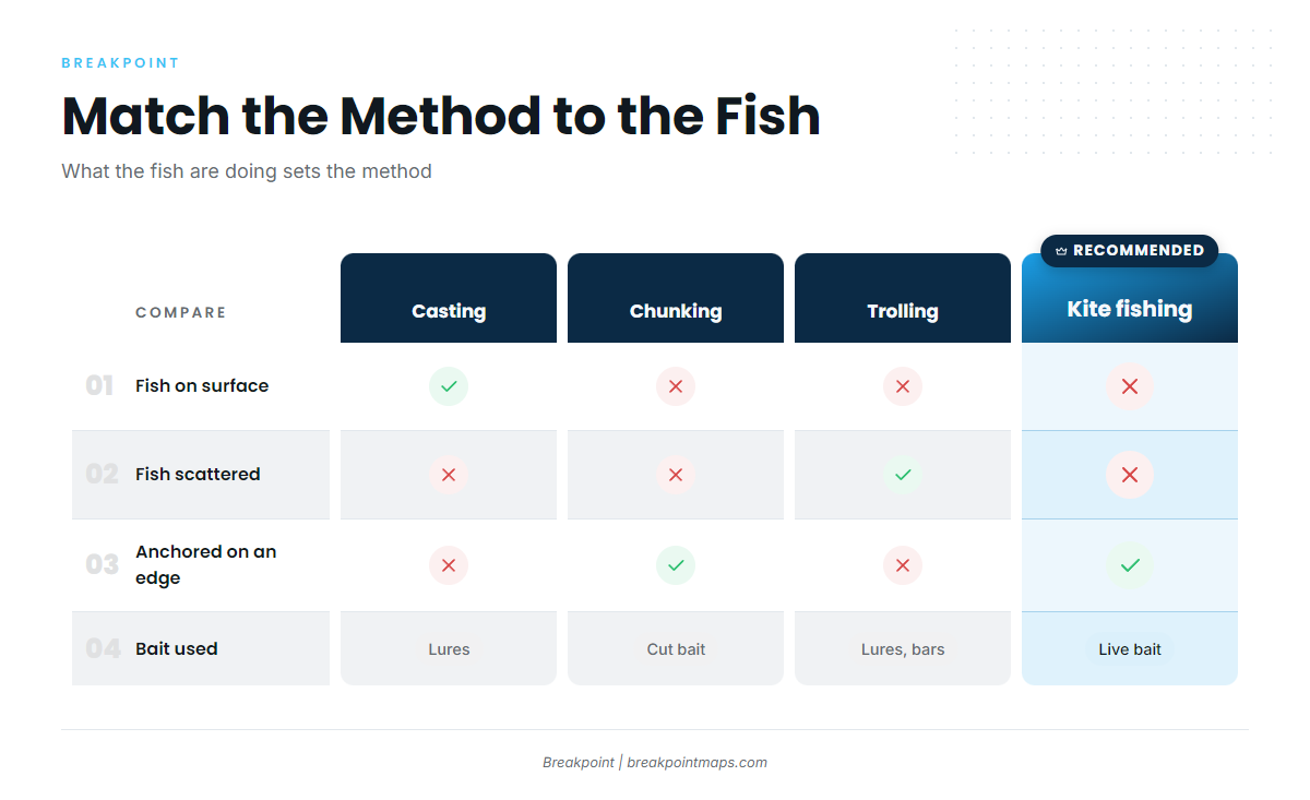
Match the method to what the fish are doing. If you are comparing bluefin methods with other offshore tuna, see our tuna fishing guides.
| Method | When it fits | What it needs |
|---|---|---|
| Casting topwater | Fish are breaking on the surface | Stickbaits, poppers or soft plastics and a quiet approach |
| Chunking | Fish are on an edge and not showing | Anchor or drift, cut bait and a steady slick |
| Trolling spreader bars | Fish are scattered or not on top | Lures that cover water |
| Kite and live bait | Larger fish | A kite and a live bait at the surface |
Casting topwater. Run to surface feeds, often school fish on sand eel, and cast stickbaits, poppers or soft plastics. Approach the feed without running over it.
Chunking. Anchor or drift on an edge and lay a steady line of cut herring, mackerel or menhaden. Drift a baited hook back in the slick. It is a mainstay later in the season.
Trolling spreader bars. Pull bars and other lures to cover water when fish are scattered or not showing on top.
Kite fishing and live bait. A kite keeps a live bait struggling at the surface with the leader out of sight. It is used for larger fish.
Federal rules set the gear. An Angling permit allows rod and reel (downriggers allowed) and handline. Gaffs are used only at boatside on fish already hooked.
The step up from stripers
Tackle must match the size class you might hook, and striper-weight gear is undergunned against bluefin. Tie strong braid-to-leader connections and keep drags, hooks and leaders checked. Conventional gear has the advantage on bigger fish.
Plan the run on the layers, then check the HMS page before you leave the dock.
Guides to Atlantic bluefin tuna fishing from specific ports: New London / Waterford, Indian River Inlet, Bar Harbor / Mount Desert, Ocean City, Barnstable / Cape Cod Bay harbors, Hampton / Seabrook, Atlantic City and Freeport.
FAQ
Do I need an HMS permit to fish for bluefin in state waters?
Yes. An HMS Angling or Charter/Headboat permit is required in coastal state waters, except Connecticut. Federal rules follow the permit, and the stricter rule applies.
Does a charter’s permit cover me?
Yes. The HMS permit is issued to the vessel and covers the people fishing aboard. In Maine, passengers on a boat with a licensed for-hire captain are also exempt from the saltwater registry.
How do I measure a bluefin?
Measure curved fork length, from the tip of the jaw to the fork of the tail along the curve of the body. The minimum is 27 inches. A head-off fish must measure at least 20 inches PFCFL.
What happens after I keep a trophy bluefin?
The limit is 1 trophy (73 inches or more) per vessel per year. Once it is kept, no one aboard may continue fishing, and the vessel returns to port.
How do I report a bluefin?
Report within 24 hours at hmspermits.noaa.gov/catchReports, through the HMS Catch Reporting App or at (888) 872-8862. This covers every retained or dead-discarded fish.
Can I sell a bluefin caught under an Angling permit?
No. Sale is possible only under a permit category that allows it, such as a Charter/Headboat permit with a commercial sale endorsement fishing General category limits.
When do bluefin arrive on Stellwagen?
Typically in summer, after the first fish show farther south. They often stay into fall as bait holds. Exact timing shifts with bait each year.
Where can I check whether the fishery is open?
Check hmspermits.noaa.gov and NOAA’s HMS landings updates page before every trip, or call (888) 872-8862. Limits and closures change in season.