



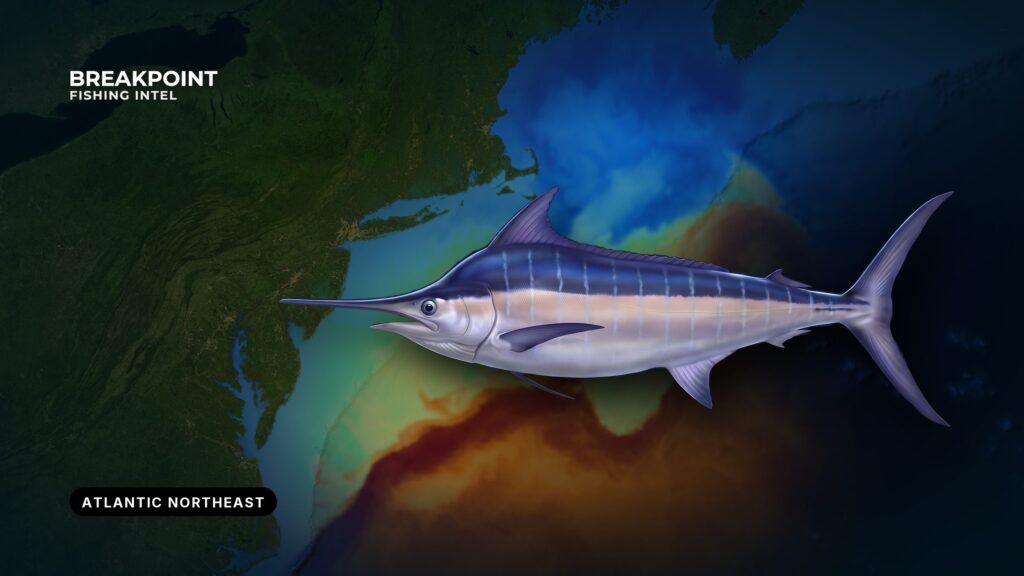
Blue marlin fishing in the Atlantic Northeast depends on finding Gulf Stream water where it meets a canyon wall. The fish arrive in a narrow summer window, when warm water pushes onto the shelf edge. Most fish caught here are released.
This page covers where and when blue marlin show up, the water and structure that hold them, how crews fish the spread, and how federal and state rules divide. It is organized around reading water and structure, and around knowing who makes the rules before you leave the dock.
Blue Marlin at a Glance
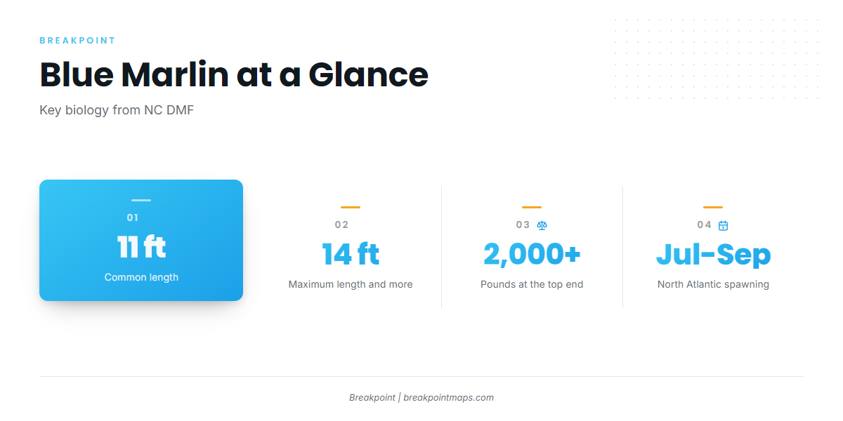
The NC Division of Marine Fisheries profile covers the basics. Blue marlin have a pointed dorsal fin and a pointed anal fin; white marlin have rounded ones. Blue marlin spawn in the North Atlantic from July through September. They are common to 11 ft and can reach 14 ft and more than 2,000 lb.
For identification and biology, see our blue marlin guide. The Northeast is predominantly a catch-and-release fishery.
Where and When Blue Marlin Show Up in the Northeast
Blue marlin hold in the offshore canyons from the Mid-Atlantic north into New England. Working south to north, the canyons that matter are:
- Norfolk and Baltimore: the Mid-Atlantic canyons, the first to feel Gulf Stream water.
- Hudson: the anchor of the New York Bight.
- Block, Atlantis and Hydrographer: the central and eastern canyons.
- Oceanographer: the far eastern end of the usual range.
The eastern canyons sit farther offshore than the western ones, so fuel range drives the choice. Pick a target the boat can run and return from, then read the water once you get there. For ports, regional context and the wider fishery, see Atlantic Northeast fishing.
The Summer Window
The core of the season runs from mid-July through September, and it opens only when Gulf Stream water reaches the shelf edge. For most of the year the Northeast is too cold for blue marlin.
Fish ride the Gulf Stream north past Hatteras. For the southern leg of that migration, see blue marlin fishing in the Atlantic Southeast.
The window shifts with where the eddies set up, so treat it as a pattern rather than a fixed calendar.
The Water and Structure That Hold Blue Marlin
Four things stack up in this order: the Gulf Stream, the eddies and filaments that peel off it, a break pressed against a steep contour, and the bait that gathers there.
Gulf Stream, Warm-Core Eddies and Filaments
Clockwise warm-core eddies pinch off the north wall of the Gulf Stream. They drift inshore and stall against the walls of Hudson, Block, Atlantis and Hydrographer. Filaments and streamers pull blue water up onto the shelf edge between them.
When an eddy parks against a canyon, warm water and structure overlap. That overlap is the setup to look for.
Temperature Breaks Against the Canyon Wall
The classic setup is warm, clean water sliding over a steep depth change. Look along the canyon walls and along the 100-fathom line or shelf edge. On a sharp break, the productive side is the warm, blue one.
Surface trolling works best in the comfortable upper range. When the surface runs hotter than that, fish slide deeper toward the thermocline, and a surface spread can run over them.
Water Color, Chlorophyll and Bait
Water can be too clear. Clear blue water with no chlorophyll edge often means no bait, so look for the color edge rather than the bluest water on the chart.
Marlin follow the food. The usual forage in the Northeast is:
- Squid
- Small tunas such as skipjack
- Tinker mackerel
- Small mahi
On the water, look for birds working, isolated bait balls and weed lines. Yellowfin tuna and bluefin tuna share these canyons and trips, so a good bait edge often serves the whole fishery.
Reading the Water on the Chart
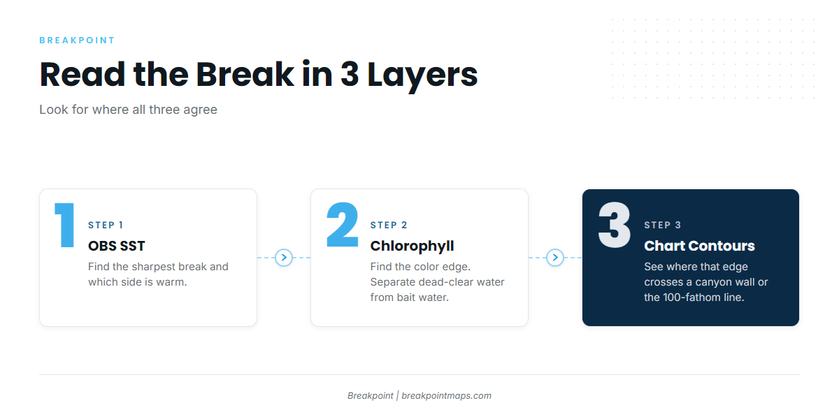
Three layers do most of the work:
- OBS SST: find the sharpest break and which side is warm.
- Chlorophyll: find the color edge, and separate dead-clear water from water with bait.
- Chart Contours: see where that edge crosses a canyon wall or the 100-fathom line.
Open all three together and look for where they agree: a warm, clean break against steep bottom.
The data has limits. SST shows only the skin of the ocean, not the thermocline. Cloud can block satellite SST passes, so a gap-filled composite is a blend, not a reading. Canyon contours are survey-based, and chart layers are not for navigation. None of this promises fish, but it improves the decision about where to look.
How Anglers Fish for Blue Marlin Here
The sequence is to lay out the spread, raise a fish, pitch a bait, drop back and come tight, then release.
The Spread
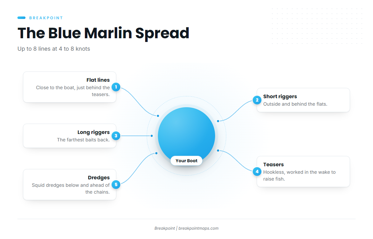
According to the NC DMF profile, crews troll up to 8 lines at 4 to 8 knots. A standard layout runs like this:
- Flat lines: close to the boat, inside and just behind the teasers.
- Short riggers: outside and behind the flats.
- Long riggers: the farthest baits back.
- Teasers: hookless, worked in the wake to raise fish.
- Dredges: squid dredges below and ahead of the squid chains.
Baits are skirted lures and rigged ballyhoo, natural or skirted.
Many canyon boats troll for tuna first. In the midday lull, crews commonly swap spread bars for single lures or smaller daisy chains and run squid teaser chains to draw a marlin. A simpler spread with the baits close is easier to manage when a big fish comes.
White marlin share the same spread. For the rest of the fishery, see our other billfish guides.
Raising, Pitching and Hooking
The bite follows a repeatable order:
- A marlin rises on a teaser.
- Pull the teaser away and pitch a bait back, or reel a rigger bait up to the fish.
- Drop back, let the fish turn and take line, then come tight smoothly with the drag.
Circle hooks go with natural baits. The HMS compliance guide in the Regulations section covers the rules.
Release Handling
Release is the norm. Keep the fish in the water and handle it at the leader quickly. Sale of Atlantic marlin is federally prohibited.
Planning the Canyon Run
Fuel range sets which canyons are realistic. Work out the round trip, plus the trolling, before you pick a target.
To choose between a canyon edge, an eddy and a break, ask where warm, clean water meets a steep contour with a color edge nearby. Then check the NWS offshore forecast for wind, wave height and period.
Plan the run on the chart before you burn the fuel. Chart layers are not for navigation, cloud can block SST passes, and no chart promises fish.
Guides to blue marlin fishing from specific ports: Indian River Inlet, Ocean City, Falmouth / Woods Hole, Atlantic City, Moriches, Oregon Inlet, Point Judith and Chincoteague.
Frequently Asked Questions
Do blue marlin reach the Northeast?
Yes, in a narrow summer window from mid-July through September. They arrive when Gulf Stream water and warm-core eddies reach the canyons. For most of the year the water is too cold.
Which canyons hold blue marlin?
Fish show from Norfolk and Baltimore north through Hudson, Block, Atlantis and Hydrographer, toward Oceanographer. They hold where warm, clean water meets the canyon wall.
How do I tell a blue marlin from a white marlin?
Blue marlin have a pointed dorsal fin and anal fin. White marlin have rounded ones. For more, see the blue marlin guide.
Can I keep a blue marlin?
Check the rules first, because several apply at once:
- A fish must meet the 99 in LJFL federal minimum, and federal permit, reporting and landing-limit rules apply.
- Sale is prohibited.
- Most Northeast fish are released.
- NOAA HMS is the agency to check.
Who handles permits on a charter?
Federal HMS rules apply to the vessel. For the permit category and reporting, use the NOAA HMS compliance guide linked in Regulations.
What spread do crews troll for blue marlin here?
Up to 8 lines at 4 to 8 knots: flat lines, short and long riggers, teasers and dredges, with skirted lures and ballyhoo.
Can satellite charts show me where the marlin are?
Not directly. The data has limits:
- Charts show where the water is, not where the fish are.
- SST shows the skin of the ocean.
- Cloud can block passes.
- Chart layers are not for navigation.
Find the break, read the wall, and check the agency page before you fish.