



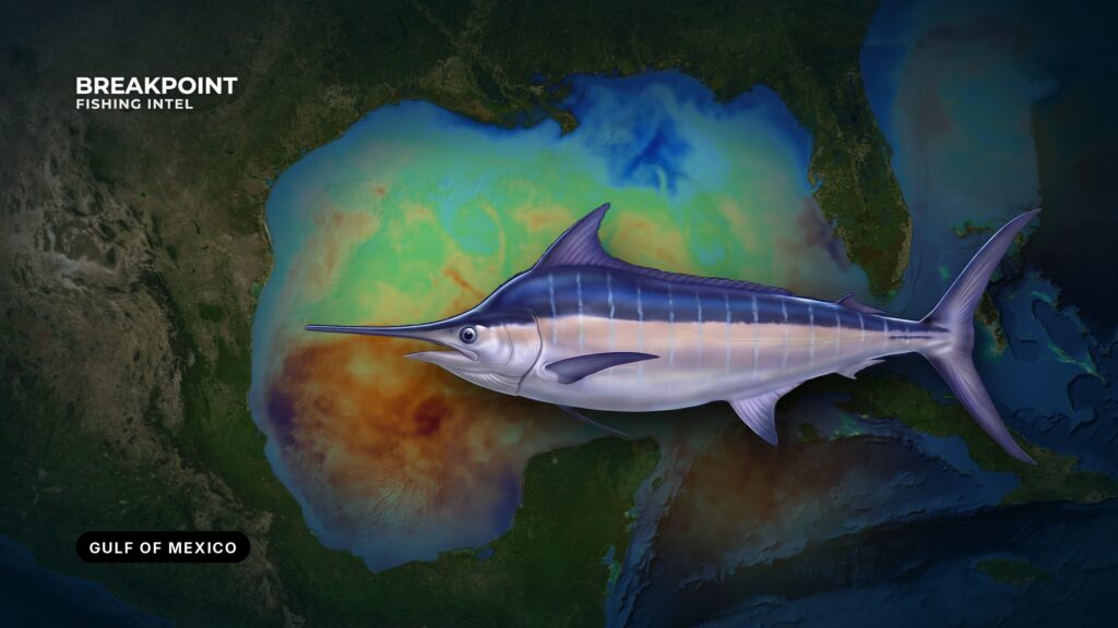
Gulf blue marlin follow the Loop Current and its eddies into deep water off the northern Gulf states, and the rigs and canyons there give them reasons to stop. Fishing for them comes down to reading warm, clear water and finding where it meets structure. This guide covers where and when the fish show up, the water and structure to read, how anglers fish for them here, and how federal and state rules apply.
Blue Marlin at a Glance
Blue marlin are the largest Atlantic billfish. They are warm-water, blue-water pelagic hunters that feed by sight, which is why clear water matters more than almost anything else in this guide. They spend the warm months in the northern Gulf, and catch and release is the norm.
Identification, growth and spawning biology are in our blue marlin fishing guide. White marlin and sailfish share the same water, so any spread that can raise a blue marlin can raise another billfish.
Keep these points in mind:
- The fish are tied to warm, clear water, not to a fixed spot.
- Structure matters most when the right water sits on it.
- Anglers handle the species as a billfish, and regulations apply from the moment a fish is boated.
Where and When to Find Gulf Blue Marlin
Season
The northern Gulf peaks in summer. The tournament calendar runs roughly May through September from the Florida Panhandle to Texas. Fish timing follows warm, blue water reaching the shelf edge rather than the calendar, so a good date can still be a poor day if the water is wrong.
Ports
Each northern Gulf port gives access to a different piece of the fishery:
- Venice, LA: Rig fishing and the Mississippi Canyon.
- Orange Beach and Gulf Shores, AL: Named spots The Nipple, 131 Hole and The Elbow, plus the DeSoto Canyon to the east.
- Destin, FL: The DeSoto Canyon.
- Port Aransas, TX: Deepwater structure off the middle Texas coast.
- South Padre Island, TX: Southern Texas blue water.
Run Planning
Blue water is a long run from most northern Gulf ports, and the distance changes with eddy position. Plan fuel for the run out, the trolling hours and the run home, with a reserve. Check the National Weather Service offshore forecast and the National Hurricane Center before you commit. We supply the water data; the official forecast is yours to read.
Other offshore species and ports across the region are in our Gulf of Mexico fishing guide.
The Water and Structure That Hold Blue Marlin
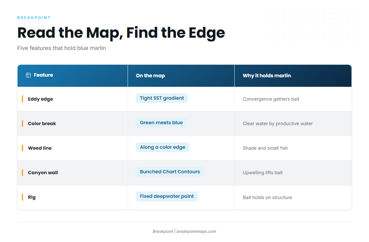
Work from large scale to small: the current, then the eddy, then the edge, then a feature on the edge, then the boat.
The Loop Current and Warm-Core Eddies
The Loop Current carries warm, clear Caribbean water into the eastern Gulf. It sheds warm-core eddies that drift west. Bait and marlin hold close to the current and its spin-off eddies. Eddy position on any chart lags the water, and eddies move and weaken, so treat a charted edge as a starting point.
Eddy Edges and Temperature Breaks
The eddy edge is where warm, clear eddy water meets cooler, greener shelf or slope water. Current shear and convergence there gather bait. A temperature break is the sharp gradient on OBS SST. Fish the tightest gradient rather than a target number.
Color Changes vs. Temperature Breaks
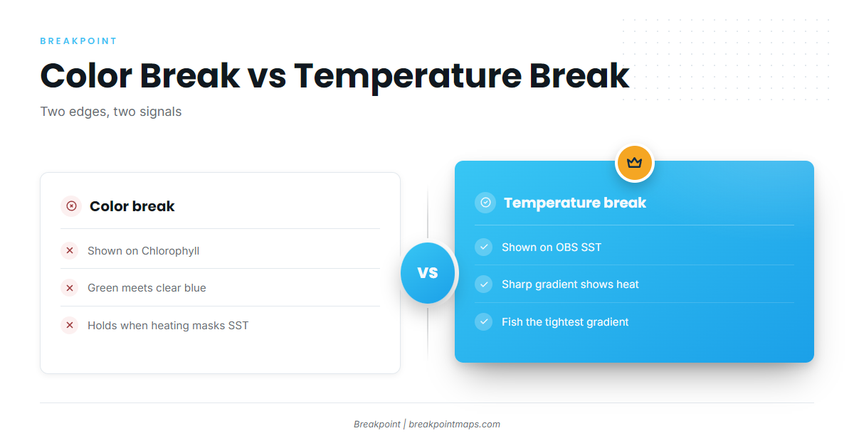
A Chlorophyll color break shows where productive green water meets clear blue water. A temperature break shows heat. The two often coincide, but not always. Surface heating can mask a temperature break while the color break still holds. Where both line up, the edge is stronger.
Sargassum Weed Lines
Weed lines form along convergence zones and edges. They shelter small fish, which draws dolphin, tuna and marlin. Troll parallel to the weed line on the blue side.
Canyons: DeSoto, Mississippi and Green
When an eddy edge rides over a canyon wall, current hitting the steep bottom pushes nutrients and bait up. The overlap of edge and wall is the target. In each canyon the wall drops from the shelf into thousands of feet.
- DeSoto Canyon: Off the Florida Panhandle and Alabama.
- Mississippi Canyon: South of the Mississippi River delta, off Venice.
- Green Canyon: Farther west, off central Louisiana.
Deepwater Oil and Gas Platforms
Fixed and floating platforms hold bait from the surface down. Rig fishing is strong off Louisiana. A rig in blue water outfishes the same rig in green water, because marlin hunt by sight and follow the clear water. The rig only matters when the edge is on it.
Platforms keep being removed, some through Rigs-to-Reefs programs. Any structure map ages, so confirm a rig still stands before you run to it.
What Each Feature Looks Like
| Feature | What it looks like on the map | Why it holds marlin |
|---|---|---|
| Eddy edge | Tight SST gradient wrapping a warm lobe | Convergence gathers bait |
| Color break | Chlorophyll green meeting low-chlorophyll blue | Clear hunting water beside productive water |
| Weed line | Often along a color or temperature edge (confirm visually) | Shade and small fish |
| Canyon wall | Bunched Chart Contours | Upwelling lifts bait |
| Rig | Fixed point in deep water | Bait holds on structure |
Lay the OBS SST, Chlorophyll and Chart Contours layers together and look for an eddy edge sitting over a canyon wall or a rig field. The data has limits. Cloud can block a satellite pass and leave gaps, eddy position lags the water, and a forecast is only a forecast. Chart layers are not for navigation.
How Anglers Fish for Blue Marlin in the Gulf
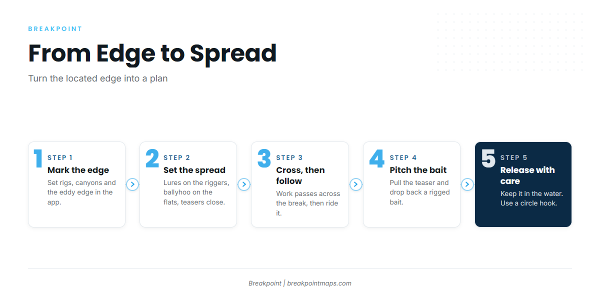
Once you have located the edge, the job is turning it into a spread and a plan for the fish that rises.
Lure Trolling Spreads and Teasers
The common Gulf spread puts lures on the riggers, ballyhoo on the flat lines and teasers in close. In a big sea, choose lures that stay down. Work the edge in passes that cross the break, then follow it.
Pitch Baits
When a fish rises on a teaser, pull the teaser away and drop back a rigged bait. Coordinate the crew before the fish shows. Use a circle hook with natural bait. See the Regulations section for the tournament rule.
Live Baiting at Rigs
Live baiting around rigs has grown alongside lure trolling. Catch blackfin tuna or bonito at the rig, bridle the bait, slow troll it and bump it around the structure. Fresh, lively bait matters.
Tackle
Heavy stand-up and chair-class outfits fit the job. Choose the outfit for the method first and the fish second.
Other Billfish and Catch and Release
White marlin and sailfish often rise in the same spread. See our billfish fishing guides.
Release handling comes down to four steps:
- Keep the fish in the water. Do not lift a fish you plan to release.
- Use a circle hook. It cuts gut-hooking.
- Revive the fish. Move it forward through the water until it swims off.
- Cut the leader close. Do it at the hook, without pulling the fish out of the water.
Tagging programs exist for anglers who want to add data on released fish.
Before the run, mark rigs, canyons and the current eddy edge in the app.
Guides to blue marlin fishing from specific ports: Orange Beach, Destin, Cocodrie, Biloxi, Corpus Christi, Panama City Beach, Grand Isle and Freeport.
Frequently Asked Questions
When is the best time to fish for blue marlin in the Gulf of Mexico?
Summer, with a general tournament window of May to September from the Florida Panhandle to Texas. Blue water near the shelf edge matters more than the date.
Do I need an HMS permit for blue marlin?
Yes, in federal waters. Private boats use the HMS Angling permit and for-hire vessels use the HMS Charter/Headboat permit. Florida does not require the permit in state waters when you fish for billfish.
Can I keep a blue marlin in Texas?
Only if it meets the Texas Parks and Wildlife Department minimum length of 131 inches and the federal rules. The stricter rule applies, and limits do not stack.
How do I report a landed blue marlin?
Call NOAA at 800-894-5528 or use the HMS permits site within 24 hours of landing a non-tournament fish. Tournament landings follow the registered tournament process, which the NOAA compliance guide covers.
How does the Gulf compare with the Atlantic for blue marlin?
The Gulf fishery revolves around the Loop Current, eddies, canyons and rigs. The Atlantic coast fishes the Gulf Stream and its own canyons. The same federal HMS rules apply on both coasts. See our Southeast Atlantic blue marlin guide and Northeast Atlantic blue marlin guide.
Why do oil rigs matter for blue marlin?
Rigs hold bait in deep water. They produce when the blue-water edge sits on them. Removals change the map over time, so confirm a rig still stands before you run.
What water should I look for?
A tight temperature break and a Chlorophyll color break, lined up over a canyon wall or a rig.
Do I need a state license if I fish federal waters?
Texas and Florida both require a state license to land fish there, wherever the fish was caught. For Alabama, Mississippi and Louisiana, check the state agency.