



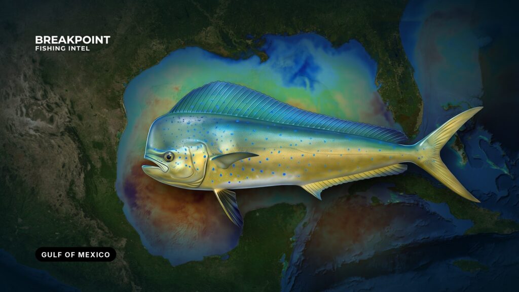
Gulf mahi-mahi fishing follows the Loop Current, the eddies it sheds, the sargassum those eddies carry, and the rigs that hold bait in open water. The Gulf of Mexico, which federal agencies call the Gulf of America, is a subject of its own (see the Gulf of Mexico fishing guide), and mahi-mahi are among its best surface targets.
This guide covers reading water: temperature edges, color edges, weed and structure. It can’t promise fish, but it should help you decide where to look. It also covers where and when the fish show up, the water that holds them, how to fish them, and how the rules split between federal and state jurisdictions.
Where and When Gulf Mahi Show Up
Fish build through spring and hold through summer, and the bigger fish run ahead of the schoolies. The Gulf has no single edge to follow. It has a moving set of features, and mahi follow the ones that carry blue water and weed.
The Loop Current enters through the Yucatán Channel and exits through the Florida Straits. Eddies pinch off and drift west and north, carrying blue water and sargassum toward the northern shelf. Where they press against shelf water determines which ports get the fish. Fish don’t sit at a fixed distance from shore; they sit on blue water and weed, and that line moves.
Florida Panhandle and the Big Bend Edge
Destin sits on a broad, shallow shelf, so blue water often lies well out. Fish follow eddy edges and weed toward the DeSoto Canyon area. When an eddy lays its edge close to the shelf, the run is short. When it doesn’t, the fish are farther out.
Alabama and Mississippi
Out of Orange Beach, the pattern is eddy-driven blue water, weedlines, and rigs farther offshore. Temperature breaks where eddy water meets shelf water are the first thing to look for.
Louisiana: Venice, the Rigs and the River
Venice sits at the Mississippi River mouth. The plume pushes green water out, and the edge against blue Gulf water concentrates bait. Rigs hold fish in open water. Large bulls and cows ride weedlines, rips and debris toward the northern coast, and the edge off the river is where that run gets fished.
Texas Bluewater
Out of Port Aransas, blue water and weed arrive on eddy edges drifting west. Platforms and floaters off the Texas coast give fish something to hold on.
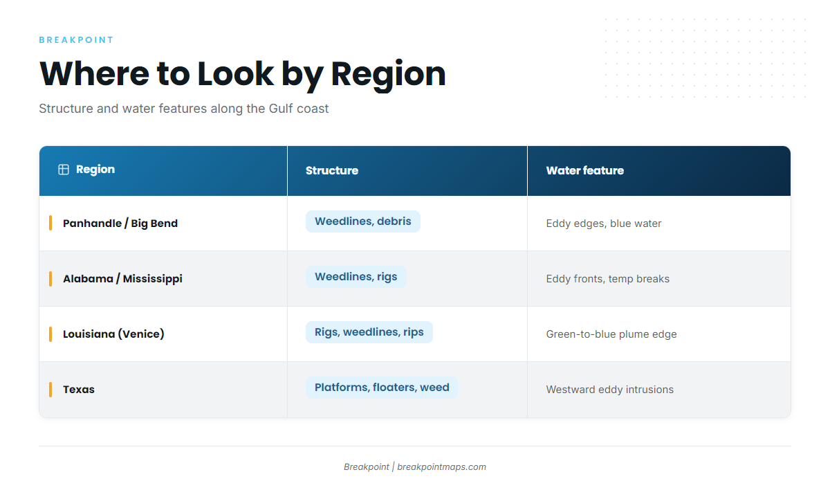
Where to look by region:
| Region | Typical structure | Water feature |
|---|---|---|
| Florida Panhandle / Big Bend edge | Weedlines, debris | Eddy edges, blue water over a wide shelf |
| Alabama / Mississippi | Weedlines, rigs | Eddy fronts, temperature breaks |
| Louisiana (Venice) | Rigs, weedlines, rips | Plume green-to-blue edge |
| Texas | Platforms, floaters, weed | Blue-water intrusions from westward eddies |
The Water and Structure That Hold Mahi-Mahi
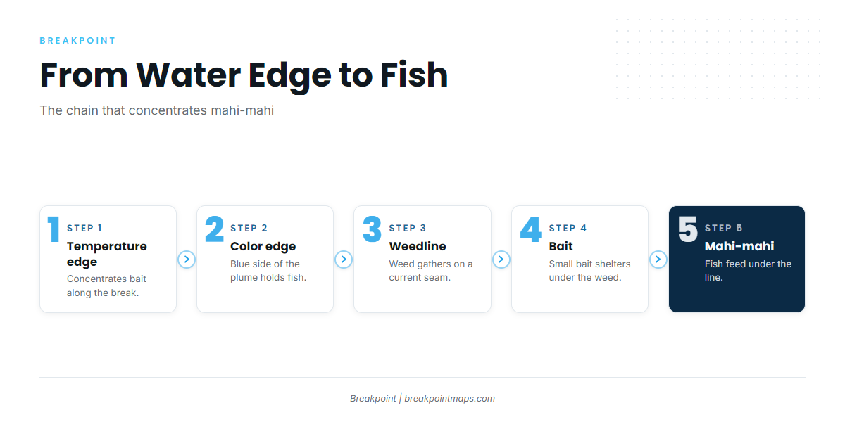
The chain runs in one direction: temperature edge, color edge, weedline, bait, fish. A blue-water eddy edge pressed against plume water south of the river shows it well. The temperature break gathers bait, the color edge marks where clean water meets green, weed lines up on the seam, and mahi work the blue side beneath it.
Sargassum Weedlines and Rips
Convergence zones gather weed into lines. Weed shelters small bait, and mahi feed under it. A long, clean line on a current seam is worth more than a scattered patch, because the seam holds the weed and the bait in place.
Temperature Breaks
Bait stacks on the side of a warm-cool edge that suits it, and the break keeps it from spreading out. Predators sit on the edge for the same reason. A break that lines up with weed is worth more than either feature alone.
Color Edges and the Mississippi River Plume
Sediment-laden, nutrient-rich river water meets clear Gulf water and makes the green-to-blue edge off Venice. Fish work the blue side. The plume can read green far out, so the edge you want is where clean blue water starts.
Rigs, Floating Debris and FADs
Platforms act as vertical structure in open water and build a food chain from the legs up. Logs, pallets and buoys work as smaller versions of the same thing. Approach quietly, since engine noise scatters fish.
How the Gulf Differs from the Gulf Stream
The Atlantic fishery works one dominant current edge, while the Gulf works a moving set of eddies, river plumes and fixed rigs. For the Atlantic pattern, see mahi-mahi fishing in the Atlantic Southeast. The same fish ride the Gulf Stream north into the Atlantic Northeast. Dorado off Southern California work kelp paddies the way Gulf fish work weed, which you can read about in Pacific Southwest.
Signs you are in mahi water:
- Sargassum weed, especially in long lines
- Rips and current seams
- Birds working, particularly frigatebirds over weedlines
- Floating debris such as logs, pallets and buoys
- Blue water
- A temperature edge
Reading the Water on the Map
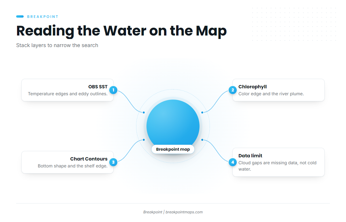
Three layers do most of the work for mahi.
OBS SST shows surface temperature edges and eddy outlines. Cloud blocks satellite passes, so a gap in the layer is missing data, not cold water.
Chlorophyll shows the color edge and the river plume. River sediment and dense weed can both read green, so pair Chlorophyll with OBS SST before you trust a green patch.
Chart Contours show bottom shape and the shelf edge where eddies ride up.
The data has limits. Weedlines are often too narrow for satellite resolution, so the map gets you to the edge and your eyes find the weed. An eddy’s position is a forecast, and it moves. Stacking a temperature edge from OBS SST on a color edge from Chlorophyll narrows a long search to a short stretch of water worth running. Chart layers are not for navigation.
How Anglers Fish Mahi-Mahi in the Gulf
Methods change with what the fish are doing. Start with the one that covers the most water, then switch once you find a school.
Trolling the Spread
Anglers troll ballyhoo and skirted lures, staggered at different distances behind the boat. Speed is fast enough to keep skirts swimming clean and ballyhoo tracking straight.
Running Weedlines
Run the line, mark fish, circle back. Look for color, and for birds and frigatebirds working over the weed.
Holding the School
Keep a hooked fish in the water. The fish on the line keeps the others near the boat. Then cast to schoolies or pitch chunks.
Chunking and Live Bait
Feed small chunks of cut bait gradually, upwind of the fish, with a baited hook drifted among them. Pitch live baits around rigs and weed.
Schoolies vs. Bulls
Bulls often hang below the school, so use larger baits and heavier tackle for them. Light spinning gear suits schoolies around floaters, while heavier conventional gear in the spread suits bulls.
Weather and Sea State
Wind and swell shift weedlines and break them apart. Read the numbers: wind, wave height and period. Check the National Weather Service marine forecast and NDBC buoy reports for the official picture. Check OBS SST and Chlorophyll the night before a run and again the morning of.
The same water holds wahoo, blackfin tuna and king mackerel. See the other offshore gamefish guides.
Identification and Biology
Mahi-mahi are dolphinfish (Coryphaena hippurus). They are surface feeders and fast growers. For bull and cow differences, coloration and life history, see the mahi-mahi species guide.
Guides to mahi-mahi fishing from specific ports: Dauphin Island, Apalachicola, Cocodrie, Biloxi, Corpus Christi, Orange Beach, Boca Grande and Grand Isle.
Frequently Asked Questions
When is mahi season in the Gulf?
Florida Gulf state waters are open year-round. Fish build through spring and hold through summer, and the bigger fish run ahead of the schoolies. Timing shifts with where blue water and weed sit that year, so watch the water rather than the calendar.
How far offshore are Gulf mahi?
There is no fixed distance. Fish follow blue water and weed, and both move with eddies and the river plume. Look for the temperature edge and the color edge on OBS SST and Chlorophyll, then run to the stretch where they line up.
Is there a federal bag limit for mahi in the Gulf?
No. Federal Gulf waters have no size or bag limit for dolphinfish. State rules apply in state waters, so check the agency for the state you fish before you go.
What is Florida’s Gulf limit?
In Florida Gulf state waters, there is no minimum size and the limit is 10 per person per day, with 60 per private vessel. For-hire vessels keep 10 per customer fishing, and captain and crew keep none.
Do I keep mahi whole in Florida?
Yes. Each fish must be landed whole in Florida Gulf waters. Gutting and removing gills are allowed. Keep the head and fins attached until you are back at the dock.
Does the Atlantic federal limit apply in the Gulf?
No. The federal dolphin rules in 50 CFR part 622 cover the Atlantic. The Gulf has no federal size or bag limit for dolphinfish, so state rules govern in state waters.
Can satellite maps show weedlines?
Sometimes, indirectly. Chlorophyll can flag weed or plume water, but narrow lines fall below satellite resolution and cloud blocks passes. Use the map to find the edge, then find the weed by eye.
Ready to read the water before you run? Download Breakpoint from the App Store or Google Play and see where the temperature and color edges line up for mahi-mahi in your Gulf port.