



The short answer
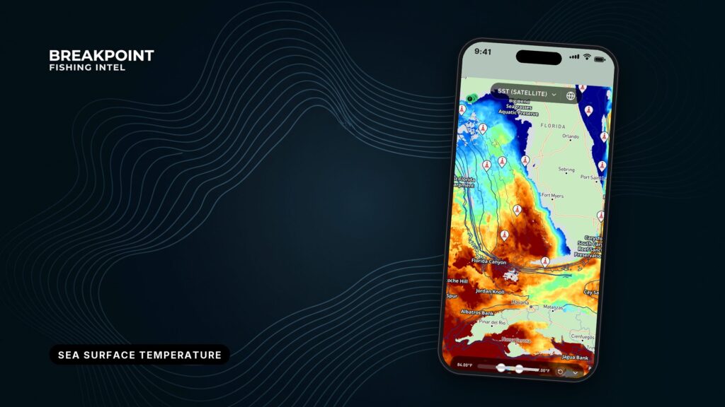
OBS SST shows only what the satellite actually observed, so clouds leave blank spots. HD SST blends data into a complete, higher-resolution picture. Use OBS SST to confirm a temperature edge, and HD SST to see the whole area when cloud hides it.
Blank areas on OBS SST are cloud or fog, not a broken app. Each layer suits a different situation, so the useful question is which one answers what you’re asking right now.
OBS SST vs HD SST side by side
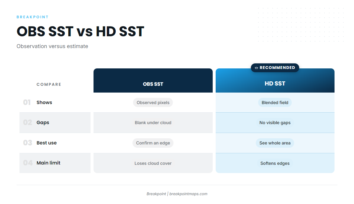
| OBS SST | HD SST | |
|---|---|---|
| What it shows | Observed satellite sea surface temperature pixels only | A blended, continuous field |
| Source data | GOES satellite infrared (GOES-19 East, GOES-18 West) | Blended satellite data |
| Gaps | Blank spots where cloud or fog blocked the view | No visible gaps. Filled areas are estimates |
| Resolution | Native satellite pixels | Higher resolution |
| Freshness | 1-day or 3-day composites, refreshed several times a day | Continuous coverage |
| Best use | Confirming a break or edge | Seeing the whole area and planning through cloudy stretches |
| Main limit | Loses coverage under cloud | Can soften sharp edges |
You can open OBS SST and HD SST over the same water in the app and compare them directly.
What does OBS SST show?
OBS SST is observed sea surface temperature: real satellite pixels with nothing filled in. Each pixel is either observed or missing. The layer refreshes several times a day, and you choose the composite window in the app. The two options trade freshness for coverage.
1-day composite
The 1-day composite is the freshest view. It shows only pixels observed over roughly the last day, so it has more blank spots on cloudy days. It suits the morning of a trip, when you want the newest look at an edge you plan to run to.
3-day composite
The 3-day composite stacks up to 3 days of observations to fill cloud gaps. Some pixels are older as a result. Suppose a front has parked over the canyons for 2 days and you want its whole shape through broken cloud. The 3-day composite will fill in more of it, but a pixel from 3 days ago shows where the water was, not where it is now.
Why clouds leave gaps
Infrared satellites read heat. According to NOAA’s GOES sea surface temperature documentation, the sensor responds to the upper few micrometers of the sea surface, the "skin layer." Cloud and fog block that signal. Where the satellite couldn’t see the water, it shows nothing rather than guessing, which is why blank spots appear on an SST map.
Take a Gulf Stream or Loop Current edge that sits partly under cloud. The visible half is real data, and the hidden half is unknown on OBS SST.
What does HD SST show, and how far can you trust it?
HD SST is a higher-resolution blended product that gives continuous coverage with no blank spots. That completeness comes from blending, and blending has a cost. The NOAA CoastWatch satellite course notes that gap-filled products degrade (smooth) the native sensor resolution and do not identify which pixels have been filled.
On the water, that means:
- HD SST looks complete because it blends, and the filled areas are estimates.
- A sharp break can look softer or wider in blended SST than in an observed pass.
- You cannot tell by looking which pixels are filled.
Research on satellite SST processing levels points the same way: the highest-resolution observed data is preferred for fronts and eddies, at the cost of having gaps. Softening is simply what blending does. HD SST is the better tool for seeing the whole picture and the weaker one for pinpointing an edge.
Which satellite covers your water?
OBS SST in the Gulf and Atlantic comes from GOES-19, also called GOES-East. On the Pacific it comes from GOES-18, also called GOES-West. Both are NOAA geostationary satellites, each watching a fixed half of the country’s waters.
| Region | Satellite |
|---|---|
| Gulf of Mexico | GOES-19 (GOES-East) |
| Atlantic Southeast | GOES-19 (GOES-East) |
| Atlantic Northeast | GOES-19 (GOES-East) |
| Pacific Northwest | GOES-18 (GOES-West) |
| Pacific Southwest | GOES-18 (GOES-West) |
Pacific temperature breaks matter because species like albacore sit in a narrow band. FishBase albacore temperature data lists them as abundant in surface waters of 15.6° to 19.4°C. A break in that range is worth a look, though it doesn’t promise fish.
When should you use each layer?
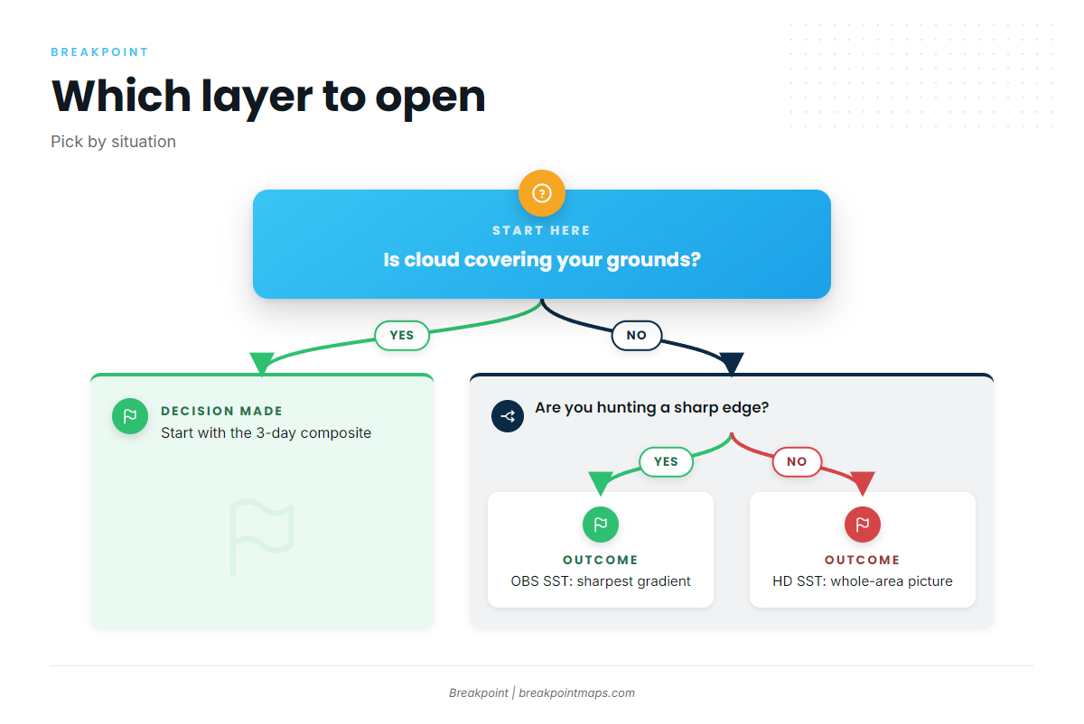
Match the layer to the question:
- Finding breaks and edges: Use OBS SST. Observed pixels keep the sharpest gradient. For the full method, see how to read a temperature break.
- Cloudy stretch over your grounds: Start with the 3-day composite. If gaps remain, use HD SST for the overall shape, and treat the filled areas as estimates.
- Planning days ahead: Use HD SST for the broad picture of where warm or cool water sits.
- Morning of the trip: Use the 1-day composite for the freshest look at the edge you plan to run to.
Yellowfin tuna, mahi and billfish tend to work edges, but nothing on a map guarantees they are there. The map improves where you look first.
How do you check a break before you run?
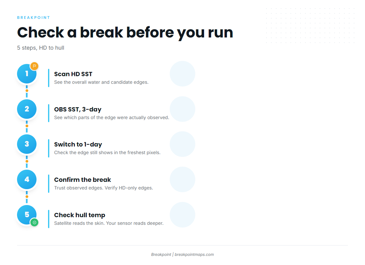
Cross-check the two layers in this order:
- Look at HD SST over your area to see the overall water and candidate edges.
- Switch to OBS SST, 3-day composite to see which parts of that edge were actually observed.
- Switch to the 1-day composite to check whether the edge still shows in the freshest pixels.
- Confirm the break. Trust edges that appear in observed pixels. Treat edges that appear only in HD SST as a lead to verify. The steps for reading a temperature break cover what a real edge looks like.
- Check your hull temperature on arrival. The satellite reads the skin, and your sensor reads deeper water.
What can’t the data see?
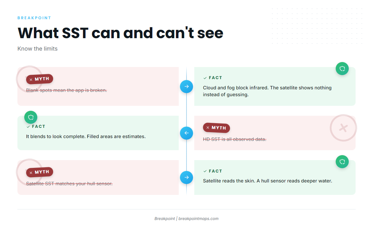
- Cloud and fog leave blank pixels in OBS SST. The satellite is reporting that it couldn’t see, and the app is working normally.
- HD SST looks complete because it blends. Filled areas are estimates.
- Satellite SST measures the skin of the water. A hull sensor reads deeper, so the two can differ.
- Chart layers are not for navigation.
FAQ
Why does OBS SST have blank spots?
Infrared cannot see through cloud or fog, so those pixels stay blank instead of being guessed. Try the 3-day composite or HD SST.
Is HD SST real data?
It is built from satellite data, but it blends to fill gaps, so some areas are estimates. That is the main difference between OBS SST and HD SST.
Should I use the 1-day or 3-day composite?
The 1-day composite is fresher with more gaps. The 3-day composite fills more gaps with older pixels.
Which satellite covers the Pacific?
GOES-18 (GOES-West). GOES-19 (GOES-East) covers the Gulf and Atlantic.
How often does OBS SST refresh?
It is refreshed several times a day.
Does surface temperature match my hull reading?
Not always. The satellite reads the top skin of the water, and a hull sensor reads deeper.
Get the app
OBS SST shows what the satellite saw, and HD SST fills in the rest. Using both gives you a better basis for deciding where to look.
Breakpoint is on the App Store and Google Play. To compare the two layers over your own water, download it and open them side by side.