Pacific bluefin tuna fishing in the Pacific Southwest depends on water temperature, bait, and where an edge crosses structure. The California Department of Fish and Wildlife (CDFW) describes bluefin as seasonal visitors that usually arrive in May and leave by October, and ties their availability to water in the 62 to 68°F range (16.5 to 20°C).
This page covers California waters, centered on the Southern California Bight. CDFW reports that most of the U.S. catch comes from within 100 nautical miles of the California coast, and that recreational fisheries in Southern California and Mexican waters land most of it. For ports and grounds of the Pacific Southwest, start with that guide.
The sections below cover where the fish hold, when they arrive, the water and structure that hold them, the tactics used here, and which rules apply in which waters. Breakpoint publishes the layers used to read that water: OBS SST, Chlorophyll and Chart Contours.
Identification and biology
Pacific bluefin tuna belong to the family Scombridae and range across the North Pacific. According to NOAA, a typical adult runs about 4 ft 11 in and about 130 lb. The largest recorded fish reached about 9.8 ft and 990 lb.
Bluefin live up to 26 years and mature at about 5 years. They spawn in the western Pacific, in the Sea of Japan and the southwestern North Pacific, so the fish off California are feeding fish, not spawners. They eat sardines, anchovies, mackerel, squid and other schooling fish, and occasionally red crabs and krill. That diet drives the bait logic later on this page. Our Pacific bluefin tuna species guide covers identification, size and life history in full.
Where Pacific bluefin are found in the Pacific Southwest
The Southern California Bight is the core of the fishery. Fish range from the San Diego offshore banks out to the outer banks and the islands, including the Channel Islands and San Clemente Island.
The San Diego offshore banks are the home grounds. The 302, the 371 and the 425 sit offshore of San Diego. The 9 Mile Bank and the 43 Fathom Spot fish closer in when bluefin push toward shore. The 60 Mile Bank is raised structure in open water. Tanner Bank and Cortes Bank lie in the outer Bight, beyond San Clemente Island.
Banks matter because they change how water moves. Banks and island edges push current up and around them, which concentrates bait, and bait holds tuna. This mechanism is general and does not promise fish on any given day.
Long-range and multi-day boats also fish Mexican waters south of the border. The rules for those fish are covered under Regulations below.
Grounds at a glance
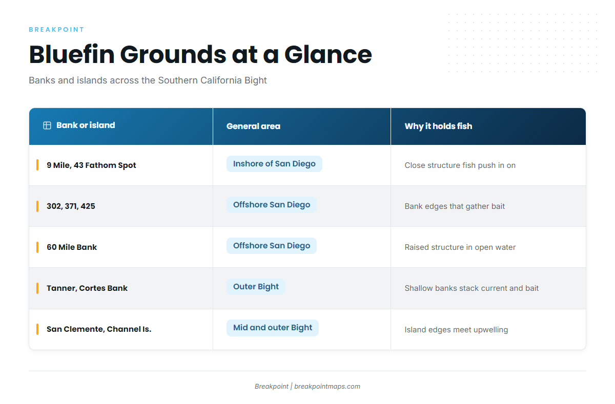
| Bank or island | General area | Why it holds fish |
|---|---|---|
| 9 Mile Bank, 43 Fathom Spot | Inshore of San Diego | Close structure fish use when they push in |
| 302, 371, 425 | Offshore San Diego | Bank edges that gather bait |
| 60 Mile Bank | Offshore San Diego | Raised structure in open water |
| Tanner Bank, Cortes Bank | Outer Bight, beyond San Clemente Island | Shallow outer banks that stack current and bait |
| San Clemente Island, Channel Islands | Mid and outer Bight | Island edges and upwelling meet offshore water |
When they arrive
The California Sea Grant species profile reports that bluefin are caught mostly from May to October but are available year-round. CDFW describes the same pattern: fish usually arrive in May and depart by October.
The 62 to 68°F window is a better guide than the calendar. Water that fits it is a reason to run, whatever the date.
Fish can be present in winter and spring, but they are harder to find from the surface. SST shows only the skin of the ocean, and fish holding deep do not appear on it.
Fish also move north past Point Conception in late summer and fall. For the next stretch of that movement, see our guide to bluefin off Northern California, Oregon and Washington.
The water and structure that hold them
Read the water in this order: temperature first, then bait, then edges, then where an edge meets structure.
Temperature edges
An SST break is where warm offshore water meets cooler water. Bluefin sit inside the 62 to 68°F window, so the useful edge has that water on one side. The task on an SST chart is to find the edge that carries that window.
Bait and chlorophyll fronts
A chlorophyll front marks productive green water against clean blue water. Plankton feeds sardine, anchovy, squid and red crab, the prey on the bluefin diet list. The color break and the temperature break often run close together, and where they line up, bait gathers on the edge.
Where an edge meets a bank
When an edge pushes across a bank or an island corner, current and upwelling hold bait in place. Fish then have a reason to stay rather than pass through. The grounds table above lists the structure to check.
Stacking the layers
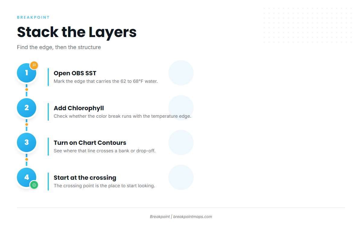
The method in the app:
- Open OBS SST and mark the edge that carries the 62 to 68°F water.
- Add the Chlorophyll layer to see whether the color break runs with it.
- Turn on Chart Contours to see where that line crosses a bank or drop-off.
- Start looking at the crossing point.
Chart layers are not for navigation.
What the data cannot see
SST shows the skin of the ocean, so bluefin holding deep do not appear on it. Cloud blocks satellite passes, so a clear image may be older than it looks. Fish counts lag, reporting where fish were rather than where they are. The layers improve where you look, and the meter and the birds confirm what is there.
How anglers fish for bluefin in the Pacific Southwest
Tactics follow fish behavior, so pick the method that fits what the fish are doing.
Reading the surface and the meter
These are the signs to know:
- Foamers: fish busting bait at the surface.
- Breezers: schools riffling the surface without feeding.
- Kelp paddies: floating structure that can also hold yellowtail and yellowfin tuna.
- Meter marks: fish showing on sonar below the surface.
Bluefin are boat-shy, so approach without running over the school.
Kites at dawn and dusk
A kite holds the bait at the surface far from the boat, away from hull and engine noise, and keeps the line out of the water. That suits fish that shy from boats and fits the low-light bite at dawn and dusk. Rigged flying fish are one kite bait.
Fly-lined sardines
A live sardine on a hook with no weight swims naturally away from the boat. Use it on fish that are up and feeding. Fluorocarbon leaders are common.
Flat-fall and knife jigs on the night drift
Use these for fish deep on the meter, often during the night drift. Drop fast to the depth of the marks and work the jig back up.
Trolling with long set-backs
Run lures well back from the boat, out of the prop wash, because engine noise and vibration spook bluefin.
On a party or long-range boat
The crew picks the tactic. Live sardine and jigs are standard. Listen to the deck crew when a fish is hooked. Before departure, confirm license needs with the landing. On trips into Mexican waters, confirm Mexican permit requirements with the landing as well.
Overlap with other tunas
Yellowfin tuna and albacore can share paddies and trips with bluefin, and yellowtail hold on paddies too. See our tuna fishing guides for the other species.
Planning the long run
Before running to the outer banks, check wind speed, wave height and wave period on the NWS marine forecast. Also check where the edge sits on OBS SST, so the fuel goes toward water worth looking at.
Guides to Pacific bluefin tuna fishing from specific ports: Avalon, Bodega Bay, Half Moon Bay, Marina del Rey, Monterey, Morro Bay, Moss Landing and Newport Beach.
Frequently Asked Questions
What is the bluefin bag limit in California?
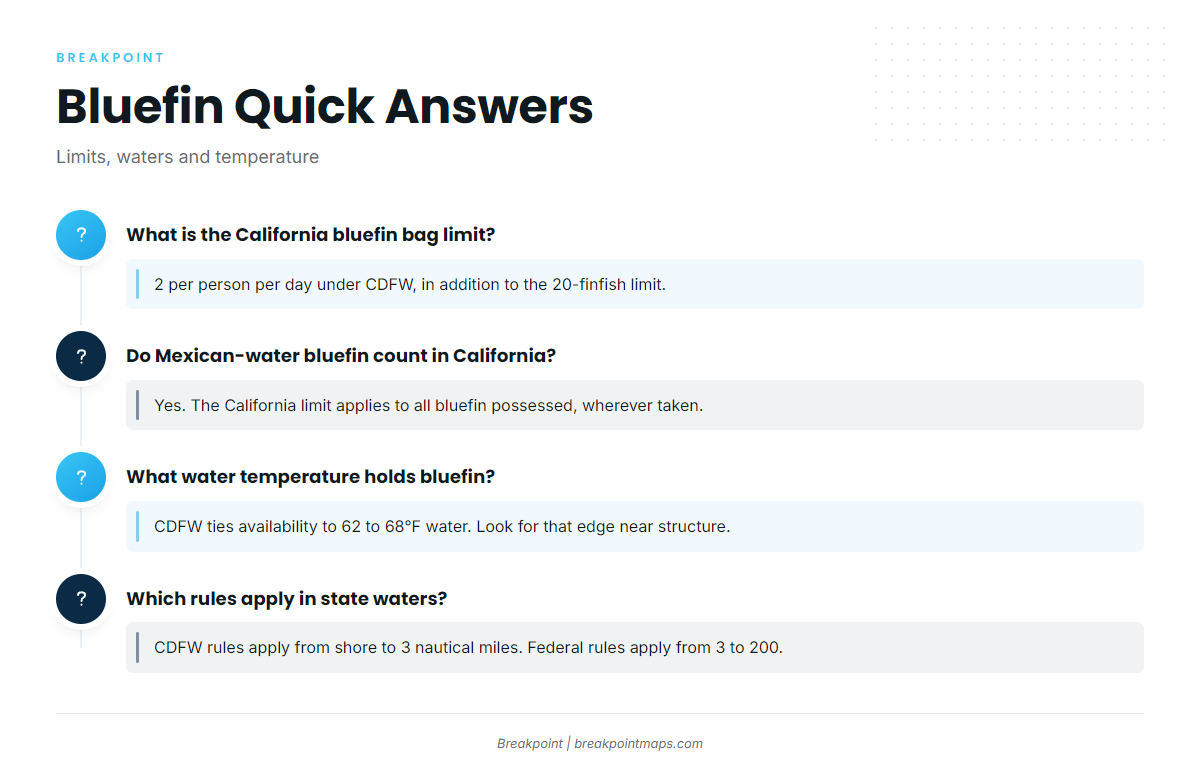
The limit is 2 per person per day under CDFW, in addition to the 20-finfish general limit. The federal limit is also 2 per person in the EEZ. Rules change, so check CDFW before fishing.
Do bluefin caught in Mexican waters count against California limits?
Yes. The California limit applies to all bluefin possessed, wherever taken. CDFW rules govern fish landed in California. Confirm Mexican permit requirements with the landing before departure.
Do private boats need a federal HMS permit?
The federal permit requirement names commercial fishing vessels and recreational charter vessels. Private recreational vessels are not named. Confirm your situation with NOAA Fisheries before you fish.
How must bluefin be filleted at sea?
South of Point Conception, each tuna is cut into 6 skin-on pieces. Each fish is bagged individually, and the bag is labeled with the species’ common name. CDFW and NOAA Fisheries both carry this rule.
What water temperature holds bluefin?
CDFW ties availability to water of 62 to 68°F. The useful water is an edge in that range near structure, where bait gathers. Check OBS SST for where that edge sits.
Are bluefin off California in winter?
California Sea Grant says bluefin are available year-round, though caught mostly May to October. Fish outside that window are often deeper and harder to find from the surface, since SST shows only the skin of the ocean.
Do federal or state rules apply in state waters?
CDFW rules apply from shore to 3 nautical miles. Federal rules apply from 3 to 200 nautical miles. Federal rules are not intended to override a stricter state rule, so the stricter limit governs.