



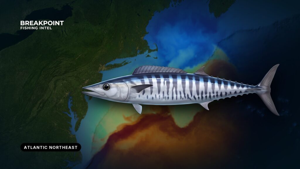
Wahoo reach the Northeast when Gulf Stream water does: late summer into fall, mostly on the canyon edges and the flats inside them. Up here they are a bonus fish rather than a resident one. They depend on warm water reaching the shelf edge, and some stretches of the season produce none.
If you know wahoo from the Carolinas or Florida, expect a short, water-dependent window instead of a year-round fishery. For canyon country and the other species that share it, see our Northeast offshore fishing guide.
We never promise fish, but we can help you decide where to look. This page covers where and when the fish show, the water and structure that hold them, how anglers fish them, and which federal and state rules govern the ones you keep.
Wahoo at a Glance
The wahoo is a long, torpedo-shaped mackerel relative with vertical bars and a mouth full of razor teeth. It is a warm-water pelagic that follows blue water worldwide, as it does off Southern California. In the Northeast it arrives with Gulf Stream water and leaves when that water does. For identification, teeth, growth and range, see the wahoo species guide.
| Trait | In the Northeast |
|---|---|
| Water | Blue Gulf Stream water |
| Window | July into October |
| Where | Canyon edges, shelf edge and the flats inside them |
Where and When to Find Wahoo in the Northeast
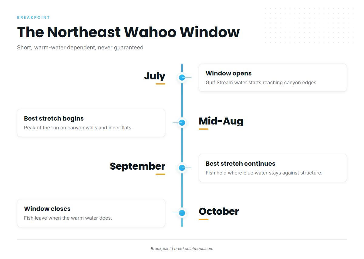
Wahoo here are a canyon and shelf-edge fish from July into October, with the best of it from mid-August through September, and only where Gulf Stream water reaches. A canyon with green, cool water holds no wahoo regardless of the calendar.
The Canyons and Inshore Grounds
These are the grounds anglers work, running south to north:
- Wilmington, Lindenkohl and Toms canyons: the southern New Jersey and Delaware edge.
- Hudson Canyon: the 100 Square, East Elbow and Southwest Corner are long-standing structure spots.
- Block Canyon.
- Atlantis Canyon, including the west side.
- Veatch Canyon, whose walls are known for holding pelagics in warm water.
- New Jersey inshore grounds: the Fingers, Monster Ledge and the 28 Mile Wreck area. These hold wahoo when warm water pushes inside the canyons.
The flats and "tails" inshore of the canyons hold fish too, along with the deep walls.
The Season Window
The window runs July into October, with the best fishing from mid-August through September. Many canyon regulars favor the days leading up to the August and September full moons. That is angler lore, a tendency and not data.
The Southeast fishes wahoo all year, which the Northeast does not. For the comparison, see our page on the year-round Southeast wahoo fishery, and plan around the short window up here.
Water and Structure: Reading the Canyon Edge
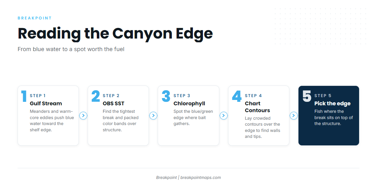
Find the place where blue Gulf Stream water touches canyon structure, then fish the hardest edge on it. Three things have to line up: warm water, structure and bait.
How Gulf Stream Water Reaches the Canyons
The Gulf Stream runs well offshore. Meanders bulge toward the shelf, and warm-core eddies spin off and drift onto the shelf edge, carrying blue water, bait and pelagics with them. When that water stacks against a canyon wall, structure and warm water combine.
Eddies move and change shape between satellite passes, so a chart shows yesterday’s water.
Temperature Breaks and Color Edges
Look for the hardest temperature break you can find over mid-shelf depths and along the walls. On OBS SST, that shows as tightly packed color bands over structure.
On Chlorophyll, the blue and green edge marks clean offshore water against productive green water. Bait gathers along it, and wahoo follow bait.
Cloud blocks a satellite pass. Use both layers together, because one often shows an edge the other misses.
Walls, Tips and the Flats
Chart Contours show you where to put the boat:
- Canyon walls, where the contour lines crowd together.
- Tips, where the canyon head cuts into the shelf.
- The flats and tails inshore of the canyons.
The 100-fathom curve is the reference line most anglers work along. The best set-up is an SST or color edge that lies on top of crowded contours.
| Layer | What to look for | What it tells you |
|---|---|---|
| OBS SST | Tightly packed color bands over structure | A temperature break where warm water meets cooler water |
| Chlorophyll | A blue to green edge | Clean offshore water against productive water, where bait stacks |
| Chart Contours | Crowded lines, canyon tips, flats | The wall, tip or flat to fish |
Weed Lines, Buoys and High-Flyers
Floating structure holds bait. That includes substantial weed lines, offshore buoys, fixed lobster gear, high-flyers on the flats, and logs. Each one is a reason to switch spreads, which the next section covers.
Before you commit the fuel, check OBS SST and Chlorophyll for where blue water is touching the canyon walls. Then lay Chart Contours over it to pick the edge. Chart layers are not for navigation. For wind, wave height and period, use the official NOAA marine forecast.
How to Fish for Wahoo on the Canyon Grounds
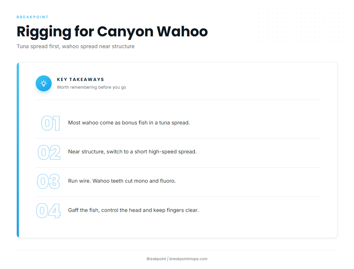
Most Northeast wahoo come on a tuna spread with wire somewhere in it. Anglers who target them switch to a short, high-speed wahoo spread near structure. Yellowfin tuna, bigeye tuna and mahi-mahi share the same water, so see our other offshore gamefish guides for how those spreads work.
Spread and Rigging Points
- Fold in or switch: A standard Northeast tuna spread catches incidental wahoo. At midday, between spots, or when approaching a buoy or weed line, switch to a dedicated wahoo spread.
- High-speed trolling: Run well above tuna speed.
- Short spread: Run only a few rods. More lines at speed mean tangles and slow clearing.
- Wire leaders: Wahoo teeth cut mono and fluorocarbon. Rig wahoo lures on wire.
- Lures: Use ballyhoo behind skirts or Islanders, skirted lures in the tuna spread, or dedicated high-speed wahoo lures on wire.
- Dawn: The first lines in at first light are worth running near an edge. That is a tendency, not a guarantee.
Jigging Logs and Buoys; Why Baiting Rarely Pays
Jigging is worth a drop when you find a large log or an offshore buoy. Chunking or baiting for wahoo rarely pays here, because concentrations are thin compared with southern waters. The overnight chunk is a tuna play, and any wahoo in the slick is a bonus.
Handling the Teeth
Use a gaff, not hands. Control the head and keep fingers away from the mouth. Plan the box or the release before the fish comes over the rail. Keep the fish whole, as the head-and-fins rule below requires.
Guides to wahoo fishing from specific ports: Indian River Inlet, Ocean City, Chatham, Atlantic City, Freeport, Point Judith, Chincoteague and Lewes.
FAQ
Are there wahoo off New Jersey and New England?
Yes, when Gulf Stream water reaches the canyons and flats. They are a sometimes fish rather than a resident one. Hudson, Atlantis and Veatch canyons and the New Jersey inshore grounds are where anglers look.
When is wahoo season in the Atlantic Northeast compared with the Carolinas and Florida?
Wahoo fishing in the Atlantic Northeast runs July into October, best from mid-August through September. The Southeast fishes year-round. For that fishery, see our Southeast wahoo guide.
Do I need a permit to keep wahoo on my own boat?
No federal permit is required for private anglers. State saltwater registration is handled through your state agency, so check its page for current requirements. The federal limit is 2 per person.
Do charter boats need a federal permit for wahoo?
Yes. A charter vessel or headboat needs the federal charter vessel/headboat permit for Atlantic dolphin and wahoo, issued through NOAA Fisheries. Clients still follow the 2-per-person limit. Charters out of New Jersey, New York and Montauk run canyon trips.
Which rules apply if I fish state and federal waters on one trip?
A federally permitted vessel follows the more restrictive of the federal and state rules, depending on where the fish was caught and whether you stop to fish in state waters on the way in. Check the agency page before fishing.
Do I need an HMS permit to fish for wahoo?
Not for wahoo. You do need one for yellowfin and bigeye tuna on the same trip. See NOAA Fisheries’ Atlantic HMS permits for those species.
What is the difference between wahoo and king mackerel?
Wahoo have vertical bars, a longer snout and a first dorsal fin that runs evenly along the back. Adult king mackerel have no bars, and their lateral line dips sharply. The federal rules differ between the two, so identification matters. King mackerel carries its own size limit, so check the agency page.
Can I fillet wahoo at sea?
No. Keep the head and fins intact until landed. Wahoo is a respected table fish, so ice it whole and fillet it at the dock.
Plan the Run
When the water lines up, the edge tells you which canyon to burn the fuel on. Download Breakpoint from the App Store or Google Play and plan the run on OBS SST, Chlorophyll and Chart Contours.
Note on the link plan: row 4 (Hudson Canyon structure hot spots) points to FishTrack, which the project profile excludes from linking. It is omitted and the three Hudson Canyon spot names are listed unlinked. Swap in a non-excluded source for that claim if you want a link there.