



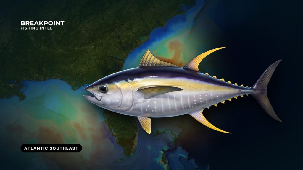
Yellowfin tuna fishing in the Atlantic Southeast comes down to the Gulf Stream. The fish follow it, and the job is finding the edge and the structure under it. The range runs from North Carolina down the Atlantic coast of Florida, and the same logic holds along all of it. This guide covers where and when the fish show, the water and structure that hold them, how anglers fish them, and how federal and state rules divide. For the wider region, see our Atlantic Southeast fishing guide.
Identification and biology
Yellowfin is a fast, warm-water, schooling tuna that travels with warm currents and works the edges where bait collects. Anglers in this region often mix it up with blackfin tuna, and the two share the same water and the same spreads. The management split matters more than appearance: yellowfin is federally managed as an Atlantic HMS tuna, while blackfin is managed by the states. Identification marks, growth and life history are covered in the yellowfin tuna species guide.
Where and when
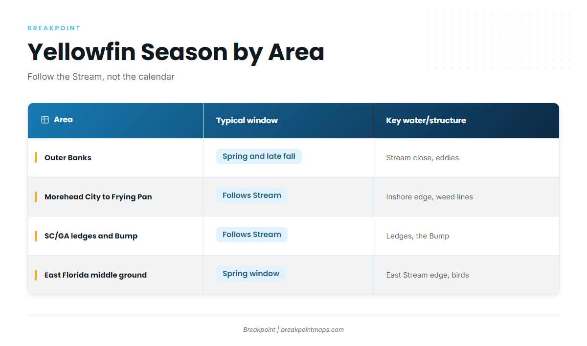
The Gulf Stream is the highway. Where it runs relative to each stretch of coast sets where yellowfin show up and when, so the water is a better guide than the calendar.
Outer Banks: Hatteras and Oregon Inlet
Spring and late fall are both established runs off Hatteras and Oregon Inlet. Spring yellowfin off the Outer Banks is the primary window, and the fall run follows it. Sources disagree on exact months, so treat the two runs as seasons rather than dates.
Off Hatteras the Stream comes closest to the coast, which shortens the run to blue water. Eddies and meanders can push warm water toward the shelf and bring fish with them.
Wind is the limiting factor and frequently cancels early-spring trips. Check the NWS marine forecast and the NDBC Diamond Shoals buoy before committing to a run.
North of Hatteras, the Stream turns offshore. For what happens beyond it, see yellowfin in the Atlantic Northeast.
Morehead City and Cape Lookout to Frying Pan
The Stream sits farther offshore here. Yellowfin are targeted along temperature breaks and weed lines on its inshore edge. The NDBC Frying Pan Shoals buoy is the reference for local conditions.
South Carolina and Georgia: the ledges and the Charleston Bump
The Charleston Bump is a raised bottom feature that deflects the Gulf Stream offshore. That deflection creates eddies and upwelling, and bait and pelagic fish gather there. Ledges along the shelf break off South Carolina and Georgia work the same way on a smaller scale.
The fishery follows the Stream and its warm-water edges, so the work is finding where the edge sits and fishing it.
East Florida: the middle ground
The middle ground on the east side of the Gulf Stream is one of the dependable patterns in Florida’s middle ground yellowfin fishery, and it holds up from year to year. It is a spring fishery. Big fish are uncommon, but the bite is reliable. Terns working over tuna are the classic sign in that window.
Season by area
| Area | Typical window | Key water and structure |
|---|---|---|
| Outer Banks | Spring and late fall runs | Stream close to shore, eddies |
| Morehead City to Frying Pan | Follows Stream position | Inshore edge, weed lines |
| SC and GA ledges and Charleston Bump | Follows Stream position | Ledges, the Bump |
| East Florida middle ground | Spring window | East edge of the Stream, birds |
Water and structure
Yellowfin sit where several signals stack: a temperature edge, a color edge and bottom that moves water. Read them in that order.
Stream edges and temperature breaks
The edge you want changes through the year. Early in the season, fish favor the warmer Stream water while the surrounding water is still cold. As the Stream heats up, they shift toward its edges and slightly cooler water. Follow the break that is holding fish rather than last month’s temperature.
Color and chlorophyll
A green-to-blue edge marks productive water meeting clear Stream water, and bait stacks on it. Chlorophyll can lag the surface, so a color edge can sit a day behind the temperature edge.
Weed lines and sargassum
Sargassum is floating structure that holds bait. Weed lines tend to form on current and temperature seams. Fish along them, not through them.
Eddies and meanders
A meander or warm eddy off Hatteras pushes Stream water onto the shelf. That moves the fish closer to shore, and the position changes week to week, so use the latest satellite pass rather than last week’s.
Bottom structure: ledges, humps, the Point and the Bump
- The Point: where the shelf break and the Stream converge off Hatteras.
- Ledges and humps: push current upward and hold bait along the shelf break.
- Charleston Bump: deflects the Stream and sets up eddies and upwelling downstream.
Stacking the signals
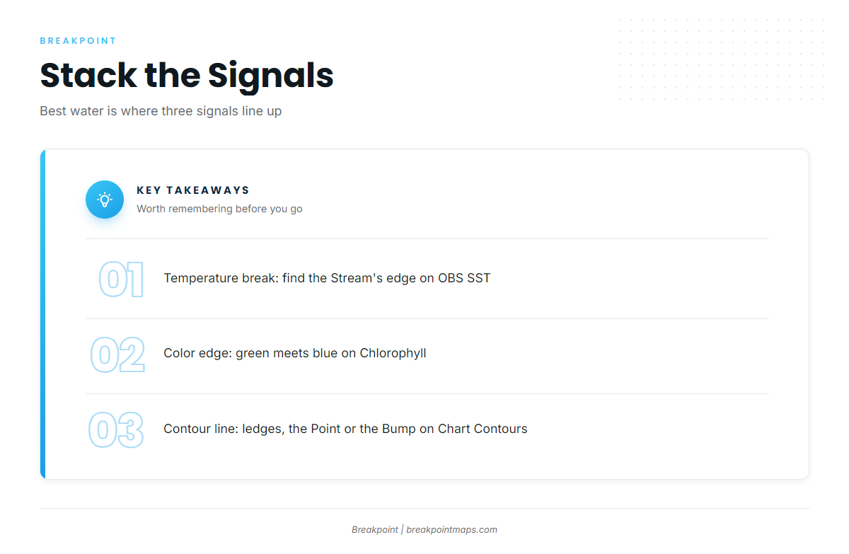
The best water is where three things line up:
- A temperature break between warm Stream water and cooler shelf water
- A color edge where green water meets blue
- A contour line, ledge or hump under that edge
Reading it on the chart
In Breakpoint, OBS SST shows the Stream’s edge and its breaks. Chlorophyll shows the color breaks. Chart Contours shows the ledges, the Point and the Charleston Bump. Cloud cover blocks satellite passes and leaves gaps in SST and Chlorophyll, and some offshore features rest on old survey data. Chart layers are not for navigation. They help you decide where to look.
How anglers fish here
Match the method to how the fish are sitting.
- Trolling: Spreads of ballyhoo and skirted lures are the regional standard. Work them along breaks and weed lines. Lures weed out smaller fish.
- Chunking and live bait: Use these when fish are concentrated on a spot or under birds.
- Kite fishing: A Florida middle-ground method for fish feeding near the surface.
- Jigging and popping: For marked or busting fish, on heavy spinning or conventional tackle.
Signs on the water are birds, bait, rips and slicks. Terns are the sign off Florida. Boats often run past fish at first light, so slow down and look before you reach the spot.
Yellowfin share the water with wahoo, dolphin, blackfin tuna and billfish, so expect a mixed bag on the same spreads. Gear must be authorized HMS gear, covered in Regulations below. For other tuna species and regions, see our tuna fishing guides.
Before you leave the dock, check OBS SST, Chlorophyll and Chart Contours. In short, find the edge, then find the structure under it.
Handling the catch
Bleed the fish promptly, then get it on ice fast to protect the meat.
Know the landing-form rule before you clean anything at sea. Fish must land round, or eviscerated with the head off, with the tail and at least 1 pectoral fin attached. The tail lobes may be cut if the fork stays intact. Details are in Regulations. Use the gaff only at boatside on a hooked, legal fish.
Guides to yellowfin tuna fishing from specific ports: Fernandina Beach, Savannah, Carolina Beach, Edisto Beach, Fort Lauderdale, Hatteras Village, Folly Beach and Haulover.
FAQ
Do I need an HMS permit on a charter?
No personal permit is needed. The vessel’s HMS Charter/Headboat permit covers customers. On for-hire trips the limit includes captain and crew.
Does the HMS permit cover everyone aboard?
Yes. It is issued to the vessel and covers all persons fishing aboard. Each person is still held to 3 yellowfin.
Do I need a state license in federal waters?
In Florida, a license is required to land fish there regardless of where they were caught, with the exemptions listed in Regulations. For other states, check NCDMF, SCDNR and the Georgia DNR Coastal Resources Division.
What is the minimum size for yellowfin?
27 inches curved fork length. A headless fish must measure at least 27 inches from the forward edge of the cut to the fork of the tail.
How do I tell blackfin from yellowfin?
The two share the same water, and blackfin is the smaller, more compact fish. Management differs too: blackfin is state-managed and needs no HMS permit. Full identification is in the yellowfin tuna species guide.
Can you catch yellowfin off Florida’s Atlantic coast?
Yes. Fish the middle ground east of the Gulf Stream, mainly in a spring window. Big fish are uncommon, but the bite is reliable.
Do these rules apply on the Pacific coast?
No. Atlantic HMS rules cover the Atlantic, the Gulf and the Caribbean only. For the West Coast, see yellowfin in the Pacific Southwest.
When is the Outer Banks run?
Spring and late fall are both established runs off Hatteras and Oregon Inlet. Exact timing follows the Stream and its eddies, so watch the water.