



Introduction
Yellowfin off Southern California are a summer-into-fall, warm-water fishery. They show up where a sea surface temperature break, a chlorophyll edge, a bank and floating kelp line up. This guide covers yellowfin tuna fishing in the Pacific Southwest: the waters reached from Southern California ports, from Point Conception south to the U.S.-Mexico border, plus runs into Mexican waters off northern Baja. California is the only state involved.
The same water holds bluefin, yellowtail, dorado and albacore, so yellowfin sit inside the wider Pacific Southwest offshore fishery. Below you will find where and when the fish show, how to read the water and structure, how anglers fish for them, and how the rules apply. The aim is a better decision about where to look.
Identification and Biology
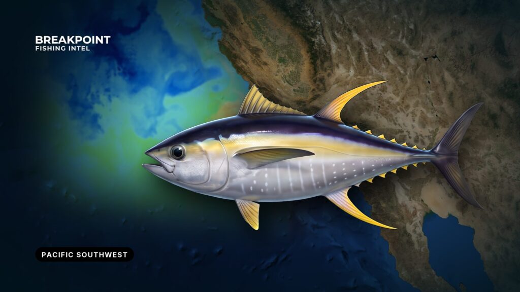
Yellowfin tuna (Thunnus albacares) are fast, schooling, warm-water tuna that follow bait. Adults carry long yellow second dorsal and anal fins and a yellow band along the side. For full identification and biology, see our yellowfin tuna species guide. In this region, the fish follow water temperature and bait more than the calendar.
Where and When Yellowfin Show Up
The first yellowfin typically appear off northern Baja. Through summer into fall they build north into U.S. waters and, in some years, toward the Channel Islands. The exact window moves with the water:
- Warm-water years: Fish arrive earlier, push farther north and come closer to the coast.
- Cool years: Arrivals run later, and fish hold farther south and offshore.
The fishery is spread across a set of named grounds:
- The Coronado Islands and the ridges below the border
- The 9-Mile Bank and the La Jolla Canyons off San Diego
- The 43 Fathom Spot and the 302
- Tanner Bank and Cortes Bank, offshore banks well beyond the coast
The calendar sets the window, and the water decides the spot.
Reading the Water and Structure
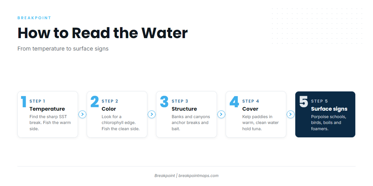
Work through the water in this order: temperature, color, structure, floating cover, then surface signs. Each layer narrows the search.
| Layer | What it shows | Where yellowfin sit |
|---|---|---|
| Temperature break | A sharp edge where water changes over a short distance | Warm side of the break |
| Chlorophyll edge | Green, plankton-rich water against clean blue | Clean side of the edge |
| Bank, canyon or high spot | Relief that lifts current and stacks bait | Along the edge of the relief |
| Kelp paddy | Floating shelter for baitfish | Under and around the paddy |
| Surface signs | Porpoise, birds, boils | Beneath and beside the activity |
Temperature breaks
Yellowfin hold on a sea surface temperature break rather than in uniform water, and they sit on the warm side. Breaks form where currents meet and where upwelling over banks and canyons lifts cooler water to the surface.
Chlorophyll and color edges
Bait collects along a chlorophyll edge, and yellowfin sit just on the clean side. The edge matters most where it overlaps a temperature break.
Banks, canyons and high spots
Relief pushes current up, concentrates bait and anchors breaks in place. That is why the 9-Mile Bank, the La Jolla Canyons, the 43 Fathom Spot, the 302, Tanner Bank and Cortes Bank come up again and again. A break that crosses one of them is worth more than the same break over flat bottom.
Kelp paddies
Detached floating kelp shades and shelters baitfish, and tuna hold under and around it. A paddy in warm, clean water is better than one in green water. Approach quietly and work the edges without running over it.
Surface signs
Look for porpoise schools with tuna beneath them, working birds, boils, jumpers and foamers. Sonar marks under a quiet surface count too.
Stacking the layers
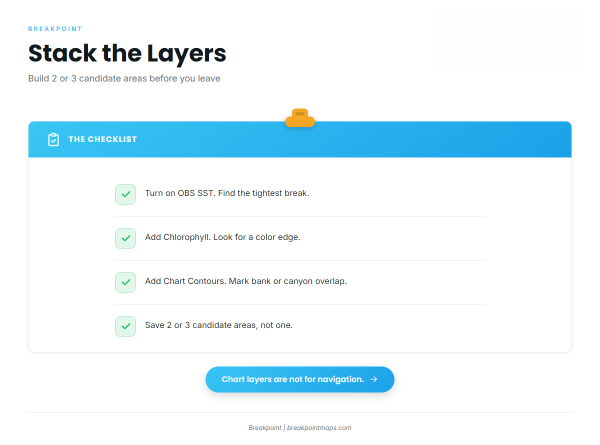
You can do this work the night before, on the map:
- Turn on OBS SST and find the tightest break near your range.
- Add Chlorophyll and look for a color edge running along or across that break.
- Add Chart Contours and mark where the overlap crosses a bank, ridge or canyon wall.
- Save 2 or 3 candidate areas rather than one, so you have options if the first is dead.
Cloud blocks satellite passes, so a gap on OBS SST or Chlorophyll is missing data, not uniform water. Some offshore contours come from older bathymetry surveys. The chart layers are not for navigation.
How Anglers Fish for Yellowfin Here
Each method fits a different situation, so match the method to what the fish are doing.
| Method | When it fits |
|---|---|
| Spot-and-stop with sonar | Fish marked or surface signs ahead |
| Flylining sardines, layered spread | Fish holding on a break, paddy or bank |
| Kite or balloon | Boat-shy or surface-feeding fish |
| Troll, then stop | Searching water with no signs |
| Poppers and jigs | Foamers and fast-moving surface fish |
Spot-and-stop and sonar
Run the edge, mark fish on sonar or under signs, stop ahead of the school and get baits in the water fast.
Flylining sardines and a layered bait spread
Flylining means fishing a live sardine on no weight. Add a second bait at mid-depth on a light egg sinker and a third deeper on a heavier one. Cover the column until one layer gets bit, then adjust.
Kite and balloon fishing
Kite fishing keeps a bait splashing away from the hull. It suits boat-shy or surface-feeding fish.
Troll, then stop
Trolling jigs or feathers searches water. On a knockdown, stop and switch to live bait or iron to hold the school.
Poppers and jigs
Cast poppers to foamers. Use surface iron or jigs when fish are up and moving fast.
On a sportboat
Overnight and 1.5-day trips reach nearer water. Longer multi-day trips reach farther banks and Mexican waters. Rental gear works for a first trip, and your own gear gives you a familiar setup. Ask the landing how Mexican permits are handled for your trip. The crew chooses the stops; your job is to have a bait ready and follow the deck’s calls.
Bluefin, Albacore and Skipjack on the Same Trips
One stop can produce bluefin and the next yellowfin. Identification matters because the limits differ:
| Species | Limit |
|---|---|
| Pacific bluefin | 2 per person, in addition to the 20-finfish limit |
| Albacore | 10 south of Point Conception, in addition to the 20-finfish limit |
| Skipjack | No limit |
The federal bluefin and albacore limits and the filleting rule are in the federal rule at 50 CFR 660.721. For the wider tuna picture, see our other tuna fishing guides.
Planning the Run
Build the plan around four items:
- Fuel: Plan the round trip plus the search miles along an edge, with reserve.
- Weather: Check the NWS marine forecast and buoy readings for wind speed, wave height and period. A forecast is only a forecast.
- Border: Know where the U.S.-Mexico line falls on your route. Fish on the Coronado Islands side are in Mexican waters.
- Options: Carry 2 or 3 candidate areas from your map work, so a dead spot does not end the day.
Stacking the layers before you leave improves your decision about where to look, but it does not promise fish.
Guides to yellowfin tuna fishing from specific ports: Avalon, Channel Islands Harbor, Dana Point, Marina del Rey, Mission Bay, Newport Beach, Oceanside and Redondo Beach.
FAQ
What is the yellowfin limit in California?
The limit is 10 per person, counted within the 20-finfish limit. There is no federal recreational bag limit for yellowfin.
Is there a size limit for yellowfin?
There is no minimum size for any tuna under Title 14. See the California tuna regulation text.
Do I need a federal HMS permit on my own boat?
The requirement in 50 CFR 660.707 names commercial and charter vessels. For-hire boats need the permit and a logbook. See the NOAA Pacific HMS permits page.
Does the California limit change in federal waters?
No federal yellowfin limit exists. California’s Title 14 limits also govern fish landed in California.
What about yellowfin caught in Mexico?
Check CONAPESCA and your landing. The California boat-limit clause for other jurisdictions applies. The bluefin limit applies wherever the fish are taken.
How do I tell yellowfin from bluefin?
Yellowfin have long yellow fins and a yellow band. Bluefin are shorter-finned and stockier. See the full identification notes.
What months are best?
Summer into fall, later in cool years. Water temperature and bait set the real window.
How do Pacific yellowfin rules differ from the Gulf and Atlantic?
They fall under a different federal framework with different limits. The regional pages linked in Regulations carry those rules.