



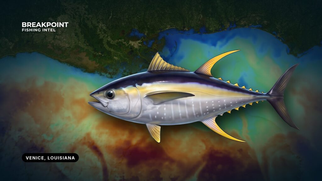
Yellowfin tuna off Venice, Louisiana start with the river. Venice sits just inside The Jump on the lower Mississippi, and Tiger Pass and the delta passes lead from it to the northern Gulf. Boats run from its marinas to the rigs, the Midnight Lump and the Mississippi Canyon.
The river drives the current at the passes, the color change offshore and much of the fog. This guide for running your own boat out of Venice covers the passes, the conditions and the rules, so you can decide where to look.
Launch and Fuel in Venice
Two marinas with ramps and listed fuel serve private boats:
Confirm fuel, hours and ramp status directly with the marina before you trailer in.
Getting Out: Southwest Pass, South Pass and Tiger Pass
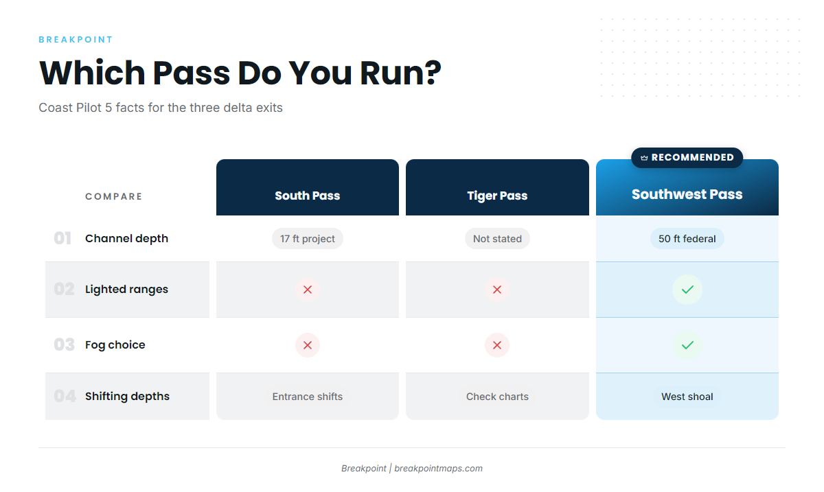
Choosing a pass is the first decision on the water. The facts below come from U.S. Coast Pilot 5, Chapter 8.
Southwest Pass is the default exit in fog. The Coast Pilot calls it more accessible and more easily navigated in thick or foggy weather. It has a better-marked, wider and nearly straight channel, a federal 50 ft channel, lighted ranges, and a lighted approach buoy 1.6 miles south of the jetty ends.
South Pass has a federal project depth of 17 ft. Its entrance depths change frequently, and a shoal of 2 to 17 ft lies along the west side of the entrance.
Tiger Pass has jetties at its Gulf entrance. Lights and daybeacons mark its lower 5 miles.
Southwest Pass is also the ship channel. Pilots board ships up to 3 miles off the sea buoys. The bar pilot boats work VHF channel 67 and also handle 6, 9 and 16, so monitor accordingly.
A shoal of 8 to 15 ft runs along the west side of the approach for about a mile beyond the west jetty. Its position is rather constant except after spring high-river stages.
The river sets the current. At Southwest Pass it runs straight out between the jetties, then spreads fan-shaped with slightly greater velocity to the west. At the entrance buoy it runs 0 to 4 knots, averages about 1.7 knots and generally sets southwest. Expect that set as you leave the jetties, and a crosscurrent near the west-side shoal, since wind and seas add crosscurrents. High river stage averages April. Low stage averages October.
| Pass | Channel depth | Marking | Hazards | Fog use |
|---|---|---|---|---|
| Southwest Pass | Federal 50 ft | Lighted ranges; lighted approach buoy 1.6 miles off jetty ends | 8 to 15 ft shoal on west side of approach; ship traffic; river current 0 to 4 knots | Coast Pilot calls it more easily navigated in fog |
| South Pass | Federal project 17 ft | Charted channel | Entrance depths change frequently; 2 to 17 ft shoal on west side | Not the Coast Pilot’s fog choice |
| Tiger Pass | Not stated | Jetties; lights and daybeacons on lower 5 miles | Check charts | Not stated |
Swipe the table sideways to see every column.
Use current NOAA charts and the Coast Pilot for navigation, not this table.
Named Grounds and Structure
Three kinds of water draw Venice boats:
- Midnight Lump (Sackett Bank): a bank at about 200 ft.
- Mississippi Canyon: the canyon edge and deep water off the delta.
- Rigs: deepwater oil and gas platforms off the delta.
Structure, depth change and bait concentrate fish at these spots, and the river feeds the bait. A bank, a canyon edge or a platform gives bait something to hold on, and yellowfin follow the bait. Treat each name as a place to start looking, not a promise.
Reading the Water off the River
Green, nutrient-heavy river water meets blue Gulf water off Southwest Pass and South Pass. Edges and rips form along that meeting, and bait gathers on them. Fish can hold on either side of the color change, so look for bait, birds and slicks along the line.
Open OBS SST and Chlorophyll to find where green river water meets blue water off Southwest Pass and South Pass. Pair them with Chart Contours to see the Midnight Lump and the canyon edge. Chart layers are not for navigation.
The data has limits. Cloud blocks satellite SST passes, and cloud is common off the river. Turbid river plumes skew Chlorophyll readings near the passes. Treat a layer as a place to start looking, not a guarantee.
Conditions and Forecasts
Read wind, wave height and period, and decide from the official forecast. The standing local patterns below come from the Coast Pilot:
- Northers: most likely from November to March, about 15 to 20 per season. They usually last about a day and a half. Severe ones reach 60 knots or more.
- River fog: from December to June the river water is usually colder than the air, which favors fog, particularly with weak south winds. Fog may be found anywhere from 60 miles off the passes to New Orleans.
- Prevailing wind: east through south winds prevail in all months except January.
Check these sources before you go:
- NDBC station BURL1: the buoy at Southwest Pass.
- NWS New Orleans marine forecasts: includes the Boothville to Southwest Pass out 20 nm zone.
- CWFLIX: the NWS New Orleans coastal waters forecast, reached from the NWS marine page.
- U.S. Coast Pilot 5, Chapter 8: standing local conditions.
Season
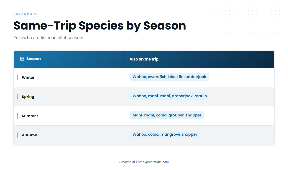
Yellowfin tuna are listed in all four seasons off Venice. The other species on the same trips change with the calendar:
| Season | Also on the list |
|---|---|
| Winter | wahoo, swordfish, blackfin tuna, amberjack |
| Spring | wahoo, mahi-mahi, amberjack, blue marlin, white marlin |
| Summer | mahi-mahi, cobia, grouper, blue marlin, white marlin, red snapper |
| Autumn | wahoo, cobia, mangrove snapper |
Weather shapes the windows. Winter brings northers and river fog. High river in April pushes more river water offshore, and low river in October pushes less. Pick windows from the forecast rather than the calendar.
Tactics for Yellowfin Tuna off Venice, Louisiana
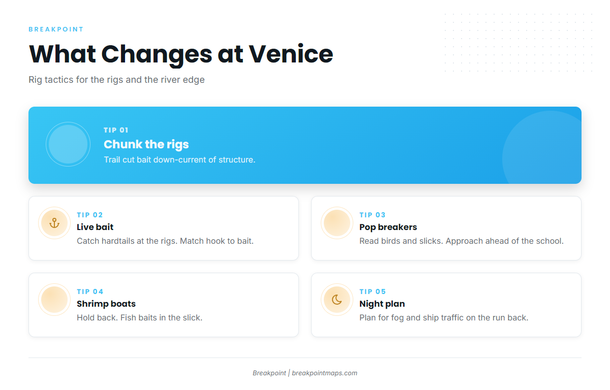
Rigging, tackle and fight basics are in the yellowfin tuna guide. What follows covers what changes at Venice.
Chunking at the rigs. Drift a steady trail of cut bait down-current of the structure. Overfeeding can fill the fish up and send them down, so feed in measured amounts.
Live bait. Hardtails, also called blue runners, are caught at the rigs. Match the hook to the bait, since fish often lock onto one size and ignore everything else.
Popping on breaking fish. Use topwater when fish push bait up. Read birds and slicks, and approach ahead of a moving school, not straight into it.
Shrimp boats. Fish work the bycatch behind trawlers. Hold well back and fish your baits in the slick.
Nights at the rigs. Plan for fog and ship traffic on the run back.
Blackfin tuna and wahoo show up on the same trips, so rig to suit.
Plan the Run
Save the Midnight Lump and the Mississippi Canyon edge as waypoints. Check OBS SST, Chlorophyll and Chart Contours before the run, then pair the layers with BURL1 and the NWS forecast. Chart layers are not for navigation.
FAQ
Do I need an HMS permit for yellowfin tuna off Venice?
Yes. An HMS Angling permit is required for the vessel, and you get it through the NOAA HMS Permit Shop. LDWF rules also apply.
What is the ROLP?
It is Louisiana’s free Recreational Offshore Landing Permit. It is required for anglers 18 and older to possess tunas, in addition to the Basic and Saltwater licenses.
What are the yellowfin size and bag limits?
LDWF lists 27 in minimum curved fork length and 3 per person per day. Check LDWF and NOAA HMS before fishing.
Should I run Southwest Pass or South Pass?
Southwest Pass has the 50 ft federal channel and is the Coast Pilot’s choice in fog. South Pass has a 17 ft project depth and shifting entrance depths.
What is the Midnight Lump?
It is Sackett Bank, a bank at about 200 ft off the delta. View it on Chart Contours, and remember that chart layers are not for navigation.
Can I fillet tuna at sea?
No. Per LDWF, tuna may not be skinned or scaled until on shore.
Where do I check the marine forecast for Venice?
Use BURL1 at Southwest Pass, the NWS New Orleans/Baton Rouge marine page and the CWFLIX coastal waters forecast.